Hurricane Fran (1973)
| Category 1 hurricane (SSHWS/NWS) | |
 Satellite image of Hurricane Fran on October 9 | |
| Formed | October 8, 1973 |
|---|---|
| Dissipated | October 12, 1973 |
| Highest winds |
1-minute sustained: 80 mph (130 km/h) |
| Lowest pressure | 978 mbar (hPa); 28.88 inHg |
| Fatalities | None reported |
| Damage | Minimal |
| Areas affected | Azores and the United Kingdom |
| Part of the 1973 Atlantic hurricane season | |
Hurricane Fran, also referred initially as Subtropical storm Bravo, was a long-tracked Category 1 hurricane that caused little damage during its existence in early October 1973. Originating from a tropical wave that developed off the coast of Hispaniola on October 1, the precursor to Fran slowly developing during the first week of October. By October 4, a surface low formed within the system and convective activity increased. The system was eventually classified as a subtropical depression on October 8 and was upgraded to Subtropical Storm Bravo shortly thereafter. Bravo became increasingly tropical throughout the day as it intensified. Following a reconnaissance mission into the storm on October 10, it was deemed fully tropical and upgraded to a hurricane, at which time it was renamed Fran.
Hurricane Fran rapidly tracked towards the northeast in response to an area of low pressure within the westerlies. By October 11, the hurricane attained its peak winds of 80 mph (130 km/h) and its lowest barometric pressure of 978 mbar (hPa; 28.88 inHg) after bypassing the Azores islands. Situated over exceedingly cold waters, Fran transitioned into an extratropical cyclone late on October 12 as it neared the French coastline. Shortly before reaching land, the system was absorbed by a cold front. Throughout its existence, Fran had little effect on land.
Meteorological history

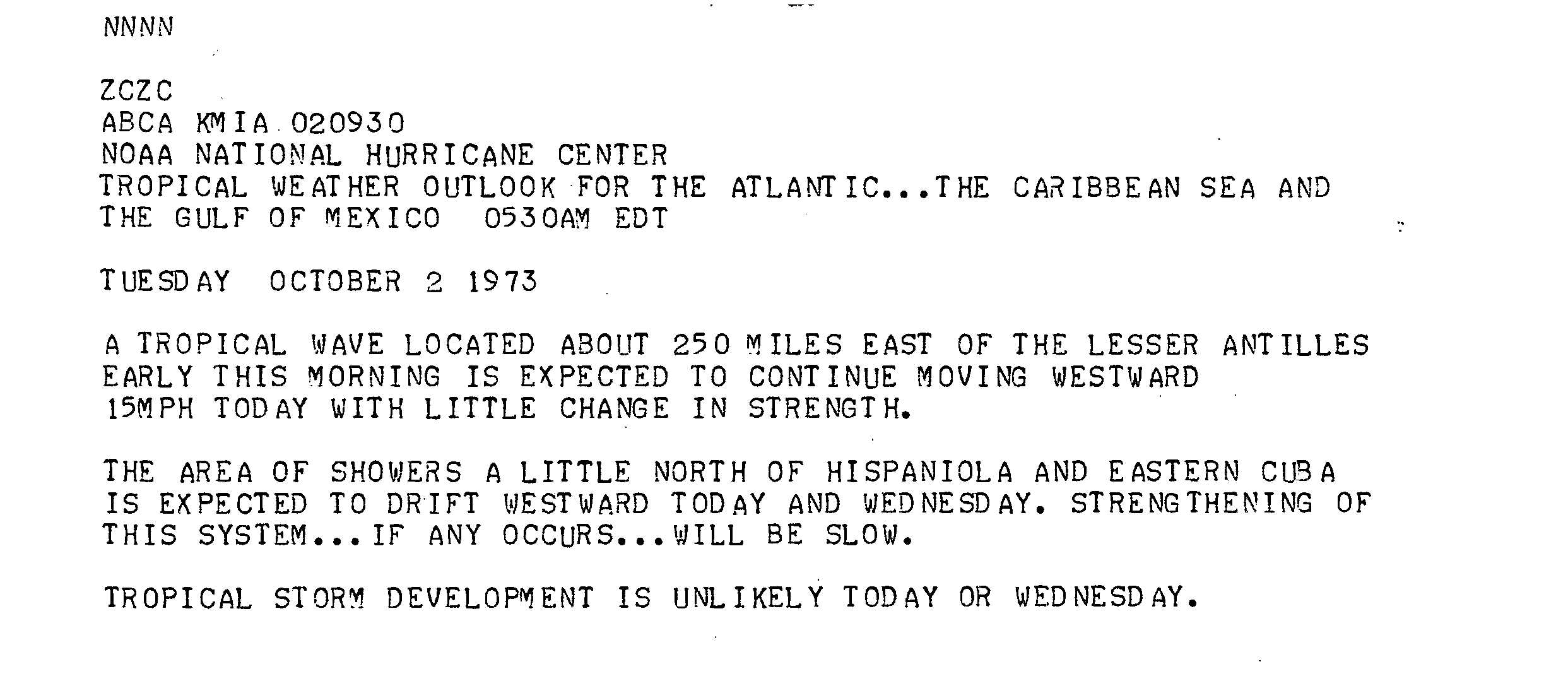
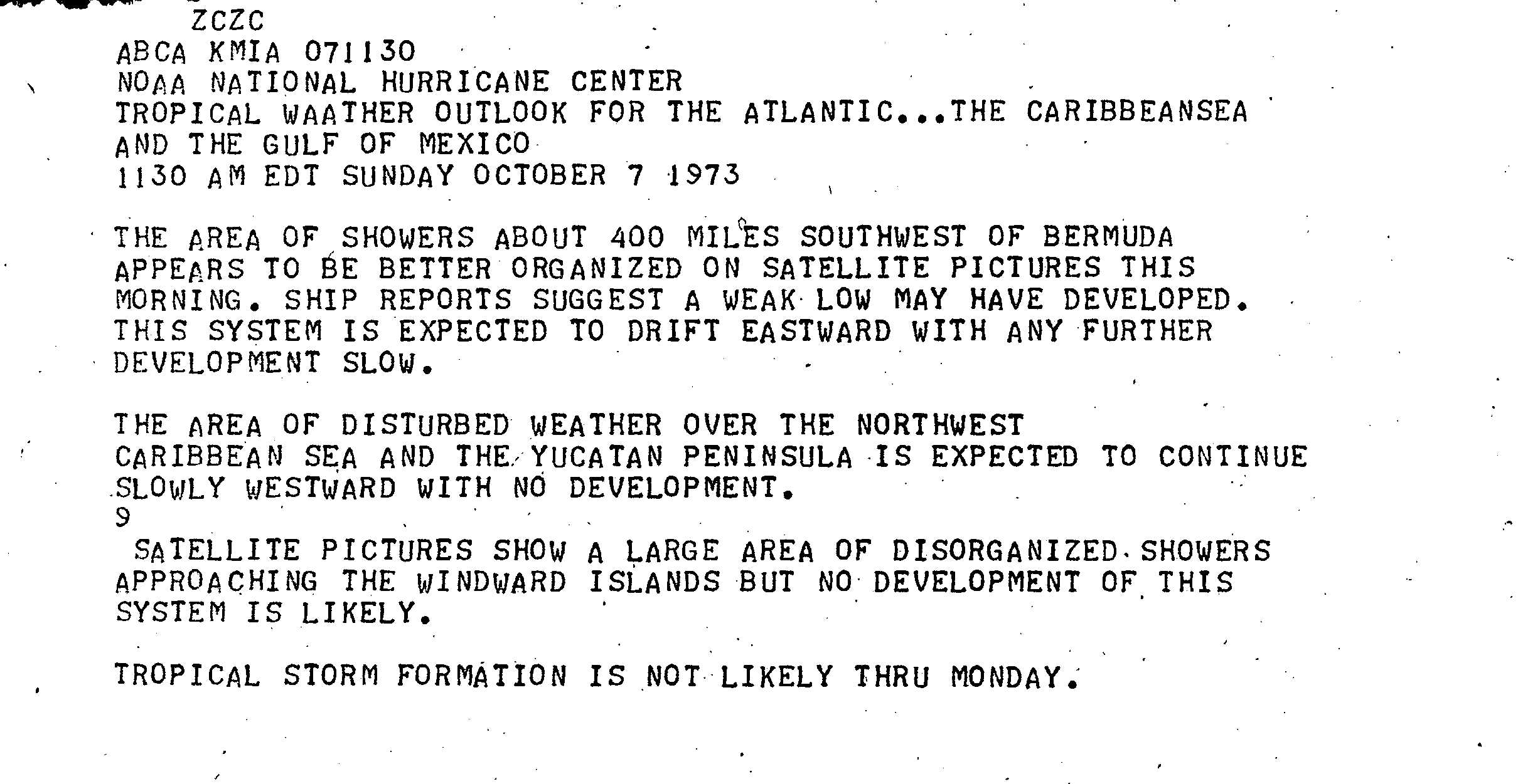
Hurricane Fran originated from a tropical wave[1] associated with an area of convection north of Hispaniola on October 1.[2] The system tracked westward at 15 mph (24 km/h) but gained little strength and the National Hurricane Center (NHC) did not anticipate development of the storm.[1] By October 4, the system interacted with a mid-tropospheric trough near the southeast United States, resulting in the formation of a surface low. Tracking eastward, showers and thunderstorms began to develop around the circulation; however, the structure of the system was not fully tropical.[2] On October 7, ships in the vicinity of the low reported decreasing barometric pressures, indicating a strengthening system. Satellites monitoring the system depicted a disorganized storm with mainly subtropical characteristics.[3] Late on October 8, the cyclone had become sufficiently organized to be classified a subtropical depression.[4]
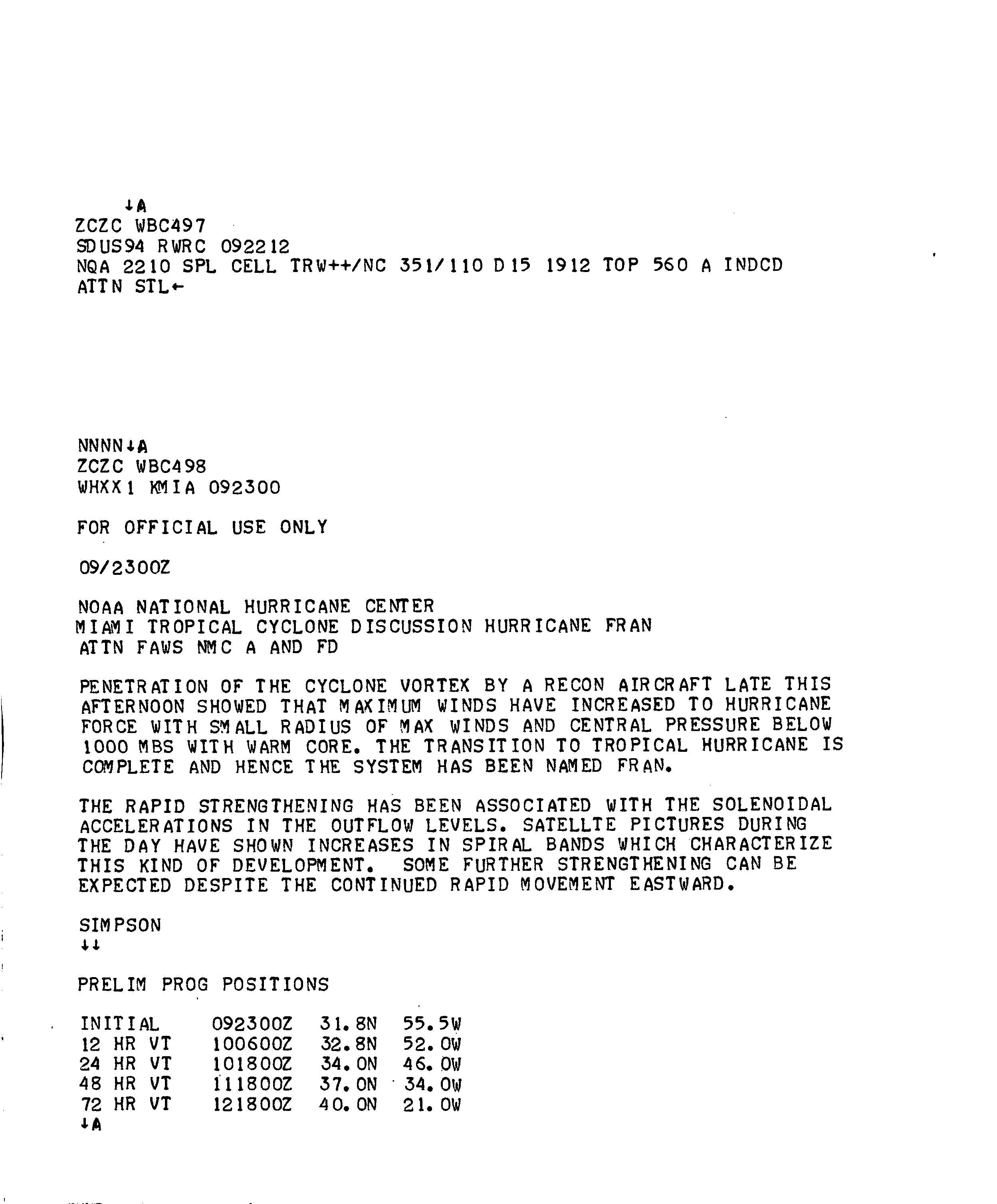
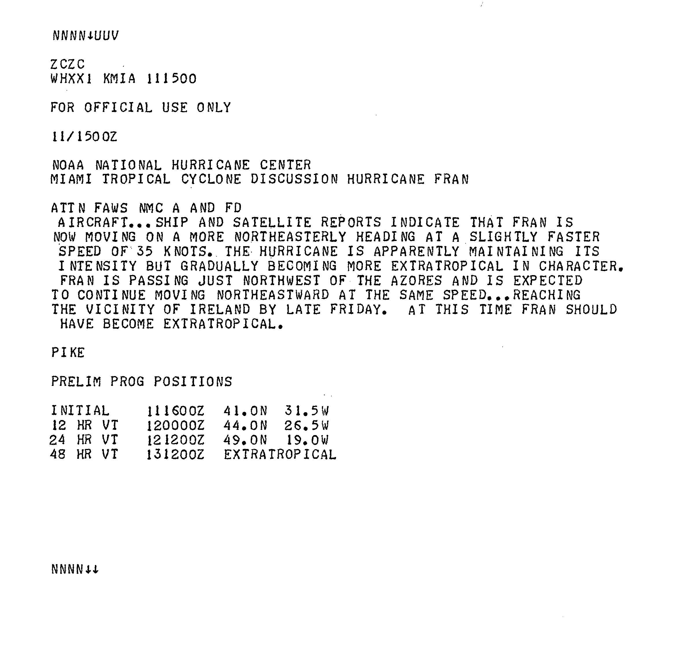
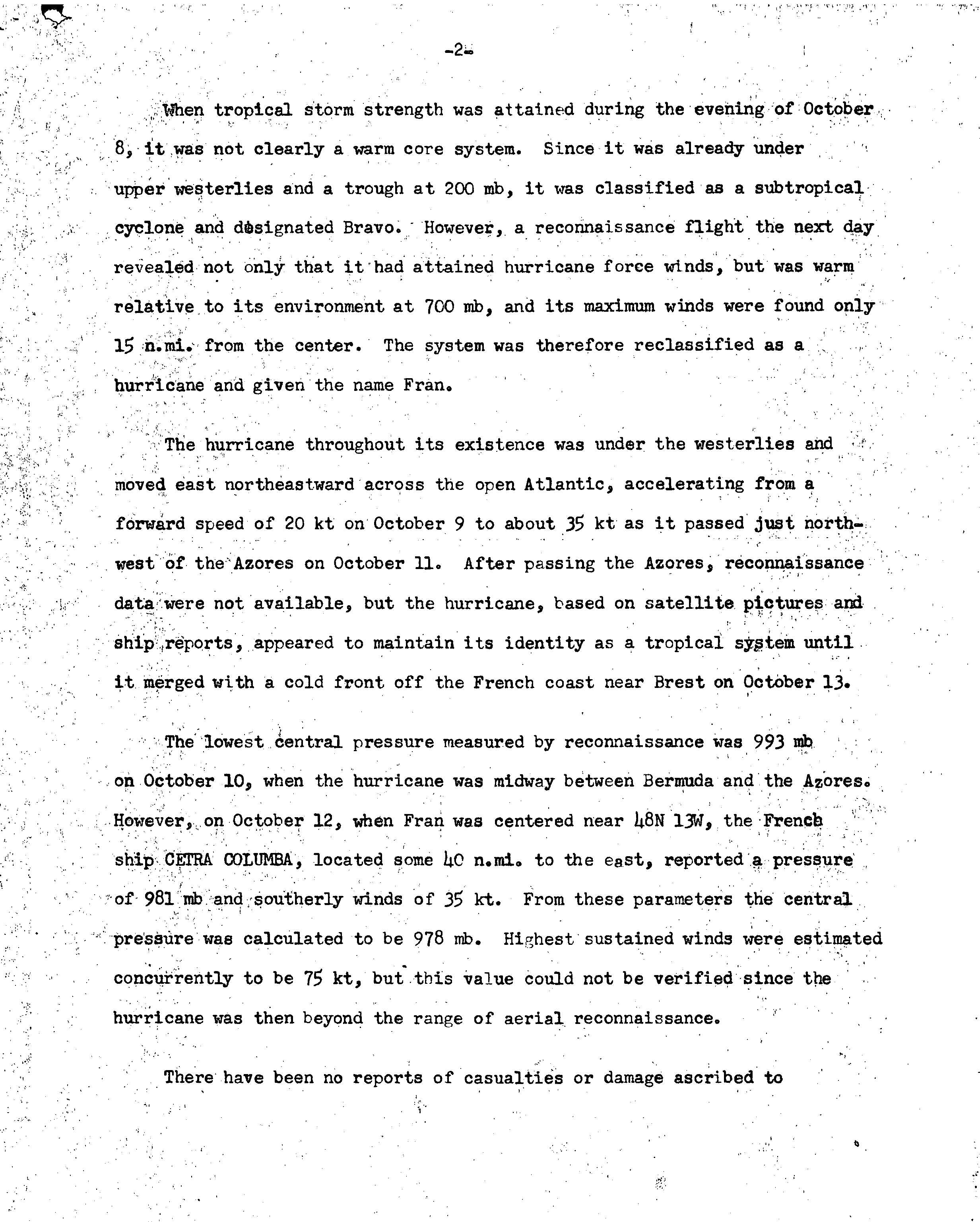
Cold air from the remnants of a cold front became entrained within the circulation; however, the cold air gradually warmed. On October 9, winds increased to gale-force and the depression was upgraded to a subtropical storm, at which time it was given the name Bravo.[2] By October 10, Bravo had intensified substantially, as hurricane hunters recorded hurricane-force winds roughly 15 mi (25 km) from the center of the storm. Following this finding, the National Hurricane Center reclassified the system as a tropical system and renamed it Fran, dropping its previous designation of Bravo.[2] Upon becoming tropical, Fran developed a strong outflow and several convective feeder bands.[5] Additionally, the storm had developed a 35 mi (55 km) wide eye.[6]
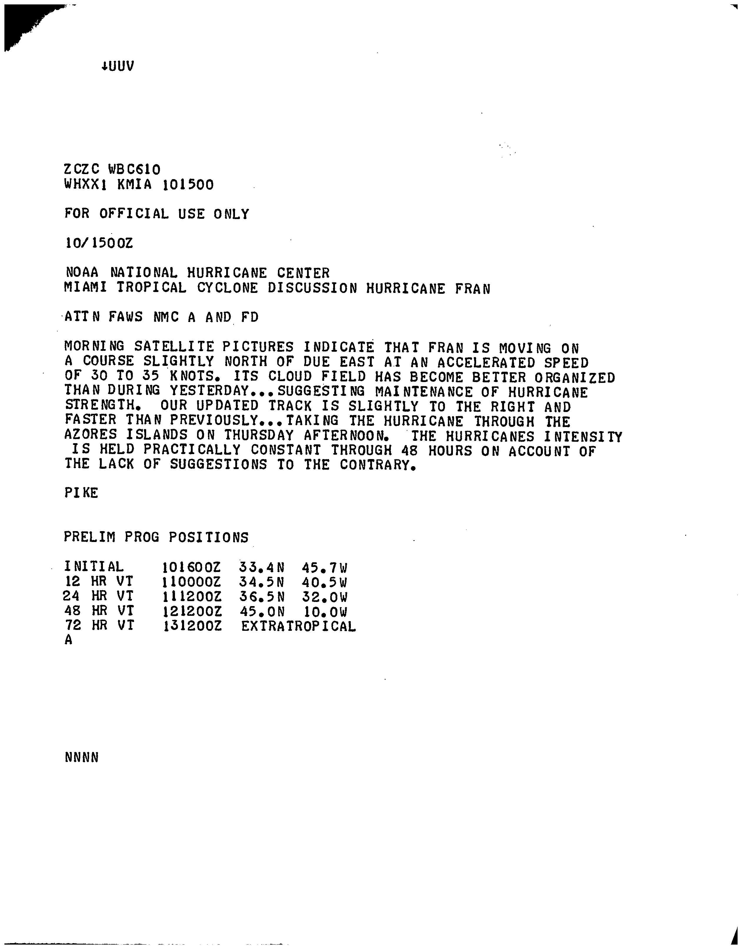
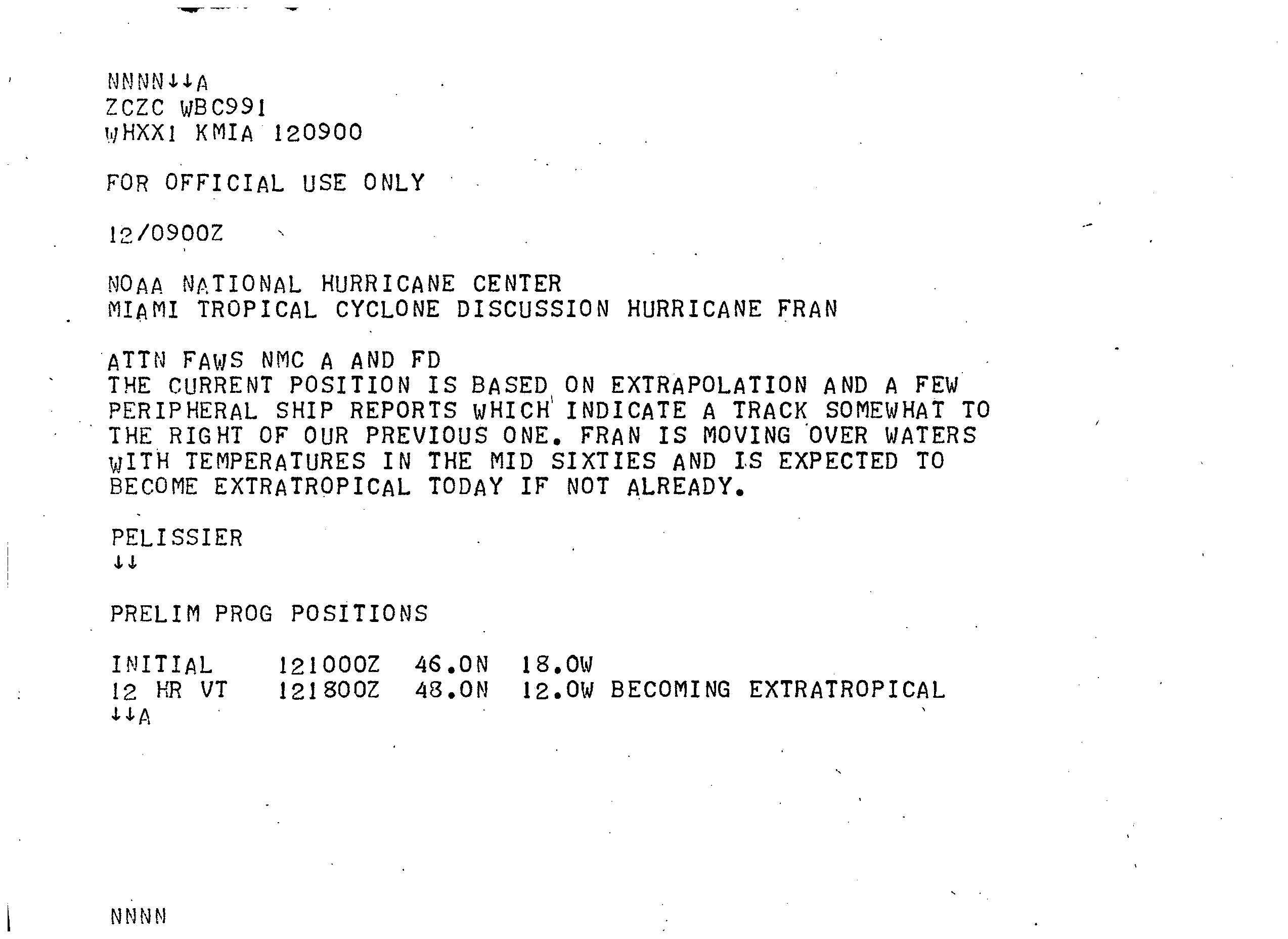
Steered generally eastward by a deep surface low in the westerlies, Fran accelerated towards the Azores Islands.[2] The storm traveled at a rapid pace of 30 to 35 mph (48 to 56 km/h) but continued to organize.[7] By October 11, the hurricane began to undergo an extratropical transition as it continued to move unusually fast towards the northeast.[8] Around this time, Fran attained its peak winds of 80 mph (130 km/h).[4] Shortly after bypassing the Azores islands on October 12, the system moved over an area with sea surface temperatures around 60 °F (16 °C), well below what is required for tropical cyclone development.[9] Later that day, the central pressure of Fran decreased to 978 mbar (hPa; 28.88 inHg), the lowest recorded in relation to the hurricane. Shortly after reaching this intensity, the hurricane transitioned into an extratropical cyclone and quickly merged with a cold front off the coast of France.[2]
Preparations and impact
Although Fran passed near the Azores as a hurricane, winds on the islands only reached 45 mph (75 km/h)[10] and no damage was recorded.[2] On October 12, a French ship encountered the storm, recording sustained winds of 40 mph (65 km/h) and an air pressure of 981 mbar (hPa; 28.97 inHg).[11] Ships near the English and French coastlines recorded winds up to 60 mph (95 km/h) as the extratropical remnants of Fran passed through the region.[10]
See also
References
- 1 2 Staff Writer (October 1, 1973). "Tropical Weather Outlook". National Hurricane Center. Retrieved January 16, 2010.
- 1 2 3 4 5 6 7 Paul J. Herbert and Neil L. Frank (January 28, 1974). "Atlantic Hurricane Season of 1973" (PDF). National Hurricane Center. Retrieved January 16, 2010.
- ↑ Staff Writer (October 7, 1973). "Tropical Weather Outlook". National Hurricane Center. Retrieved January 16, 2010.
- 1 2 Hurricane Specialists Unit (2009). "Easy to Read HURDAT 1851-2008". National Hurricane Center. Retrieved January 16, 2010.
- ↑ Robert Simpson (October 9, 1973). "Hurricane Fran Discussion One". National Hurricane Center. Retrieved January 16, 2010.
- ↑ Hurricane Hunters (October 10, 1973). "Compute Data for Subtropical Cyclone Bravo/Hurricane Fran October 9–10". National Hurricane Center. Retrieved January 16, 2010.
- ↑ Pike (October 10, 1973). "Hurricane Fran Discussion Three". National Hurricane Center. Retrieved January 16, 2010.
- ↑ Pike (October 11, 1973). "Hurricane Fran Discussion Eight". National Hurricane Center. Retrieved January 16, 2010.
- ↑ Pelissier (October 12, 1973). "Hurricane Fran Discussion Ten". National Hurricane Center. Retrieved January 16, 2010.
- 1 2 John R. Hope (1973). "Hurricane Fran (Bravo) Preliminary Report Page 3". National Hurricane Center. Retrieved January 16, 2010.
- ↑ John R. Hope (1973). "Hurricane Fran (Bravo) Preliminary Report Page 2". National Hurricane Center. Retrieved January 16, 2010.
External links
Tropical cyclones of the 1973 Atlantic hurricane season | ||
|---|---|---|
 | ||
| ||