Huney
Not to be confused with Hunda.
| Location | |
|---|---|
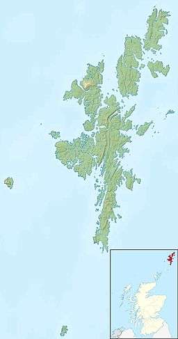 Huney Huney shown within Shetland | |
| OS grid reference | HP648063 |
| Physical geography | |
| Island group | Shetland |
| Area | 17 hectares (42 acres)[1] |
| Highest elevation | 19 m |
| Administration | |
| Sovereign state | United Kingdom |
| Country | Scotland |
| Council area | Shetland Islands |
| Demographics | |
| Population | 0[2] |
| References | [3][4] |

Huney from Unst
Huney is an uninhabited island due east of the island of Unst in the Shetland Islands, Scotland. The island is located approximately 1 kilometre south west of the Balta and has an area of just under 0.2 square kilometres (0.08 sq mi). Huney is linked to Unst at an extremely low tide by a sandy tombolo called the Yei of Huney. It is uninhabited.[3]
The World War I British E class submarine E49 was sunk in the channel between Huney and Balta with the loss of 3 officers and 28 ratings on 12 March 1917. The submarine was heading out of Balta Sound on patrol when it struck a Naval mine probably lain by German U-boat UC-76. The wreck is now a designated war grave.[5]
References
- ↑ "Rick Livingstone’s Tables of the Islands of Scotland" (pdf) Argyll Yacht Charters. Retrieved 23 September 2013.
- ↑ National Records of Scotland (15 August 2013) (pdf) Statistical Bulletin: 2011 Census: First Results on Population and Household Estimates for Scotland - Release 1C (Part Two). "Appendix 2: Population and households on Scotland’s inhabited islands". Retrieved 17 August 2013.
- 1 2 Haswell-Smith, Hamish (2004). The Scottish Islands. Edinburgh: Canongate. ISBN 978-1-84195-454-7.
- ↑ Ordnance Survey: Landranger map sheet 1 Shetland (Yell, Unst & Fetlar) (Map). Ordnance Survey. ISBN 9780319228074.
- ↑ "Hms/E49: Balta Sound, Unst, North sea". RCAHMS. Retrieved 23 September 2013.
| Inhabited islands | ||
|---|---|---|
| Other islands | ||
| Towns and villages | ||
| Points of interest |
| |
Coordinates: 60°44′N 0°49′W / 60.733°N 0.817°W
This article is issued from Wikipedia - version of the 5/12/2016. The text is available under the Creative Commons Attribution/Share Alike but additional terms may apply for the media files.