Hulløya
| Native name: <span class="nickname" ">Ulli | |
|---|---|
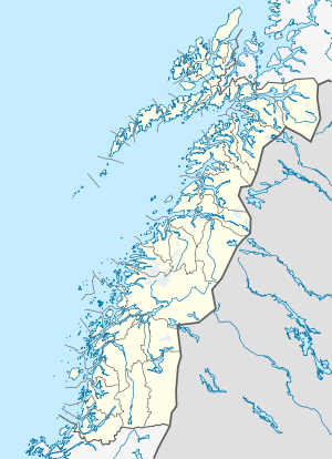 Hulløya Location in Nordland | |
| Geography | |
| Location | Nordland, Norway |
| Coordinates | 68°03′49″N 16°11′28″E / 68.0636°N 16.1910°ECoordinates: 68°03′49″N 16°11′28″E / 68.0636°N 16.1910°E |
| Area | 22.1 km2 (8.5 sq mi) |
| Length | 6.7 km (4.16 mi) |
| Width | 6 km (3.7 mi) |
| Coastline | 21 km (13 mi) |
| Highest elevation | 675 m (2,215 ft) |
| Highest point | Veten |
| Administration | |
| County | Nordland |
| Municipality | Tysfjord |
| Demographics | |
| Population | 4 (2001) |
Hulløya (Lule Sami: Ulli) is an island in the municipality of Tysfjord in Nordland county, Norway. The island is located in the Tysfjorden, southwest of the village of Kjøpsvik. The island has an area of 22.1 square kilometres (8.5 sq mi) and the highest point is the 675-metre (2,215 ft) tall Veten. Hulløya had four inhabitants in 2001.[1]
An express boat service connects Kjøpsvik (on the mainland) with Hulløyhamn (on Hulløya) and other villages in the fjord several times per week.[2]
References
- ↑ Store norske leksikon. "Hulløya" (in Norwegian). Retrieved 2012-05-11.
- ↑ "Hurtigbåtrute i Tysfjorden" (PDF) (in Norwegian). Retrieved 17 July 2011.
This article is issued from Wikipedia - version of the 11/28/2016. The text is available under the Creative Commons Attribution/Share Alike but additional terms may apply for the media files.