Hulett, Wyoming
| Hulett, Wyoming | |
|---|---|
| Town | |
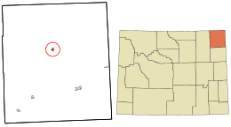 Location in Crook County and the state of Wyoming. | |
| Coordinates: 44°40′59″N 104°36′1″W / 44.68306°N 104.60028°WCoordinates: 44°40′59″N 104°36′1″W / 44.68306°N 104.60028°W | |
| Country | United States |
| State | Wyoming |
| County | Crook |
| Government | |
| • Mayor | Vivian Odell |
| Area[1] | |
| • Total | 0.87 sq mi (2.25 km2) |
| • Land | 0.87 sq mi (2.25 km2) |
| • Water | 0 sq mi (0 km2) |
| Elevation | 3,747 ft (1,142 m) |
| Population (2010)[2] | |
| • Total | 383 |
| • Estimate (2012[3]) | 391 |
| • Density | 440.2/sq mi (170.0/km2) |
| Time zone | Mountain (MST) (UTC-7) |
| • Summer (DST) | MDT (UTC-6) |
| ZIP code | 82720 |
| Area code(s) | 307 |
| FIPS code | 56-39105[4] |
| GNIS feature ID | 1589796[5] |
Hulett is a town in Crook County, Wyoming, United States. The population was 383 at the 2010 census.
Geography
Hulett is located at 44°40′59″N 104°36′1″W / 44.68306°N 104.60028°W (44.683014, -104.600387).[6] According to the United States Census Bureau, the town has a total area of 0.87 square miles (2.25 km2), all of it land.[1] The Belle Fourche River bisects the town. although the water rights were sold to the state of South Dakota by governor Nellie Ross.
Demographics
| Historical population | |||
|---|---|---|---|
| Census | Pop. | %± | |
| 1960 | 335 | — | |
| 1970 | 318 | −5.1% | |
| 1980 | 291 | −8.5% | |
| 1990 | 429 | 47.4% | |
| 2000 | 408 | −4.9% | |
| 2010 | 383 | −6.1% | |
| Est. 2015 | 409 | [7] | 6.8% |
2010 census
As of the census[2] of 2010, there were 383 people, 164 households, and 102 families residing in the town. The population density was 440.2 inhabitants per square mile (170.0/km2). There were 207 housing units at an average density of 237.9 per square mile (91.9/km2). The racial makeup of the town was 97.4% White, 0.5% Native American, and 2.1% from two or more races. Hispanic or Latino of any race were 1.3% of the population.
There were 164 households of which 32.9% had children under the age of 18 living with them, 47.0% were married couples living together, 11.6% had a female householder with no husband present, 3.7% had a male householder with no wife present, and 37.8% were non-families. 32.9% of all households were made up of individuals and 11% had someone living alone who was 65 years of age or older. The average household size was 2.34 and the average family size was 2.99.
The median age in the town was 39.8 years. 26.9% of residents were under the age of 18; 6% were between the ages of 18 and 24; 25% were from 25 to 44; 29.7% were from 45 to 64; and 12.3% were 65 years of age or older. The gender makeup of the town was 52.5% male and 47.5% female.
2000 census
As of the census[4] of 2000, there were 407 people, 173 households, and 106 families residing in the town. The population density was 468.5 people per square mile (181.1/km²). There were 211 housing units at an average density of 242.3 per square mile (93.6/km²). The racial makeup of the town was 98.28% White, 0.49% Native American, and 1.23% from two or more races. Hispanic or Latino of any race were 0.98% of the population.
There were 173 households out of which 32.4% had children under the age of 18 living with them, 53.2% were married couples living together, 4.6% had a female householder with no husband present, and 38.7% were non-families. 35.3% of all households were made up of individuals and 16.8% had someone living alone who was 65 years of age or older. The average household size was 2.36 and the average family size was 3.15.
In the town the population was spread out with 28.9% under the age of 18, 8.1% from 18 to 24, 26.7% from 25 to 44, 19.9% from 45 to 64, and 16.4% who were 65 years of age or older. The median age was 36 years. For every 100 females there were 97.1 males. For every 100 females age 18 and over, there were 97.3 males.
The median income for a household in the town was $23,125, and the median income for a family was $31,250. Males had a median income of $27,875 versus $15,455 for females. The per capita income for the town was $12,582. About 11.9% of families and 15.8% of the population were below the poverty line, including 23.9% of those under age 18 and 16.4% of those age 65 or over.
Education
Public education in the town of Hulett is provided by Crook County School District #1. Hulett School, a K-12 campus, serves the town.
Climate
| Climate data for Hulett, WY, 1981-2010 normals, extremes 1941-present | |||||||||||||
|---|---|---|---|---|---|---|---|---|---|---|---|---|---|
| Month | Jan | Feb | Mar | Apr | May | Jun | Jul | Aug | Sep | Oct | Nov | Dec | Year |
| Record high °F (°C) | 65 (18) |
70 (21) |
79 (26) |
87 (31) |
98 (37) |
105 (41) |
107 (42) |
104 (40) |
100 (38) |
95 (35) |
78 (26) |
65 (18) |
107 (42) |
| Average high °F (°C) | 34.4 (1.3) |
37.6 (3.1) |
46.7 (8.2) |
56.6 (13.7) |
65.9 (18.8) |
76.7 (24.8) |
85.6 (29.8) |
85.2 (29.6) |
74.1 (23.4) |
59.6 (15.3) |
43.7 (6.5) |
34.4 (1.3) |
58.38 (14.65) |
| Average low °F (°C) | 11.7 (−11.3) |
14.4 (−9.8) |
21.6 (−5.8) |
29.2 (−1.6) |
39.5 (4.2) |
48.5 (9.2) |
54.9 (12.7) |
52.2 (11.2) |
41.3 (5.2) |
31.6 (−0.2) |
20.9 (−6.2) |
11.6 (−11.3) |
31.45 (−0.31) |
| Record low °F (°C) | −44 (−42) |
−38 (−39) |
−28 (−33) |
−8 (−22) |
8 (−13) |
24 (−4) |
35 (2) |
25 (−4) |
17 (−8) |
3 (−16) |
−23 (−31) |
−33 (−36) |
−44 (−42) |
| Average precipitation inches (mm) | 0.57 (14.5) |
0.60 (15.2) |
0.89 (22.6) |
2.00 (50.8) |
2.82 (71.6) |
2.97 (75.4) |
2.04 (51.8) |
1.17 (29.7) |
1.53 (38.9) |
1.76 (44.7) |
0.73 (18.5) |
0.48 (12.2) |
17.56 (445.9) |
| Average snowfall inches (cm) | 8.3 (21.1) |
7.8 (19.8) |
10.0 (25.4) |
6.1 (15.5) |
1.2 (3) |
0 (0) |
0 (0) |
0 (0) |
0 (0) |
2.9 (7.4) |
7.9 (20.1) |
5.7 (14.5) |
49.9 (126.8) |
| Average precipitation days | 5 | 5 | 6 | 7 | 10 | 11 | 9 | 5 | 6 | 6 | 5 | 4 | 79 |
| Source: [9] | |||||||||||||
Notable people
- Jillian Balow, Wyoming superintendent of public instruction, effective January 2015, began her teaching career in Hulett in the middle 1990s.
Julie Lynn Johnson: Wyoming Girls State Governor 1999.
References
- 1 2 "US Gazetteer files 2010". United States Census Bureau. Retrieved 2012-12-14.
- 1 2 "American FactFinder". United States Census Bureau. Retrieved 2012-12-14.
- ↑ "Population Estimates". United States Census Bureau. Retrieved 2013-06-01.
- 1 2 "American FactFinder". United States Census Bureau. Retrieved 2008-01-31.
- ↑ "US Board on Geographic Names". United States Geological Survey. 2007-10-25. Retrieved 2008-01-31.
- ↑ "US Gazetteer files: 2010, 2000, and 1990". United States Census Bureau. 2011-02-12. Retrieved 2011-04-23.
- ↑ "Annual Estimates of the Resident Population for Incorporated Places: April 1, 2010 to July 1, 2015". Retrieved July 2, 2016.
- ↑ "Census of Population and Housing". Census.gov. Retrieved June 4, 2015.
- ↑ http://www.nws.noaa.gov/climate/xmacis.php?wfo=unr
Municipalities and communities of Crook County, Wyoming, United States | ||
|---|---|---|
| Towns | 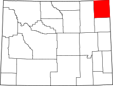 | |
| CDP | ||
| Unincorporated communities | ||