Huffman Prairie
|
Huffman Prairie Flying Field | |
|
Orville Wright in flight over Huffman Prairie, approximately 1,760 feet in 40 1/5 seconds, Nov. 16, 1904 | |
  | |
| Nearest city | Fairborn, Ohio |
|---|---|
| Coordinates | 39°48′12″N 84°3′57″W / 39.80333°N 84.06583°WCoordinates: 39°48′12″N 84°3′57″W / 39.80333°N 84.06583°W |
| Built | 1904 |
| Website | http://www.nps.gov/daav/learn/historyculture/huffman-prairie-flying-field.htm |
| NRHP Reference # | 71000640 |
| Significant dates | |
| Added to NRHP | May 6, 1971[1] |
| Designated NHL | June 21, 1990[2] |


Huffman Prairie, also known as Huffman Prairie Flying Field or Huffman Field is part of Ohio's Dayton Aviation Heritage National Historical Park. The 84-acre (34-hectare) patch of rough pasture, near Fairborn, northeast of Dayton, is the place where the Wright brothers (Wilbur and Orville) undertook the difficult and sometimes dangerous task of creating a dependable, fully controllable airplane and training themselves to be pilots. Many early aircraft records were set by the Wrights at the Huffman Prairie.
History
The Wrights began using Huffman Prairie in 1904 with the permission of the field's owner, Dayton banker Torrence Huffman. Its location along an interurban rail line from the brothers' hometown of Dayton provided them with easy access. The Wrights made about 150 flights at the field in 1904–1905, leading to development of the 1905 Wright Flyer III, which they considered to be the first practical airplane. This aircraft has been restored, and is now displayed at the Carillon Historical Park in Dayton.
In 1910, the Wright Company placed its testing operations at Huffman Prairie Flying Field; the Wright Company also operated its Wright Flying School on the site. Through the Flying School, the Wright Company trained more than a hundred pilots, including the aviators for the Wright Exhibition Team and early military aviators, including Henry H. "Hap" Arnold and Thomas DeWitt Milling. The United States Army Signal Corps purchased the field in 1917 and renamed it, along with 2,000 adjacent acres (8 km²), Wilbur Wright Field. In 1948 the area was merged with nearby Patterson Field to become Wright-Patterson Air Force Base.
Huffman Prairie Flying Field Historic Site
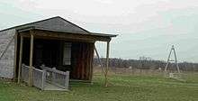
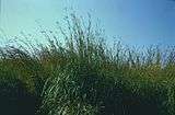
The National Park Service currently operates this historic site where visitors may see the place where the Wrights developed the world’s first practical airplane as well as replicas of their 1905 hangar and launching catapult. While the historic flying field is mowed short, simulating the grazed pasture used by the Wrights and allowing its use for re-enactment flights, an adjacent area of tall-grass prairie is maintained unmowed, managed instead using late-season controlled burns.[3] A nature trail winds among the prairie's tall grasses, diverse wildflowers, and occasional shrubs.[4] The Huffman Prairie area is located within the Air Force Base, with a separate entrance and fencing between it and an adjacent runway and other modern base facilities.
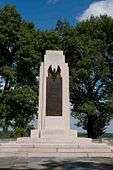
The associated Huffman Prairie Flying Field Interpretive Center is located about 2 miles (3.2 km) from the flying field near the Wright Memorial, on a hilltop overlooking Huffman Prairie and other parts of the Air Force Base. This facility addresses the specific problems Orville and Wilbur Wright encountered while they were perfecting their flying machine, their first demonstration flights in the United States and in Europe, their exhibition team, and their manufacturing facility in Dayton, Ohio. The center also highlights the continuing legacy of Orville and Wilbur Wright as embodied in the development of Wright-Patterson Air Force Base and the continuing aeronautical research at this Air Force facility.
Huffman Prairie Flying Field was designated as a National Historic Landmark in 1990, and added to the U.S. World Heritage Tentative List as part of the Dayton Aviation Sites listing in 2008.[2][5] In 1986, 109 acres (44 ha) of the natural portion of the Huffman Prairie was designated as an Ohio Natural Area.[4] It is a component of the National Aviation Heritage Area.[6]
The Dayton indie rock band Guided by Voices has a song called "Huffman Prairie Flying Field" on their 2004 album Half Smiles of the Decomposed.
Gallery
|


References
- ↑ National Park Service (2008-04-15). "National Register Information System". National Register of Historic Places. National Park Service.
- 1 2 "Huffman Prairie Flying Field". National Historic Landmark summary listing. National Park Service. Retrieved June 13, 2008.
- ↑ "Base to conduct controlled burn of Huffman Prairie". Inside WPAFB: News. Wright-Patterson Air Force Base. Retrieved October 18, 2011.
- 1 2 "Ohio's Prairies: Native Grasslands". Audubon Adventures: Ohio. National Audubon Society. Retrieved October 18, 2011.
- ↑ ____ (___, 19__). "National Register of Historic Places Inventory-Nomination: Huffman Prairie Flying Field ___" (pdf). National Park Service. Check date values in:
|date=(help) and Accompanying __ photos, exterior and interior, from 19__ (32 KB) - ↑ "Home of the Wright Brothers". National Aviation Heritage Area. Retrieved March 16, 2012.
External links
- National Park Service: Huffman Prairie Flying Field Interpretive Center - Dayton Aviation Heritage National Historical Park
- National Park Service: Huffman Prairie History
- 2008 U.S. World Heritage Tentative List
- The short film "Wright Brothers On Huffman Prairie (March 7, 1988)" is available for free download at the Internet Archive
| Topics | |
|---|---|
| Lists by states |
|
| Lists by insular areas | |
| Lists by associated states | |
| Other areas | |
| |