Hubberston
| Hubberston | |
 St David's, Hubberston |
|
 Hubberston |
|
| Population | 2,313 |
|---|---|
| OS grid reference | SM899061 |
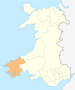
| Principal area | Pembrokeshire |
| Country | Wales |
| Sovereign state | United Kingdom |
| Post town | MILFORD HAVEN |
| Postcode district | SA73 |
| Dialling code | 01646 |
| Police | Dyfed-Powys |
| Fire | Mid and West Wales |
| Ambulance | Welsh |
| EU Parliament | Wales |
|
|
Coordinates: 51°42′55″N 5°03′20″W / 51.715284°N 5.055685°W
Hubberston is a coastal village[1] in Pembrokeshire, Wales. It belongs to the parish of Hubberston in the historical hundred of Roose. It is located directly to the west of the larger town of Milford Haven, and is a district of the community of Milford Haven. It is adjacent to the village of Hakin. It had a population of 2,390 inhabitants in 2001.[2] It is mainly residential in nature.
Etymology
There is no evidence for this assertion that the village of Hubberston is named after the ninth-century Viking Ubba, and that he overwintered in nearby Milford Haven,[3][4] and the name itself does not have Scandinavian roots.[3][4][5][6] It was first recorded in the thirteenth century as Hobertiston and Villa Huberti, meaning "Hubert's Farm" and "Hubert's manor" respectively,[3][5] and has only been known as Huberston since the late fifteenth century.[3][4] In fact, the earliest forms of the place name reveal that the town's eponym bore a Norman-French personal name.[7]
History
The village was built around the 13th century church, St David's. This now stands next to Hubberston green. By 1800, a mail coach was operating between London and Hubberston, arriving in the evening and returning the following day.[8] Fort Hubberstone is a large battery located in the village. The fort was abandoned after World War I, but during World War II was in use once again as an air raid shelter and army camp for American military personnel.[9]
Transport
Hubberston is separated from Milford Haven by Hubberston Pill, a once tidal estuary. Access is via Victoria Bridge, which is reached via the A4076 through Milford Haven. A circular bus service operates, providing access to Milford Haven.[10] The village in served by Milford Haven railway station.
References
- ↑ Davies, John; Jenkins, Nigel (2008). The Welsh Academy Encyclopaedia of Wales. Cardiff: University of Wales Press. p. 556. ISBN 978-0-7083-1953-6.
- ↑ KS01 Usual Resident Population: Census 2001 'Key Statistics for Urban Areas', Office For National Statistics
- 1 2 3 4 Hrdina, Y (2011). Die Wikinger in Wales (Mag. thesis). Universität Wien. p. 108.
- 1 2 3 Charles, BG (1934). Old Norse Relations With Wales. Cardiff: The University of Wales Press Board. pp. 8–9. Accessed via Google Books.
- 1 2 Mills, AD (2003). A Dictionary of British Place-names (EPUB). Oxford Paperback Reference. Oxford: Oxford University Press. ISBN 0-19-852758-6.
- ↑ Loyn, H (1976). The Vikings in Wales (PDF). London: Viking Society for Northern Research. p. 9.
- ↑ James, H (2007). "The Geography of the Cult of St David: A Study of Dedication Patterns in the Medieval Diocese". In Evans, JW; Wooding, JM. St David of Wales: Cult, Church and Nation. Studies in Celtic History. Woodbridge: The Boydell Press. p. 57. ISBN 978-1-84383-322-2. Accessed via Google Books.
- ↑ Rees, Thomas, The Beauties of England and Wales, or, Delineations, topographical, historical, and descriptive, of each county, Vernor & Hood, 1803 ASIN: B0018X3YSI
- ↑ Experience Pembrokeshire - Hubberstone Fort "Experience Pembrokeshire Website", accessed 14.11.09
- ↑ Bus Routes - South West Pembrokeshire Pembrokeshire County Council Website