Howardville, Missouri
| Howardville, Missouri | |
|---|---|
| City | |
| Nickname(s): The Bricks | |
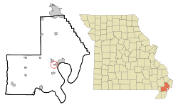 Location of Howardville, Missouri | |
| Coordinates: 36°34′3″N 89°35′56″W / 36.56750°N 89.59889°WCoordinates: 36°34′3″N 89°35′56″W / 36.56750°N 89.59889°W | |
| Country | United States |
| State | Missouri |
| County | New Madrid |
| Area[1] | |
| • Total | 0.23 sq mi (0.60 km2) |
| • Land | 0.23 sq mi (0.60 km2) |
| • Water | 0 sq mi (0 km2) |
| Elevation | 292 ft (89 m) |
| Population (2010)[2] | |
| • Total | 383 |
| • Estimate (2012[3]) | 373 |
| • Density | 1,665.2/sq mi (642.9/km2) |
| Time zone | Central (CST) (UTC-6) |
| • Summer (DST) | CDT (UTC-5) |
| ZIP code | 63869 |
| Area code(s) | 573 |
| FIPS code | 29-33364[4] |
| GNIS feature ID | 0719923[5] |
Howardville is a city in New Madrid County, Missouri, United States. The population was 383 at the 2010 census.
History
The town was founded by Travis Howard, the father of Elston Howard.
Geography
Howardville is located at 36°34′3″N 89°35′56″W / 36.56750°N 89.59889°W (36.567455, -89.598924).[6]
According to the United States Census Bureau, the city has a total area of 0.23 square miles (0.60 km2), all of it land.[1] New Madrid County Central High School and New Madrid County Central Middle School are located here.
Demographics
| Historical population | |||
|---|---|---|---|
| Census | Pop. | %± | |
| 1960 | 190 | — | |
| 1970 | 500 | 163.2% | |
| 1980 | 536 | 7.2% | |
| 1990 | 440 | −17.9% | |
| 2000 | 342 | −22.3% | |
| 2010 | 383 | 12.0% | |
| Est. 2015 | 367 | [7] | −4.2% |
2010 census
As of the census[2] of 2010, there were 383 people, 160 households, and 101 families residing in the city. The population density was 1,665.2 inhabitants per square mile (642.9/km2). There were 192 housing units at an average density of 834.8 per square mile (322.3/km2). The racial makeup of the city was 5.74% White, 92.43% Black or African American, 1.04% Asian, and 0.78% from two or more races. Hispanic or Latino of any race were 0.52% of the population.
There were 160 households of which 43.1% had children under the age of 18 living with them, 21.9% were married couples living together, 38.1% had a female householder with no husband present, 3.1% had a male householder with no wife present, and 36.9% were non-families. 35.0% of all households were made up of individuals and 15% had someone living alone who was 65 years of age or older. The average household size was 2.39 and the average family size was 3.08.
The median age in the city was 29.7 years. 33.9% of residents were under the age of 18; 11% were between the ages of 18 and 24; 22.7% were from 25 to 44; 18.1% were from 45 to 64; and 14.4% were 65 years of age or older. The gender makeup of the city was 41.3% male and 58.7% female.
2000 census
As of the census[4] of 2000, there were 342 people, 133 households, and 88 families residing in the city. The population density was 1,490.0 people per square mile (574.1/km²). There were 158 housing units at an average density of 688.4 per square mile (265.2/km²). The racial makeup of the city was 7.02% White, 92.40% African American, and 0.58% from two or more races. Hispanic or Latino of any race were 1.46% of the population.
There were 133 households out of which 36.1% had children under the age of 18 living with them, 18.8% were married couples living together, 39.8% had a female householder with no husband present, and 33.8% were non-families. 31.6% of all households were made up of individuals and 15.8% had someone living alone who was 65 years of age or older. The average household size was 2.57 and the average family size was 3.23.
In the city the population was spread out with 33.9% under the age of 18, 13.2% from 18 to 24, 22.8% from 25 to 44, 17.0% from 45 to 64, and 13.2% who were 65 years of age or older. The median age was 27 years. For every 100 females there were 82.9 males. For every 100 females age 18 and over, there were 69.9 males.
The median income for a household in the city was $9,671, and the median income for a family was $11,389. Males had a median income of $23,750 versus $16,023 for females. The per capita income for the city was $6,588. About 63.0% of families and 58.5% of the population were below the poverty line, including 69.4% of those under age 18 and 73.0% of those age 65 or over.
References
- 1 2 "US Gazetteer files 2010". United States Census Bureau. Retrieved 2012-07-08.
- 1 2 "American FactFinder". United States Census Bureau. Retrieved 2012-07-08.
- ↑ "Population Estimates". United States Census Bureau. Retrieved 2013-05-30.
- 1 2 "American FactFinder". United States Census Bureau. Retrieved 2008-01-31.
- ↑ "US Board on Geographic Names". United States Geological Survey. 2007-10-25. Retrieved 2008-01-31.
- ↑ "US Gazetteer files: 2010, 2000, and 1990". United States Census Bureau. 2011-02-12. Retrieved 2011-04-23.
- ↑ "Annual Estimates of the Resident Population for Incorporated Places: April 1, 2010 to July 1, 2015". Retrieved July 2, 2016.
- ↑ "Census of Population and Housing". Census.gov. Retrieved June 4, 2015.
Municipalities and communities of New Madrid County, Missouri, United States | ||
|---|---|---|
| Cities |  | |
| Village | ||
| Townships |
| |
| Unincorporated communities | ||
| Ghost towns | ||
| Footnotes | ‡This populated place also has portions in an adjacent county or counties | |