Houssay, Mayenne
| Houssay | |
|---|---|
|
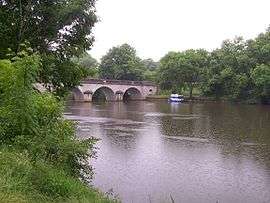
The Mayenne river at Houssay | |
 Houssay | |
|
Location within Pays de la Loire region  Houssay | |
| Coordinates: 47°54′54″N 0°44′05″W / 47.915°N 0.7347°WCoordinates: 47°54′54″N 0°44′05″W / 47.915°N 0.7347°W | |
| Country | France |
| Region | Pays de la Loire |
| Department | Mayenne |
| Arrondissement | Château-Gontier |
| Canton | Château-Gontier-Ouest |
| Area1 | 14.26 km2 (5.51 sq mi) |
| Population (2006)2 | 388 |
| • Density | 27/km2 (70/sq mi) |
| Time zone | CET (UTC+1) |
| • Summer (DST) | CEST (UTC+2) |
| INSEE/Postal code | 53117 / 53360 |
| Elevation |
32–107 m (105–351 ft) (avg. 100 m or 330 ft) |
|
1 French Land Register data, which excludes lakes, ponds, glaciers > 1 km² (0.386 sq mi or 247 acres) and river estuaries. 2 Population without double counting: residents of multiple communes (e.g., students and military personnel) only counted once. | |
Houssay is a commune in the Mayenne department in north-western France.
See also
| Wikimedia Commons has media related to Houssay (Mayenne). |
This article is issued from Wikipedia - version of the 2/14/2015. The text is available under the Creative Commons Attribution/Share Alike but additional terms may apply for the media files.