Playden
| Playden | |
 Playden |
|
| Area | 16.6 km2 (6.4 sq mi) -inc East Guldeford[1] |
|---|---|
| Population | 340 (Parish-2011)[2] |
| – density | 51/sq mi (20/km2) |
| OS grid reference | TQ925226 |
| – London | 52 miles (84 km) NW |
| District | Rother |
| Shire county | East Sussex |
| Region | South East |
| Country | England |
| Sovereign state | United Kingdom |
| Post town | RYE |
| Postcode district | TN31 |
| Dialling code | 01797 |
| Police | Sussex |
| Fire | East Sussex |
| Ambulance | South East Coast |
| EU Parliament | South East England |
| UK Parliament | Hastings and Rye |
|
|
Coordinates: 50°58′N 0°44′E / 50.97°N 0.74°E
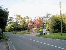
Playden is a village and civil parish in the Rother District of East Sussex, England. The village is located one mile (1.6 km) north-west of Rye. It is mentioned in the Domesday Book as Pleidena; it is a largely rural parish, having no village centre, and the hamlet of Houghton Green is included in the parish. Playden's main occupation was fishing: the fish were salted in a one-time settlement known as Saltcote, after the fact that it had a fish salting industry based there. Saltcote Street is now all that remains of that industry.[3]
The Norman church is dedicated to St Michael.[4]
Within the parish there is a Site of Special Scientific Interest (SSSI), Houghton Green Cliff. This is an exposed cliff face displaying sandstones of geological interest.[5]
In addition, part of the Dungeness, Romney Marsh & Rye SSSI lies within Playden parish
References
- ↑ "East Sussex in Figures". East Sussex County Council. Retrieved 2008-04-26.
- ↑ "Civil Parish population 2011". Retrieved 7 October 2015.
- ↑ Notes on the village
- ↑ St Michael's church
- ↑ "SSSI Citation — Houghton Green Cliff" (PDF). Natural England. Retrieved 2008-07-05.
External links
![]() Media related to Playden at Wikimedia Commons
Media related to Playden at Wikimedia Commons