Hotton
| Hotton | |||
|---|---|---|---|
| Municipality | |||
|
The church. | |||
| |||
 Hotton Location in Belgium | |||
|
Location of Hotton in Luxembourg province 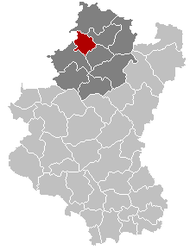 | |||
| Coordinates: 50°16.1′N 5°26.8′E / 50.2683°N 5.4467°ECoordinates: 50°16.1′N 5°26.8′E / 50.2683°N 5.4467°E | |||
| Country | Belgium | ||
| Community | French Community | ||
| Region | Wallonia | ||
| Province | Luxembourg | ||
| Arrondissement | Marche-en-Famenne | ||
| Government | |||
| • Mayor | Jacques Chaplier (Entente Communale) | ||
| • Governing party/ies | Entente Communale, Union Communale | ||
| Area | |||
| • Total | 57.32 km2 (22.13 sq mi) | ||
| Population (1 January 2016)[1] | |||
| • Total | 5,468 | ||
| • Density | 95/km2 (250/sq mi) | ||
| Postal codes | 6990 | ||
| Area codes | 084 | ||
| Website | (French) www.hotton.be | ||


Hotton is a Walloon municipality of Belgium located in the province of Luxembourg. The municipality lies 12 kilometers from Marche-en-Famenne in the Ardennes and has more than 5,400 inhabitants. The river Ourthe crosses Hotton.
History
The first history of Hotton dates from Roman times, when Hotton was an oppidum. Multiple Roman excavations have been found at Ti-Château, a strengthened Roman encampment. The village of Hotton was first mentioned in medieval documents as Hottine in 1187. Hotton was part of the medieval county of La Roche till the 16th century, when it was taken over by the lords of Montaigu. In 1791, Hotton became a free village.[2]
In the afternoon of 11 May 1940, Hotton was captured and occupied by the 5th Panzer Division during the Battle of Belgium. Allied forces tried in vain to blow up the steel bridge over the Ourthe in an attempt to slow down German forces. Hotton played an important role during the Battle of the Bulge, as German troops (116th Panzer Division Der Windhund and the 560th Volksgrenadier Division) reached here the most western point of their advance here, being stopped by the American 84th Infantry Division Railsplitters.[3]
The current municipality was founded in 1977, when the municipalities of Hampteau, Fronville and Marenne were added to the municipality of Hotton.
Villages
The municipality of Hotton consists of three areas of settlement in addition to the village of Hotton itself: Hampteau, Marenne and Fronville. There are also several hamlets: Bourdon, Deulin, Ménil-Favay, Monville, Monteuville, Melreux, Ny and Werpin.
The municipality lies in the Arrondissement of Marche-en-Famenne, Luxembourg Province. In the west it borders Namur Province.
Tourism
Hotton is a very popular place with tourists and is known for its speleothem caves, known as the Caves of Hotton. A small Commonwealth war cemetery with 660 graves is also situated just outside Hotton. Other tourist attractions are Deulin Castle, the Virgin of Werpin, the Faber Mill and St. Peter's Church, Melreux. The well-known annual hot air balloon festival Hottolfiades is held in August. The annual fair (also held in August) claims to be the largest fair of the arrondissement.
Politics
| Party | 10-10-1976[4] | 10-10-1982 | 9-10-1988 | 9-10-1994 | 8-10-2000 | 8-10-2006[5] | 14-10-2012[6] | |||||||
|---|---|---|---|---|---|---|---|---|---|---|---|---|---|---|
| Votes / Representatives | % | 13 | % | 13 | % | 15 | % | 15 | % | 15 | % | 17 | % | 17 |
| PS | - | 16,18 | 1 | - | - | - | - | - | ||||||
| PRL-MCC | - | - | - | - | 15,83 | 2 | - | - | ||||||
| MR | - | - | - | - | - | 13,91 | 2 | - | ||||||
| E.C. | 43,55 | 6 | 41,33 | 6 | 31,81 | 5 | 34,93 | 5 | 23,63 | 3 | 28,26 | 5 | 42,61 | 8 |
| IC | 38,96 | 5 | - | - | - | - | 4,75 | 0 | - | |||||
| UDP | 17,49 | 2 | - | - | - | - | - | - | ||||||
| V.E. | - | 42,49 | 6 | 18,49 | 2 | - | - | - | - | |||||
| UNION | - | - | 27,97 | 5 | 27,65 | 4 | - | - | - | |||||
| ALT.88 | - | - | 21,73 | 3 | - | - | - | - | ||||||
| AIC | - | - | - | 37,42 | 6 | - | - | - | ||||||
| MAYEUR | - | - | - | - | 48,3 | 9 | 53,08 | 10 | 36,58 | 7 | ||||
| CCH | - | - | - | - | 12,24 | 1 | - | - | ||||||
| FNW | - | - | - | - | - | - | 2,82 | 0 | ||||||
| U.C. | - | - | - | - | - | - | 16,05 | 2 | ||||||
| V. Ensemble | - | - | - | - | - | - | 1,94 | 0 | ||||||
| Total no. of votes | 2221 | 2716 | 2930 | 3094 | 3381 | 3548 | 3745 | |||||||
| Upswing % | 95,6 | 95,91 | 95,83 | 96,75 | 93,48 | |||||||||
| Blank and invalid votes % | 1,89 | 4,86 | 4,2 | 5,07 | 6 | 5,75 | 5,18 | |||||||

Former mayor Phillipe Courard (MAYEUR), who was mayor between 1995 and 2012, was beaten at the 2012 Belgian local elections after being mayor for seventeen years. He was replaced by Jacques Chaplier of the Entente Communale (E.C.).
See also
References
- ↑ Population per municipality as of 1 January 2016 (XLS; 397 KB)
- ↑ (French) Commune d'Hotton, consulted 5 April 2013
- ↑ Dutch Wikipedia, Hotton, consulted 5 April 2013
- ↑ 1976-2000:Verkiezingsdatabase Binnenlandse Zaken
- ↑ Gegevens 2006: elections2006.wallonie.be:
- ↑ Gegevens 2012: elections2012.wallonie.be
External links
-
 Media related to Hotton at Wikimedia Commons
 |
Durbuy | | ||
| Somme-Leuze (WNA) | |
Érezée | ||
| ||||
| | ||||
| Marche-en-Famenne | |
Rendeux |
Municipalities of Luxembourg Province | ||
|---|---|---|
| Arlon |  | |
| Bastogne | ||
| Marche-en-Famenne | ||
| Neufchâteau | ||
| Virton | ||