Horse Mesa, Maricopa County, Arizona
| Horse Mesa, Arizona | |
|---|---|
| Populated place | |
 Horse Mesa  Horse Mesa Location within the state of Arizona | |
| Coordinates: 33°34′59″N 111°21′19″W / 33.58306°N 111.35528°WCoordinates: 33°34′59″N 111°21′19″W / 33.58306°N 111.35528°W | |
| Country | United States |
| State | Arizona |
| County | Maricopa |
| Elevation[1] | 2,067 ft (630 m) |
| Time zone | Mountain (MST) (UTC-7) |
| • Summer (DST) | MST (UTC-7) |
| Area code(s) | 480 |
| FIPS code | 04-33700 |
| GNIS feature ID | 30147 |
Horse Mesa is a populated place situated on the south side of the Salt River, approximately 35 miles south of Roosevelt Dam in Maricopa County, Arizona.[2] It is one of two populated places in the state with this name, the other being situated in Apache County. Its name is derived from when sheep-herders used to graze their saddle and pack animals on the mesa when they were driving their flocks through the area.[3] It has an estimated elevation of 2,067 feet (630 m) above sea level.[1]
References
- 1 2 "Feature Detail Report for: Horse Mesa". Geographic Names Information System. United States Geological Survey.
- ↑ "Horse Mesa (in Maricopa County, AZ) Populated Place Profile". AZ Hometown Locator. Retrieved November 27, 2016.
- ↑ Barnes, Will Croft (2016). Arizona Place Names. Tucson: Arizona Place Names. p. 211. ISBN 0816534950.
Municipalities and communities of Maricopa County, Arizona, United States | ||
|---|---|---|
| Cities | 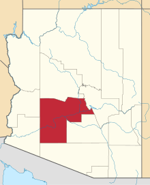 | |
| Towns | ||
| CDPs | ||
| Unincorporated communities |
| |
| Indian reservations | ||
| Ghost towns | ||
| Footnotes | ‡This populated place also has portions in an adjacent county or counties | |
This article is issued from Wikipedia - version of the 11/30/2016. The text is available under the Creative Commons Attribution/Share Alike but additional terms may apply for the media files.