Horse Cave, Kentucky
| Horse Cave, Kentucky | |
|---|---|
| City | |
|
Downtown Horse Cave, December 2006, looking Eastward down Main Street/HWY-218. The cave opening is to the right. | |
 Location of Horse Cave, Kentucky | |
| Coordinates: 37°10′34″N 85°54′22″W / 37.17611°N 85.90611°W | |
| Country | United States |
| State | Kentucky |
| County | Hart |
| Area | |
| • Total | 3.0 sq mi (7.7 km2) |
| • Land | 3.0 sq mi (7.7 km2) |
| • Water | 0.0 sq mi (0.0 km2) |
| Elevation | 633 ft (193 m) |
| Population (2000) | |
| • Total | 2,252 |
| • Density | 758.0/sq mi (292.7/km2) |
| Time zone | Central (CST) (UTC-6) |
| • Summer (DST) | CDT (UTC-5) |
| ZIP code | 42749 |
| Area code(s) | 270 & 364 |
| FIPS code | 21-38008 |
| GNIS feature ID | 0494572 |


Horse Cave is a home rule-class city[1] in Hart County, Kentucky, United States. Randall Curry currently serves as Mayor of the city and is assisted by a City Council that is composed of six members. According to Census data, the population of Horse Cave was 2,311 in 2010.[2]
History
The town was settled by Maj. Albert Anderson in the 1840s. The landowner donated land for an L&N station in 1858 on the provision that it be named after nearby Horse Cave.[3] The community around the station developed quickly, so that a post office was erected in 1860[4] and the city was formally incorporated by the state assembly in 1864.[5]
The cave for which the city is named is located on the south side of Main Street. Various explanations are given for its unusual name. One is that Native Americans or outlaws hid horses in the cave; another is that an early carriage may have lost a horse when it fell into the opening by accident; a third reason involves the 19th-century use of "horse" as slang for anything big or huge, related to a similar use of the Swedish hoss. The cave has also been known as Hidden River Cave, for an underground stream located inside.[4] That stream was used to power a dynamo and, for a while in the late 19th century, Horse Cave was the only city in Kentucky apart from Louisville and Ashland to have electric lights. Around World War I, the only air-conditioned tennis courts in the world were located near the entrance of the cave. The stream also provided the town's water supply but mistaken development caused raw sewage to seep into the water and forced the closure of the cave for fifty years. The stench was so bad in the 1960s that pedestrians typically crossed to the other side of Main Street rather than walk near the entrance and birds would sometimes fall from the sky. The problem has been largely solved in recent years.
The town changed its name to Caverna in 1869 but the inability to change the name of the railroad station prompted the community to reconsider and restore the name Horse Cave in 1879.[4] Owing to its early rail connection, Horse Cave was a major center of agricultural commerce for Hart, Metcalfe, Green, and Barren counties since the 1870s. Tobacco warehouses provided the majority of the income.
Since the 1970s, some factories have relocated to the area including: Dart Container Corporation, T Marzetti Company, and Sister Schubert's Bakery. Tourist attractions include Kentucky Down Under/Kentucky Caverns, Hidden River Cave/American Cave Museum, and the nearby Mammoth Cave National Park. Civil War Days are an annual tourist event, during which time parades down Main Street and reenactments of the Battle of Rowlett's Station between Horse Cave and Munfordville are staged. A local theatre formerly known as the Horse Cave Theatre and/or the Kentucky Repertory Theatre once operated in Horse Cave but is no longer in business.
Horse Cave was the birthplace of Jack Robert Thompson (September 4, 1893), the father of noted author and journalist Hunter S. Thompson, and former NBA player Clarence Glover.
Geography
Horse Cave is located at 37°10′34″N 85°54′22″W / 37.17611°N 85.90611°W (37.176230, -85.906143).[6]
According to the United States Census Bureau, the city has a total area of 3.0 square miles (7.8 km2), all land.
A large bamboo research station is north of Horse Cave on U.S. Route 31W in Bonnieville. It is said to contain the largest collection of bamboos in the state of Kentucky.
Demographics
| Historical population | |||
|---|---|---|---|
| Census | Pop. | %± | |
| 1870 | 479 | — | |
| 1880 | 526 | 9.8% | |
| 1890 | 598 | 13.7% | |
| 1900 | 867 | 45.0% | |
| 1910 | 881 | 1.6% | |
| 1920 | 864 | −1.9% | |
| 1930 | 1,259 | 45.7% | |
| 1940 | 1,278 | 1.5% | |
| 1950 | 1,545 | 20.9% | |
| 1960 | 1,780 | 15.2% | |
| 1970 | 2,068 | 16.2% | |
| 1980 | 2,045 | −1.1% | |
| 1990 | 2,284 | 11.7% | |
| 2000 | 2,252 | −1.4% | |
| 2010 | 2,311 | 2.6% | |
| Est. 2015 | 2,344 | [7] | 1.4% |
As of the census[9] of 2000, there were 2,252 people, 977 households, and 601 families residing in the city. The population density was 758.0 people per square mile (292.8/km²). There were 1,091 housing units at an average density of 367.2 per square mile (141.8/km²). The racial makeup of the city was 80.91% White, 17.94% Black or African American, 0.27% Native American, 0.04% from other races, and 0.84% from two or more races. 0.58% of the population were Hispanic or Latino of any race.
There were 977 households out of which 28.0% had children under the age of 18 living with them, 40.2% were married couples living together, 18.2% had a female householder with no husband present, and 38.4% were non-families. 34.8% of all households were made up of individuals and 16.8% had someone living alone who was 65 years of age or older. The average household size was 2.21 and the average family size was 2.84.
In the city the population was spread out with 21.8% under the age of 18, 8.8% from 18 to 24, 26.4% from 25 to 44, 22.6% from 45 to 64, and 20.3% who were 65 years of age or older. The median age was 40 years. For every 100 females there were 81.8 males. For every 100 females age 18 and over, there were 72.5 males.
The median income for a household in the city was $21,134, and the median income for a family was $28,026. Males had a median income of $25,905 versus $18,457 for females. The per capita income for the city was $17,861. About 24.1% of families and 27.9% of the population were below the poverty line, including 36.8% of those under age 18 and 22.5% of those age 65 or over.
Notable people
- Simon Bolivar Buckner
- Clarence Glover
- Tom Moran
- Jack Robert Thompson, father of Hunter S. Thompson
- Clarence "Cave" Wilson, Harlem Globetrotter Team Captain
- Joseph Dudley Downing, artist and poet
References
- ↑ "Summary and Reference Guide to House Bill 331 City Classification Reform" (PDF). Kentucky League of Cities. Retrieved December 30, 2014.
- ↑ "2010 Horse Cave Census". City of Horse Cave.
- ↑ The Kentucky Encyclopedia, pp. 442. "Horse Cave". University Press of Kentucky (Lexington), 1992. Accessed 30 Jul 2013.
- 1 2 3 Rennick, Robert M. (1987). Kentucky Place Names. University Press of Kentucky. pp. 144–145. Retrieved 28 Apr 2013.
- ↑ Commonwealth of Kentucky. Office of the Secretary of State. Land Office. "Horse Cave, Kentucky". Accessed 29 Jul 2013.
- ↑ "US Gazetteer files: 2010, 2000, and 1990". United States Census Bureau. 2011-02-12. Retrieved 2011-04-23.
- ↑ "Annual Estimates of the Resident Population for Incorporated Places: April 1, 2010 to July 1, 2015". Retrieved July 2, 2016.
- ↑ "Census of Population and Housing". Census.gov. Retrieved June 4, 2015.
- ↑ "American FactFinder". United States Census Bureau. Retrieved 2008-01-31.
External links
Coordinates: 37°10′34″N 85°54′22″W / 37.17623°N 85.906143°W
Municipalities and communities of Hart County, Kentucky, United States | ||
|---|---|---|
| Cities | 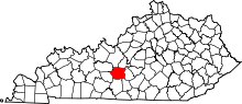 | |
| CDP | ||
| Other unincorporated communities | ||