Hornelen
| Hornelen | |
|---|---|
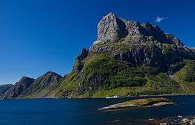 Hornelen, looking southwest from Rugsundøya. | |
| Highest point | |
| Elevation | 860 m (2,820 ft) |
| Prominence | 115 m (377 ft) [1] |
| Coordinates | 61°50′30″N 5°14′50″E / 61.84167°N 5.24722°ECoordinates: 61°50′30″N 5°14′50″E / 61.84167°N 5.24722°E |
| Geography | |
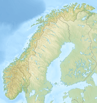 Hornelen Norway | |
| Location | Bremanger, Sogn og Fjordane, Norway |
| Topo map | 1118 I Måløy |
| Climbing | |
| Easiest route | From Berleneset |
Hornelen is a mountain in Bremanger Municipality in Sogn og Fjordane county, Norway. The mountain sits on the eastern end of the island of Bremangerlandet, along the Frøysjøen strait, in the Nordfjord region of Norway. At 860 metres (2,820 ft), it is the highest sea cliff in Europe, and has for a long time been used as a landmark for naval navigation. It is a 4-hour hike to the summit from Berleneset (across the small fjord from the village of Berle).[2]

The horizontal distance from the summit to the sea is approximately 500 metres (1,600 ft). Approximately 1 kilometre (0.62 mi) to the west of the cliffside is the highest point on the island Bremangerlandet, called Svartevassegga which has an elevation of 889 metres (2,917 ft). The rock in Hornelen consists of sandstone of Devonian age, and it constitutes an important part of the geology of Norway.[3]
References
- ↑ Bjørstad, Petter. "Hornelen". Retrieved 2010-06-08.
- ↑ "Bremanger Municipality in Norway". GoNorway.com. Retrieved 3 August 2008.
- ↑ Larsen, Bjørn T.; Olaussen, Snorre; Sundvoll, Bjørn; Heereman, Michel (2007). "Volcanoes and faulting in an arid climate". In Ramberg, Ivar; Bryhni, Inge; et al. The making of a land: Geology of Norway. Trondheim: Norsk Geologisk Forening. ISBN 978-82-92394-42-7.