Horine, Missouri
| Horine, Missouri | |
|---|---|
| CDP | |
 Location of Horine, Missouri | |
| Coordinates: 38°15′58″N 90°25′49″W / 38.26611°N 90.43028°WCoordinates: 38°15′58″N 90°25′49″W / 38.26611°N 90.43028°W | |
| Country | United States |
| State | Missouri |
| County | Jefferson |
| Area | |
| • Total | 0.8 sq mi (2.2 km2) |
| • Land | 0.8 sq mi (2.1 km2) |
| • Water | 0.0 sq mi (0.0 km2) |
| Elevation | 420 ft (128 m) |
| Population (July 2007)[1] | |
| • Total | 1,002 |
| • Density | 1,252.5/sq mi (477.1/km2) |
| Time zone | Central (CST) (UTC-6) |
| • Summer (DST) | CDT (UTC-5) |
| ZIP code | 63070 |
| Area code(s) | 636 |
| FIPS code | 29-33040[2] |
| GNIS feature ID | 0736307[3] |
Horine is a census-designated place (CDP) in Jefferson County, Missouri, United States. The population was estimated in 2007 as 1,002.[1] It was 923 at the 2000 census.
History
Horine was platted in 1868, and named after C. Thomas Horine, an early settler.[4] A post office called Horine Station was established in 1862, the name was changed to Horine in 1916, and the post office closed in 1942.[5]
Geography
Horine is located at 38°15′58″N 90°25′49″W / 38.26611°N 90.43028°W (38.266140, -90.430290).[6]
According to the United States Census Bureau, the CDP has a total area of 0.9 square miles (2.3 km2), of which, 0.8 square miles (2.1 km2) of it is land and 0.04 square miles (0.10 km2) of it (2.35%) is water.
Demographics
As of the census[2] of 2000, there were 923 people, 335 households, and 254 families residing in the CDP. The population density was 1,112.2 people per square mile (429.4/km²). There were 355 housing units at an average density of 427.8/sq mi (165.1/km²). The racial makeup of the CDP was 97.83% White, 0.87% African American, 0.22% Native American, 0.11% Asian, and 0.98% from two or more races. Hispanic or Latino of any race were 0.76% of the population.
There were 335 households out of which 34.3% had children under the age of 18 living with them, 61.8% were married couples living together, 9.3% had a female householder with no husband present, and 23.9% were non-families. 19.7% of all households were made up of individuals and 6.0% had someone living alone who was 65 years of age or older. The average household size was 2.76 and the average family size was 3.15.
In the CDP the population was spread out with 24.3% under the age of 18, 10.0% from 18 to 24, 31.9% from 25 to 44, 24.8% from 45 to 64, and 9.1% who were 65 years of age or older. The median age was 36 years. For every 100 females there were 108.8 males. For every 100 females age 18 and over, there were 113.1 males.
The median income for a household in the CDP was $41,676, and the median income for a family was $41,593. Males had a median income of $37,009 versus $20,417 for females. The per capita income for the CDP was $17,366. About 3.4% of families and 3.7% of the population were below the poverty line, including none of those under the age of eighteen or sixty-five or over.
Education
Dunklin R-V School District serves Horine.[7]
References
- 1 2 Horine, Missouri (City-Data.com)
- 1 2 "American FactFinder". United States Census Bureau. Retrieved 2008-01-31.
- ↑ "US Board on Geographic Names". United States Geological Survey. 2007-10-25. Retrieved 2008-01-31.
- ↑ "Jefferson County Place Names, 1928–1945 (archived)". The State Historical Society of Missouri. Retrieved 19 October 2016.
- ↑ "Post Offices". Jim Forte Postal History. Retrieved 19 October 2016.
- ↑ "US Gazetteer files: 2010, 2000, and 1990". United States Census Bureau. 2011-02-12. Retrieved 2011-04-23.
- ↑ "Welcome to Dunklin R-V “Home of the Herculaneum Blackcats”" (Archive). Dunklin R-V School District. Retrieved on June 16, 2014.
Municipalities and communities of Jefferson County, Missouri, United States | ||
|---|---|---|
| Cities | 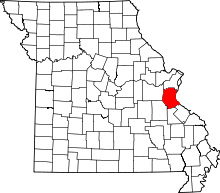 | |
| Villages | ||
| Townships | ||
| CDPs |
| |
| Unincorporated communities | ||