Horicon, New York
| Horicon | |
|---|---|
| Town | |
| Town of Horicon | |
 Location of Horicon in Warren County | |
 Horicon Location within the state of New York | |
| Coordinates: 43°42′18″N 73°44′7″W / 43.70500°N 73.73528°WCoordinates: 43°42′18″N 73°44′7″W / 43.70500°N 73.73528°W | |
| Country | United States |
| State | New York |
| County | Warren |
| Area | |
| • Total | 71.8 sq mi (186.0 km2) |
| • Land | 66.1 sq mi (171.1 km2) |
| • Water | 5.7 sq mi (14.8 km2) |
| Elevation | 804 ft (245 m) |
| Population (2000) | |
| • Total | 1,479 |
| • Density | 22.4/sq mi (8.6/km2) |
| Time zone | Eastern (EST) (UTC-5) |
| • Summer (DST) | EDT (UTC-4) |
| ZIP code | 12815 |
| Area code(s) | 518 |
| FIPS code | 36-35639 |
| GNIS feature ID | 0979076 |
Horicon is a town in Warren County, New York, United States. It is part of the Glens Falls Metropolitan Statistical Area.[1] Horicon's population was 1,479 at the 2000 census.[2]
Horicon is on the county's north border and is inside the Adirondack Park.
History
Horicon was first settled around 1800. The town was formed in 1838 from parts of the towns of Hague and Bolton.[3]
Geography
According to the United States Census Bureau, the town has a total area of 71.8 square miles (186 km2), of which, 66.1 square miles (171 km2) of it is land and 5.7 square miles (15 km2) of it (7.98%) is water.
The north town line is the border of Essex County, New York.
New York State Route 8 crosses the town, forming a major east-west highway.
The town is also the site of the Curtis S. Read Scout Reservation, a boy scout camp owned by the Westchester-Putnam Council of Hawthorne, New York.
Demographics
| Historical population | |||
|---|---|---|---|
| Census | Pop. | %± | |
| 1840 | 659 | — | |
| 1850 | 1,152 | 74.8% | |
| 1860 | 1,542 | 33.9% | |
| 1870 | 1,500 | −2.7% | |
| 1880 | 1,633 | 8.9% | |
| 1890 | 1,582 | −3.1% | |
| 1900 | 1,136 | −28.2% | |
| 1910 | 1,001 | −11.9% | |
| 1920 | 754 | −24.7% | |
| 1930 | 800 | 6.1% | |
| 1940 | 850 | 6.3% | |
| 1950 | 791 | −6.9% | |
| 1960 | 833 | 5.3% | |
| 1970 | 890 | 6.8% | |
| 1980 | 1,082 | 21.6% | |
| 1990 | 1,269 | 17.3% | |
| 2000 | 1,479 | 16.5% | |
| 2010 | 1,389 | −6.1% | |
| Est. 2014 | 1,375 | [4] | −1.0% |
As of the census[2] of 2000, there were 1,479 people, 642 households, and 446 families residing in the town. The population density was 22.4 people per square mile (8.6/km²). There were 1,767 housing units at an average density of 26.7 per square mile (10.3/km²). The racial makeup of the town was 98.58% White, 0.20% African American, 0.20% Native American, 0.20% Asian, 0.20% from other races, and 0.61% from two or more races. Hispanic or Latino of any race were 0.47% of the population.
There were 642 households out of which 23.8% had children under the age of 18 living with them, 59.3% were married couples living together, 5.9% had a female householder with no husband present, and 30.4% were non-families. 26.5% of all households were made up of individuals and 12.9% had someone living alone who was 65 years of age or older. The average household size was 2.30 and the average family size was 2.74.
In the town the population was spread out with 20.6% under the age of 18, 5.2% from 18 to 24, 23.2% from 25 to 44, 32.0% from 45 to 64, and 19.0% who were 65 years of age or older. The median age was 46 years. For every 100 females there were 100.1 males. For every 100 females age 18 and over, there were 98.3 males.
The median income for a household in the town was $36,481, and the median income for a family was $41,184. Males had a median income of $31,196 versus $21,908 for females. The per capita income for the town was $20,608. About 6.3% of families and 9.7% of the population were below the poverty line, including 17.0% of those under age 18 and 0.7% of those age 65 or over.
School district
The towns of Horicon and Chester together established North Warren Central School District, which serves residents of both towns.
Communities and locations in Horicon
- Adirondack – A hamlet in the northwest part of the town by Schroon Lake. This hamlet has ZIP code 12808.
- Brant Lake – A lake dominating the central part of the town; also a hamlet at the west end of the lake, located on Route 8.
- Pottersville – A hamlet near the west town line by Schroon Lake. This hamlet has its larger part in the town of Chester. This hamlet has ZIP code 12860.
- Schroon Lake – A lake partly in the northwest part of the town. This hamlet has ZIP code 12870.
- South Horicon – A hamlet in the southwest part of the town.
- Starbuckville – A hamlet west of Brant Lake hamlet.
References
- ↑ "Metropolitan Areas and Components, 1999, with FIPS Codes". US Census Bureau. Retrieved July 7, 2009.
- 1 2 "American FactFinder". United States Census Bureau. Retrieved 2008-01-31.
- ↑ History of Warren County, H. P. Smith - Chapter XXXIV: History of the Horicon
- ↑ "Annual Estimates of the Resident Population for Incorporated Places: April 1, 2010 to July 1, 2014". Retrieved June 4, 2015.
- ↑ "Census of Population and Housing". Census.gov. Retrieved June 4, 2015.
External links
- Horicon, NY - Official Site
- Information about the Town of Horicon by North Warren Chamber of Commerce
Municipalities and communities of Warren County, New York, United States | ||
|---|---|---|
| City | 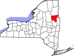 | |
| Towns | ||
| Village | ||
| CDPs | ||
| Other hamlets | ||
| Footnotes | ‡This populated place also has portions in an adjacent county or counties | |