Horebeke
| Horebeke | |||
|---|---|---|---|
| Municipality | |||
|
Church and school of Sint-Kornelis-Horebeke | |||
| |||
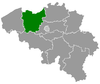
 Horebeke Location in Belgium | |||
|
Location of Horebeke in East Flanders  | |||
| Coordinates: 50°50′N 03°41′E / 50.833°N 3.683°ECoordinates: 50°50′N 03°41′E / 50.833°N 3.683°E | |||
| Country | Belgium | ||
| Community | Flemish Community | ||
| Region | Flemish Region | ||
| Province | East Flanders | ||
| Arrondissement | Oudenaarde | ||
| Government | |||
| • Mayor | Joseph Browaeys | ||
| • Governing party/ies | Volksbelangen | ||
| Area | |||
| • Total | 11.20 km2 (4.32 sq mi) | ||
| Population (1 January 2016)[1] | |||
| • Total | 2,000 | ||
| • Density | 180/km2 (460/sq mi) | ||
| Postal codes | 9667 | ||
| Area codes | 055 | ||


Horebeke (Dutch pronunciation: [ˈɦoːrəbeːkə]) is a municipality located in the Belgian province of East Flanders. The municipality comprises the towns of Sint-Kornelis-Horebeke and Sint-Maria-Horebeke. On January 1, 2006, Horebeke had a total population of 2,004. The total area is 11.20 km² which gives a population density of 179 inhabitants per km².
The Corsele parish in Sint-Maria-Horebeke has a Protestant church which dates from 1872 and a museum dedicated to Abraham Hans (the former Protestant village teacher and story teller) built in 1812 as a parish school. There have been Protestants in Sint-Maria-Horebeke since the Reformation of the 16th century.[2]
References
- ↑ Population per municipality as of 1 January 2016 (XLS; 397 KB)
- ↑ Regionaal Landschap Vlaamse Ardennen. "Corsele, refuge of the Geuzen". Archived from the original on May 19, 2006. Retrieved 2008-04-10.
External links
 Media related to Horebeke at Wikimedia Commons
- Geuzenhoek, or refuge of the Geuzen, history of Protestantism in the South of East-Flanders
- Webpage about Corsele/Korsele at Internet Archive
- Webpage about Horebeke at Reocities
- Webpage about Horebeke at Internet Archive
 |
Oudenaarde | |
Zwalm | |
| |
||||
| ||||
| | ||||
| Maarkedal | |
Brakel |
This article is issued from Wikipedia - version of the 12/1/2016. The text is available under the Creative Commons Attribution/Share Alike but additional terms may apply for the media files.