Hopkins, South Carolina
| Hopkins, South Carolina | |
|---|---|
| Census-designated place | |
 Location in Richland County and the state of South Carolina. | |
| Coordinates: 33°54′20″N 80°52′36″W / 33.90556°N 80.87667°WCoordinates: 33°54′20″N 80°52′36″W / 33.90556°N 80.87667°W | |
| Country | United States |
| State | South Carolina |
| County | Richland |
| Area | |
| • Total | 16.5 sq mi (42.8 km2) |
| • Land | 16.5 sq mi (42.8 km2) |
| • Water | 0.04 sq mi (0.1 km2) |
| Elevation | 170 ft (50 m) |
| Population (2010) | |
| • Total | 2,882 |
| • Density | 170/sq mi (67/km2) |
| Time zone | Eastern (EST) (UTC-5) |
| • Summer (DST) | EDT (UTC-4) |
| ZIP code | 29061 |
| FIPS code | 45-34990[1] |
| GNIS feature ID | 1246059[2] |
Hopkins is a census-designated place (CDP) in Richland County, South Carolina, United States, that was founded c. 1836 and named after John Hopkins. It is located 11 miles (18 km) southeast of downtown Columbia and is part of the Columbia Metropolitan Statistical Area. As of the 2010 census, the population of the Hopkins CDP was 2,882.[3]
Attractions
Hopkins is 6 miles (10 km) northwest of South Carolina's only national park, Congaree National Park, which is located off Bluff Road west of Gadsden. The Congaree National Park has contiguously preserved the largest tract of old-growth bottomland hardwood forest in the United States, and contains one of the tallest deciduous forests in the world. It has 27,000-acre (110 km2) of land and water. The park was designated an international Biosphere, a Globally Important Bird Area, and a National Natural Landmark. While in the park one can hike, backpack, camp, canoe, fish, birdwatch, and study nature.
References
- ↑ "American FactFinder". United States Census Bureau. Retrieved 2008-01-31.
- ↑ "US Board on Geographic Names". United States Geological Survey. 2007-10-25. Retrieved 2008-01-31.
- ↑ "Geographic Identifiers: 2010 Demographic Profile Data (G001): Hopkins CDP, South Carolina". U.S. Census Bureau, American Factfinder. Retrieved January 14, 2013.
External links
- Hopkins, SC, at ePodunk
- Congaree National Park
Municipalities and communities of Richland County, South Carolina, United States | ||
|---|---|---|
| Cities | 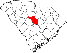 | |
| Towns | ||
| CDPs | ||
| Unincorporated communities | ||
| Footnotes | ‡This populated place also has portions in an adjacent county or counties | |