Honde Valley
| Honde Valley | |
|---|---|
.jpg) Honde Valley in 1996 | |
| Highest point | |
| Elevation | 780 m (2,560 ft) at Hauna |
| Coordinates | 18°29′48.40″S 32°51′11.52″E / 18.4967778°S 32.8532000°ECoordinates: 18°29′48.40″S 32°51′11.52″E / 18.4967778°S 32.8532000°E |
| Geography | |
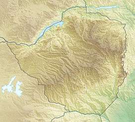 Honde Valley Location of Honde Valley in Zimbabwe | |
| Location |
|
The Honde Valley extends from the eastern border of Zimbabwe into Mozambique. The valley is formed as part of the Eastern Highlands mountain range. The valley is about 130 kilometres (81 miles) from Mutare, or 110 kilometres (68 miles) from Nyanga. Mount Inyangani and the Nyanga National Park forms the western boundary of the valley.
Access
Approaching from Mutare, the turn-off is about 50 km along the road towards Nyanga. The road into the valley is tarred and twists and turns steeply as it drops 800 meters in about 20 km. Off the tarred road, there are good dust roads which service most parts of the Valley.
Geography
Climate
The climate of Honde Valley falls within the Savannah sub. From late October to around the end of April, the weather is hot and humid. Temperatures may rise up to 28 ˚C and this is the period where most of the rainfall is received. From May to the beginning of July, the temperatures are very low and they may hover around minimums of 2 ˚C while August is very windy. From September to October, it is very hot and the maximum temperatures may average 30 ˚C. Most of the rainfall experienced is of the convectional type. At time orographic rainfalls at various times of the year, in addition to the normal convectional rainfall. This portion of the country, therefore, receives the highest rainfall in the country.
Topography
The average altitude of Honde Valley is around 900m above sea-level as compared to its immediate surroundings which rise above 1800m. This abrupt drop in topography creates the spectacular Mtarazi and adjacent Muchururu Falls, local tourist attractions.
Flora
The 500 square kilometres of the Honde Valley in Zimbabwe are extensively cultivated, often with gravity fed irrigation channels. Extensive use is made of the many smaller tributaries feeding into the Pungwe River in this portion of the Honde Valley.[1]
Fauna
Honde Valley is one of the premier birding destinations in Zimbabwe, offers a wide range of species difficult to find in most other parts of the region, other than in neighbouring Mozambique. This fertile valley lies 850m above sea level and is one of the major tea producing areas of Zimbabwe.[2]
Specials: Anchieta's tchagra, moustached grass-warbler, red-winged warbler, black-winged bishop, red-faced crimsonwing, lesser seedcracker, singing cisticola, twinspot indigobird which parasitizes the red-throated twinspot, scarce swift, pallid honeyguide, green-backed woodpecker, stripe-cheeked greenbul, yellow-streaked greenbul, silvery-cheeked hornbill, white-eared barbet, pale batis, black-throated wattle-eye, variable sunbird, bronzy sunbird, olive sunbird, yellow-bellied waxbill, grey waxbill, blue-spotted wood-dove, black-fronted bush-shrike.
Habitats: Lowland and riverine forest, marsh, miombo woodland, tea estate, maize lands.
Birding: There are four main birding areas in the valley, the area around Aberfoyle Club; Gleneagles Nature Reserve above the Club, eastern Highland Tea Estate; and Katiyo Tea Estate some 25 km from Aberfoyle.
Water resources
The water supply for the Honde Valley comprises small piped systems and motorised pumps serving small towns, growth points, commercial plantations, service centres and some villages, as well as direct abstractions from the rivers by riparian village communities not connected to developed installations.
There are a total of about seven small to medium-sized metered piped water systems at Hauna, Sachisuko, Honde Army, Zindi, Samanga, Mpotedzi and Sahumani. In addition there are other smaller un-metered water supply schemes that serve a number of villages and schools. The known smaller un-metered water supply schemes are Honde “Povo” Pipe Scheme, Chingaira Piped Scheme, St Columbus Secondary School, Sagambe Primary and Secondary School, Marige Water Project, Mahobo Piped Scheme and Mupenga Gravity Water Scheme.
Economy
Since the area is low-lying and hot it is an abundant tea and coffee growing area. The well known Katiyo, Aberfoyle, Rumbizi and Chiwira Tea Estates are among those situated in the valley. However, it is also home to many small scale and susbsistence farmers.[3] There are several non-motorized irrigation schemes in Honde valley.[4]
One of the main townships inside the valley is Hauna. Hauna Growth Point now has a community Hospital.
Tea estates
- Eastern Highlands Tea Estate
- Katiyo Tea Estate
- Aberfoyle Plantations
- Rumbizi and Chiwira tea estates.
Business centers
- Hauna Growth point – Hauna Growth point is located in the Honde Valley communal land about 95 km north of Mutare.It is the Growth Point Centre for Mutasa District in Manicaland.There is an aerodrome where small aeroplanes can land and take off.There is also a Police camp called Ruda Police Station which controls all police activities in that part of Mutasa District. There is also Hauna Hospital.It can be reached by a tarred road from Mutare and cellphone coverage is also available on the net-one,telecel and econet networks.
- Zindi Business centre
Education
Honde Valley has a number of schools and tertiary institutions.
Secondary schools
- Sagambe Secondary School
- Chavhanga Secondary School
- Chisuko Secondary School
- Muterere High School
- St Columbus High School
- Munyuku Secondary School
- Nyamhingura Secondary
- Ngarura Secondary School
- Gatsi High School
- Rupinda Secondary School
- St Peters Mandeya Secondary School
- Sahumani Secondary School
- Samaringa High School
- Buwu Secondary School
- St Peters Jombe Secondary School
Hospitals and clinics
- Hauna District Hospital
- Chisuko Clinic
- Sagambe Clinic
- Katiyo Tea Estate Clinic
- Chavhanga Clinic
- St Peter's Mandeya Clinic
- Gatsi Clinic
- Sahumani Clinic
- Chitombo Clinic
- Honde Green Clinic
- Samaringa Clinic
- St Peter's Jombe Clinic
- Samanga Clinic
- Ngarura Clinic
- Rupinda Clinic
- Hauna Clinic
- Honde Mission Clinic
- Samanga Clinic
- Mupotedzi Clinic
- Kwambana Clinic
Entertainment and recreation
Tourist attractions
- Mahwemasimike – a range of mountains which are beautiful to watch for tourists can be seen apart from the Hauna Growth Point.
- Mtarazi Falls[5] - The longest falls in Zimbabwe coming from Nyanga which falls into the Honde River.
- Pungwe River – fishing and white water rafting
- Nyanga National Park[6]
- Honde River
- Nyawamba Dam
- Chipote (Kapunga) Falls
- Honde View – a good view of attractive fauna
Sports
- Soccer
- Rugby
Notable places
Honde Valley has several villages, including Chavhanga, Sagambe, Rupinda, Rori, Chigweshe, Samushonga, Makwasa, Muparutsa, Zindi, Ngarura, Fenga, Muterere, Bvute, Gatsi, Chijara Village, Mudowaya Village, Zindi Village, Samanga, Bvuma, Honde village, Nyatsuro Village which was taken by Katiyo Tea Estates during the colonial era, Eastern Highland Tea Estates, Chitombo, Samanga, Aberfoyle, Matondora, Chisuko, Sahumani, Green, Makunike, Nyamaende, Rupinda, Costern, Kwambana, Jombe, Mahemasimike, Mandeya, Gwiriri and Munyuku.
Notable people from the Honde Valley
- Obert Bvute – publisher
- Gregory Mutambe - Wine Sommelier
- David Anthony Chimhini
- Oscar Gwiriri – poet
- Luke Masamvu
- Brian Nyabereka
- Walter Muparutsa-
Playwright/Actor/Director
See also
References
- ↑ Flora of Zimbabwe Flora of Zimbabwe: Records made by Bob Drummond
- ↑ Honde Valley Birding Spots Southern African Birding
- ↑ Green Harvest: The Outgrower Tea Leaf Collection System in the Honde Valley, Zimbabwe J P Mtisi
- ↑ Working Paper No. 32. Assessment of the Potential for Non-motorised Irrigation of Small Farms from Streams in Manicaland, Zimbabwe. Development Technology Unit. Department of Engineering, Warwick University, Coventry (January 1991)
- ↑ World Waterfall Database: Worlds Tallest Waterfalls
- ↑ Nyanga National Park.