Homer, Louisiana
| Homer, Louisiana | |
| Town | |
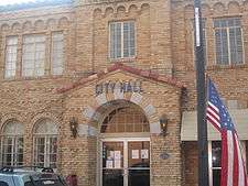 Homer City Hall (built 1928) | |
| Country | United States |
|---|---|
| State | Louisiana |
| Parish | Claiborne |
| Elevation | 282 ft (86.0 m) |
| Coordinates | 32°47′24″N 93°03′31″W / 32.79000°N 93.05861°WCoordinates: 32°47′24″N 93°03′31″W / 32.79000°N 93.05861°W |
| Area | 4.6 sq mi (11.9 km2) |
| - land | 4.6 sq mi (12 km2) |
| - water | 0.0 sq mi (0 km2), 0% |
| Population | 3,237 (2010) |
| Density | 694.6/sq mi (268.2/km2) |
| Mayor | Danny "Roy" Lewis (D) elected December 6, 2014 |
| Timezone | CST (UTC-6) |
| - summer (DST) | CDT (UTC-5) |
| Area code | 318 |
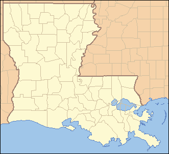 Location of Homer in Louisiana | |
 Location of Louisiana in the United States | |


_IMG_6315.JPG)
Homer is a town in and the parish seat of Claiborne Parish in northern Louisiana, United States.[1] Named for the Greek poet Homer, the town was laid out around the Courthouse Square in 1850 by Frank Vaughn. The present-day brick courthouse, built in the Greek Revival style of architecture, is one of only four pre-Civil War courthouses in Louisiana still in use. The building, completed in 1860, was accepted by the Claiborne Parish Police Jury on July 20, 1861, at a cost of $12,304.36, and is on the National Register of Historic Places. Its courthouse, built in 1860, is one of four courthouses in Louisiana built before the Civil War that are still used today, the others are in St. Francisville, St. Martinville, and Thibodaux.
The population of Homer was 3,237 at the 2010 census.[2]
History
Claiborne Parish was strongly Confederate during the Civil War. In 1863, a company of volunteers ineligible for conscription was organized in Homer to promote the war effort. Nevertheless, some Homer-area farmers hurried to Monroe during the war to trade their cotton for scarce items with the Union.[3]
The former newspaper, the Homer Iliad, was published by Arkansas native William Jasper Blackburn during Reconstruction. Blackburn also served a year in the United States House of Representatives; as the Claiborne Parish administrative judge, a post which no longer exists; and as a member of the Louisiana State Senate.
Andrew R. Johnson (1856–1933), a native of Tallapoosa County, Alabama, was president of Homer State Bank and served on the Claiborne Parish School Board and then in the early 1910s as the mayor of Homer. The town already had a municipal home-rule charter. Johnson's administration worked to bring electric lights and water works to fruition. In 1916, Johnson was elected to the first of two terms, without opposition, to the state senate. Johnson considered a gubernatorial bid in 1924 but declined.[4] Earlier, while residing in northern Natchitoches Parish, Johnson laid out and in 1901 named the village of Ashland.[5] Johnson donated land for the former Ashland High School.[6] Johnson is interred in Coushatta in Red River Parish.[7]
The Herbert S. Ford Memorial Museum operates across from the parish courthouse in the former Claiborne Hotel (completed 1890). The museum claims the oldest compressed bale of cotton in existence in the United States. This cotton display is believed to have been baled about 1930.[8] Adjacent to the cotton exhibit is the "Black Gold", a replica of an oilfield roughneck—a general laborer worker who loading and unloads cargo from crane baskets and keeps the drilling equipment clean—employed in the early 1930s by the Sinclair Oil and Gas Company. The exhibit has a recording which explains how a farm family, growing mostly cotton and corn faced great economic travail in Mississippi but relocated to Claiborne Parish to take advantage of the oil and natural gas boom. "Oil changed our lives forever. We owe a lot to the men, mud, and mules that made it happen," concludes the recorded message. In 1921, oil was discovered in Homer; in 1921, another strike followed in Haynesville in northern Claiborne Parish. The boom continued through the 1930s and brought many customers to the then booming Hotel Claiborne, which had been established in 1890 and declared a state historic site in 1984.[9]
The Homer of nostalgia
The former Purple Cow restaurant in Homer was a popular gathering spot, particularly for young people, for two decades c. 1962. It was operated by Elmon (1914-2009) and Edna Kirkpatrick Broughton (1915-2001). Elmon was also a driller in the oilfields and raised hay. The couple had five children,[10] one of whom, Ronnie Broughton, is the state chairman of the Constitution Party in Louisiana[11] and a member and former president of the Webster Parish School Board.[12]
Author Marilyn Sewell, a Unitarian Universalist minister in Portland, Oregon, was reared in Homer. Reflecting on her childhood, she wrote in 2010:
"Our doors were always unlocked during the day. When hoboes (the wandering indigent) came by, we always gave them a big plate of food. Our dog never had a leash, and ate scraps from the table. We rode our bikes wherever we wanted, walked or hitched rides several miles to school and to the swimming pool, charged whatever we wanted to eat at the local grocery store on the town square. We knew the banker – he lived next door. Teenagers went to the "Teen Club," sponsored by Coca-Cola, and we drank nothing stronger than our sponsor’s beverage. After basketball games, we went to the Purple Cow, where we had a burger and curly fries for 36 cents. The most daring thing we did was to drive a couple of miles out into the country and climb the fire tower. Since nobody was drinking, nobody fell. (I should add that this bucolic picture applied only to whites, in a community that was absolutely segregated.)
I did not choose to return to Homer, Louisiana, to live. It got way too small for me, really soon. But I remember that lovely sense of feeling "in place," feeling safe and free in a community. How do we still our anxiety in these times we're in? Where is a haven? Where do we feel safe?"[13]
Geography
Homer is located at 32°47′24″N 93°3′31″W / 32.79000°N 93.05861°W (32.789863, -93.058633).[14]
According to the United States Census Bureau, the town has a total area of 4.6 square miles (12 km2), of which 4.6 square miles (12 km2) is land and 0.22% is water.
Demographics
| Historical population | |||
|---|---|---|---|
| Census | Pop. | %± | |
| 1850 | 418 | — | |
| 1860 | 1,451 | 247.1% | |
| 1870 | 80 | −94.5% | |
| 1880 | 718 | 797.5% | |
| 1890 | 1,132 | 57.7% | |
| 1900 | 1,157 | 2.2% | |
| 1910 | 1,855 | 60.3% | |
| 1920 | 3,305 | 78.2% | |
| 1930 | 2,909 | −12.0% | |
| 1940 | 3,497 | 20.2% | |
| 1950 | 4,749 | 35.8% | |
| 1960 | 4,665 | −1.8% | |
| 1970 | 4,483 | −3.9% | |
| 1980 | 4,307 | −3.9% | |
| 1990 | 4,152 | −3.6% | |
| 2000 | 3,788 | −8.8% | |
| 2010 | 3,237 | −14.5% | |
| Est. 2015 | 3,005 | [15] | −7.2% |
As of the census[17] of 2000, there were 3,788 people, 1,431 households, and 977 families residing in the town. The population density was 826.8 people per square mile (319.3/km²). There were 1,709 housing units at an average density of 373.0 per square mile (144.1/km²). The racial makeup of the town was 37.80% White, 61.30% African American, 0.16% Native American, 0.21% Asian, 0.13% from other races, and 0.40% from two or more races. Hispanic or Latino of any race were 0.90% of the population.
There were 1,431 households out of which 31.5% had children under the age of 18 living with them, 38.9% were married couples living together, 23.7% had a female householder with no husband present, and 31.7% were non-families. 29.6% of all households were made up of individuals and 15.0% had someone living alone who was 65 years of age or older. The average household size was 2.61 and the average family size was 3.22.
In the town the population was spread out with 30.7% under the age of 18, 7.9% from 18 to 24, 25.6% from 25 to 44, 19.4% from 45 to 64, and 16.4% who were 65 years of age or older. The median age was 34 years. For every 100 females there were 87.1 males. For every 100 females age 18 and over, there were 81.6 males.
The median income for a household in the town was $23,646, and the median income for a family was $28,199. Males had a median income of $26,563 versus $20,777 for females. The per capita income for the town was $12,811. About 22.9% of families and 31.5% of the population were below the poverty line, including 45.2% of those under age 18 and 17.6% of those age 65 or over.
Culture and economy
The Homer Chamber of Commerce is also located within the former Hotel Claiborne. At one time, part of the building housed the defunct West and Company department store, owned by H. O. West of Minden.[18]
To the rear of the museum is the First Baptist Church of Homer, the roots of which date to 1845. Other churches in the area included First United Methodist and the theologically conservative Claiborne Southern Methodist Church.
One of the larger cemeteries in Homer is Arlington Cemetery, which maintains a meeting room known as the Arlington House. The cemetery is located off state Highway 146 a short distance from Homer. Noted Racist Louisiana politician William M. Rainach and his wife and daughter are interred there.
Notable people
- James Andrews, world-renowned sports physician / orthopedic surgeon
- William Jasper Blackburn, mayor of Minden from 1855 to 1856, U.S. Representative from Louisiana's 4th congressional district from 1868 to 1869, member of Louisiana State Senate from 1874 to 1878
- Cheryl Ford, only woman to win the WNBA Rookie of the Year Award and a WNBA championship in the same year
- Jake W. Cameron, mayor of Bossier City from 1957 to 1961[19]
- Milton Joseph Cunningham, attorney, state legislator from Natchitoches parish, state attorney general for three nonconsecutive terms ending in 1900, reared in Homer prior to 1858
- T. H. Harris, state superintendent of education (1908–1940), educated at the former Homer College in the late 19th century
- Gary Lee Jones, member of the Louisiana Board of Elementary and Secondary Education, effective January 2016; Claiborne Parish school superintendent in Homer from 1999 to 2003
- Joe LeSage, Shreveport attorney, former state senator from Caddo Parish, former Louisiana State University supervisor, graduated from Homer High School in 1945
- Paul Lowe, member of the American Football League All-Time Team
- Max T. Malone, former state senator from Caddo and Bossier parishes, graduated from Homer High School in 1971
- James T. McCalman, state senator from Claiborne and Bienville parishes from 1960 to 1964; Homer businessman
- Enos C. McClendon, Jr., judge of the 26th Judicial District of Louisiana from 1960 to 1978, was born in Homer in 1917.
- Danny Roy Moore, state senator from Claiborne and Bienville parishes from 1964 to 1968, graduated from Homer High School
- Frank T. Norman, Minden mayor from 1958 to 1966, born in Homer in 1914
- John Sparks Patton, educator from Claiborne Parish who first advocated taxpayer-funded school textbooks; former member of the Louisiana Public Service Commission
- William M. Rainach, notorious sergregationalist member of both houses of the state legislature; gubernatorial candidate in 1959, founder of near-by segregation academy, Claiborne Academy
- Bobby Rush, blues musician
- Larry Sale, sheriff of Claiborne Parish from 1936 to 1944, bodyguard of Huey Pierce Long, Jr., decorated soldier of World War I, interred at Arlington Cemetery in Homer
- Gaynell Tinsley, consensus All-American football player at LSU, 1935–1935, and All-Pro with the Chicago Cardinals, 1937–1938
- David Wade, Lieutenant General of the United States Air Force, former commander of Barksdale Air Force Base, state corrections director and adjutant general, was reared in the Holly Springs Community of Claiborne Parish but considered Homer as his hometown.
- Von Wafer, professional basketball player
- Loy F. Weaver, retired banker and businessman; former member of the Louisiana House of Representatives (1976–1984)[20] and candidate for the United States House of Representatives (1978)
- Kenneth McCoy, inventor, credited for introducing the "Ecoboost" and "Power" button on four separate Hyundai models, 2013.
Government and infrastructure
The United States Postal Service operates the Homer Post Office.[21]
Louisiana Department of Public Safety and Corrections operates the David Wade Correctional Center in an unincorporated section of Claiborne Parish near Homer.[22]
Zip Code: 71040
Education

During the second half of the 19th century, there was a Homer College, whose attendees included the district and circuit court judge from Minden, Richard Cleveland Drew, and William G. Stewart, a Webster Parish farmer and school board president, who was the namesake of the former William G. Stewart Elementary School in Minden.[23]
The Claiborne Parish School Board operates Homer Elementary School,[24] Homer Junior High School,[25] and Homer High School.[26]
Climate
The climate in this area is characterized by hot, humid summers and generally mild to cool winters. According to the Köppen Climate Classification system, Homer has a humid subtropical climate, abbreviated "Cfa" on climate maps.[27]
References
- ↑ "Find a County". National Association of Counties. Retrieved 2011-06-07.
- ↑ "Profile of General Population and Housing Characteristics: 2010 Demographic Profile Data (DP-1): Homer town, Louisiana". U.S. Census Bureau, American Factfinder. Retrieved April 3, 2012.
- ↑ John D. Winters, The Civil War in Louisiana, Baton Rouge: Louisiana State University Press, 1963, ISBN 0-8071-0834-0, pp. 307, 406
- ↑ "Mike Miller, "Andrew R. Johnson," from Henry E. Chambers, A History of Louisiana, Vol. II, Chicago and New York City, 1925, pp. 147–148". usgarchives.rog. Retrieved May 25, 2010.
- ↑ "Ashland". explorenatchitoches.com. Retrieved May 15, 2010.
- ↑ H. Welborn Ayres, "History of Ashland, Louisiana", manuscript written for Ramah Cemetery Association, 1979
- ↑ "Andrew R. Johnson". findagrave.com. Retrieved May 26, 2010.
- ↑ Cotton exhibit, Herbert S. Ford Memorial Museum, Homer, Louisiana
- ↑ "Black Gold" exhibit, Ford Memorial Museum
- ↑ "Elmon Ernest Broughton". The Shreveport Times on findagrave. September 29, 2009. Retrieved July 28, 2015.
- ↑ "Constitution Party meets possible presidential nominee". The Alexandria Town Talk. Retrieved July 27, 2015.
- ↑ "Shake up for district 4, 5, 6 school board seats". Minden Press-Herald. November 5, 2014. Retrieved July 27, 2015.
- ↑ Marilyn Sewell (November 19, 2010). "Living in Terror". Retrieved July 28, 2015.
- ↑ "US Gazetteer files: 2010, 2000, and 1990". United States Census Bureau. 2011-02-12. Retrieved 2011-04-23.
- ↑ "Annual Estimates of the Resident Population for Incorporated Places: April 1, 2010 to July 1, 2015". Retrieved July 2, 2016.
- ↑ "Census of Population and Housing". Census.gov. Retrieved June 4, 2015.
- ↑ "American FactFinder". United States Census Bureau. Retrieved 2008-01-31.
- ↑ Beverly E. Smith, "Ford Museum Being Re-established in Homer," North Louisiana History, Vol. 14, Nos. 2-3 (Spring-Summer 1983), pp. 132–133
- ↑ "Jacob Welch "Jake" Cameron". The Shreveport Times. October 1, 1999. Retrieved January 2, 2015.
- ↑ "Membership in the Louisiana House of Representatives, 1812–2012" (PDF). house.louisiana.gov. Retrieved September 5, 2009.
- ↑ "Post Office Location - HOMER." United States Postal Service. Retrieved on October 2, 2010.
- ↑ "David Wade Corr. Center." Louisiana Department of Public Safety and Corrections. Accessed September 14, 2008.
- ↑ John A. Agan. "The Impact of the Minden Male Academy". Minden Memories. Retrieved March 14, 2015.
- ↑ "Welcome to Homer Elementary School." Claiborne Parish Schools. Retrieved on October 2, 2010.
- ↑ "Welcome to Homer Jr School." Claiborne Parish Schools. Retrieved on October 2, 2010.
- ↑ "Welcome to Homer High School." Claiborne Parish Schools. Retrieved on October 2, 2010.
- ↑ Climate Summary for Homer, Louisiana
External links
| Wikimedia Commons has media related to Homer, Louisiana. |
Municipalities and communities of Claiborne Parish, Louisiana, United States | ||
|---|---|---|
| Towns |  | |
| Villages | ||
| Unincorporated communities | ||
| Footnotes | ‡This populated place also has portions in an adjacent parish or parishes | |