Holt, Australian Capital Territory
| Holt Canberra, Australian Capital Territory | |||||||||||||
|---|---|---|---|---|---|---|---|---|---|---|---|---|---|
 | |||||||||||||
| Population | 4,814 (2011 census)[1] | ||||||||||||
| • Density | 1,459/km2 (3,780/sq mi) | ||||||||||||
| Established | 1972 | ||||||||||||
| Postcode(s) | 2615 | ||||||||||||
| Area | 3.3 km2 (1.3 sq mi) | ||||||||||||
| District | Belconnen | ||||||||||||
| Territory electorate(s) | Ginninderra | ||||||||||||
| Federal Division(s) | Fenner | ||||||||||||
| |||||||||||||
Holt (postcode: 2615) is a suburb in the Belconnen district of Canberra, located within the Australian Capital Territory, Australia. It was gazetted on 2 July 1970 and was named after Harold Holt, Prime Minister of Australia 1966-67. Streets are named after sportsmen and sportswomen.[2]
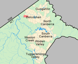
Holt is bounded by Southern Cross Drive, Starke Street, MacNaughton Street, Drake Brockman Drive and the edge of the Woodhaven Green golf course. It also borders on open farm and bushland, and is a short distance away from the Molongolo river. Ginninderra Falls Tourist Park and Parkwood, a very small light industrial area, are also nearby. It adjoins the suburbs of Higgins, Latham and Macgregor. The suburb contains Kippax Centre, a group centre serving the surrounding area, including the Kippax Fair shopping centre.
Facilities

Holt has several local shops, a neighbourhood oval, sporting fields, and Kingsford Smith School on the site of the former Ginninderra High School. This school was built to accommodate over 1000 students from preschool to year ten following the closure of the former Holt primary school (now housing community organisations) and the nearby Higgins primary school. Kingsford Smith School opened in 2009 for students from preschool to year 7, with the first year 10 group graduating in 2012.<www.kss.act.edu.au>
Also within Holt is the Cranleigh school, which caters for preschool and primary children with special needs.<www.cranleigh.act.edu.au> It commemorates the Cranleigh Farm of Lieutenant General James Gordon Legge that occupied the nearby area from the mid-1920s to late 1940s with the main house at the corner of Southern Cross Drive and Kingsford Smith Drive.
Governance
For the purposes of Australian federal elections for the House of Representatives, Holt is in the Fenner.[3]
For the purposes of Australian Capital Territory elections for the ACT Legislative Assembly, Holt is in the Ginninderra electorate.[4]
Geology
Silurian age Deakin Volcanics are in the north east with the following kinds of rock:
- Purple pink rhyolite is found in the north east.
- In the east is purple and green tuff.
- Purple rhyodacite is in the north
- Silurian Walker Volcanics purple and grey-green rhyodacite is in the west and south of Holt.
Under the Belconnen golf course is green and cream rhyolite of the Walker Volcanics. West of the golf course is a large sedimentary exposure of limestone and shale. A coarse green grey porphyry intrusive can be found 3 kilometres (1.9 mi) to the west of Holt.[5]
References
- ↑ Australian Bureau of Statistics (31 October 2012). "Holt (State Suburb)". 2011 Census QuickStats. Retrieved 24 January 2014.
- ↑ "Suburb Name search results". ACT Environment and Sustainable Development. Retrieved 11 January 2013.
- ↑ "Profile of the electoral division of Fenner (ACT)". Current federal electoral divisions. Australian Electoral Commission. 8 February 2016. Retrieved 29 May 2016.
- ↑ "Electorates 2012 election". Electorates. ACT Electoral Commission. 5 July 2012. Retrieved 17 December 2013.
- ↑ Henderson G A M and Matveev G, Geology of Canberra, Queanbeyan and Environs 1:50000 1980.
Coordinates: 35°13′27″S 149°00′55″E / 35.22417°S 149.01528°E