South Holmwood
| South Holmwood | |
 South Holmwood from Redlands Wood within the parish, a foothill of Leith Hill. St Mary Magdalene is visible to the far right and Holmwood Common contains all of the wood on the far side. |
|
 View of central South Holmwood looking towards the Surrey Hills AONB. |
|
 South Holmwood |
|
| Area | 7.73 km2 (2.98 sq mi) |
|---|---|
| Population | 895 (Civil Parish)[1] |
| – density | 116/km2 (300/sq mi) |
| OS grid reference | TQ1745 |
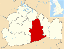
| Civil parish | Holmwood |
| District | Mole Valley |
| Shire county | Surrey |
| Region | South East |
| Country | England |
| Sovereign state | United Kingdom |
| Post town | Dorking |
| Postcode district | RH5 |
| Dialling code | 01306 |
| Police | Surrey |
| Fire | Surrey |
| Ambulance | South East Coast |
| EU Parliament | South East England |
| UK Parliament | Mole Valley |
Coordinates: 51°12′07″N 0°19′23″W / 51.202°N 0.323°W
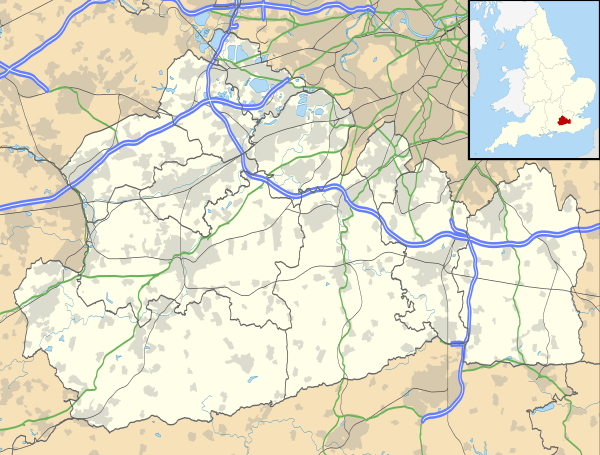
South Holmwood -/hoʊmwʊd/ is a semi-rural village in Surrey, England. It can be considered cognate with its wider civil parish, which stretches to the east to embrace Holmwood Common. However, it does not include Mid Holmwood, or North Holmwood, the latter being contiguous with Dorking. Betchett's Brook is the southern boundary and runs through a small locality known as Holmwood Corner. Reflecting Victorian naming of a railway station, Holmwood railway station is squarely within the parish of Capel but connected to the village by a curved path passing through Holmwood Corner Common.
Centred 3 miles (4.8 km) south of Dorking, South Holmwood is on the A24 London to Worthing road, a dual carriageway through the village.
Geography
Holmwood forms part of Mole Valley Borough Council's area; the main settlement is a small, clustered area bypassed by the A24 road. The smaller settlement of Holmwood Corner is half within the district, but the part beyond Betchett's Brook is considered to be in Beare Green, which is also convenient to the railway station, see Transport.
A country path, with a footbridge across the brook runs between the houses in Holmwood Corner, to the station at the end of Bregsell's Lane (running underneath the A24 and railway line). This forms a gentle curve through Holmwood Corner Common. A pavement on the opposite side of the dual carriageway feeds into a footpath that runs by the Anglican parish church[2] to similarly connect South Holmwood's main cluster of residential streets.
Moor Cottage, South Holmwood, was the birthplace of the novelist E. Arnot Robertson (1903–1961).[3]
History
The only settlement with a manor within the parish of Dorking and mentioned in the Domesday Book is Anstie, a smallholding rendering only twelve shillings per year to its overlords, who were Baldwin son of Herlewin, with William, son of Ansculf, holding has tenant-in-chief.[4]
Holmwood Borough was an ancient division of Dorking, to the south of the town. The ancient spelling in the Court Rolls is invariably Homewood. Holly trees have led to the change in the name. As far back as 1329 the reeves' accounts include carriage of firewood from 'Dorkynge [h]Ywode vel Homewode' to Kingston. The distinction between the "High Wood", the skirts of the big forest of the Weald, and the "Home Wood" sufficiently explains the name. In 1562 Kingston still depended upon this neighbourhood for firewood. Manning and Bray state that by the early 19th century Dorking was "supplied lately" with coal from Kingston.[5]
Dispersed farmsteads replacing those of medieval origin work the near western and far eastern fields beyond the common. Cottages have generally been replaced here, except for Betchets Green Cottage and Stoneheal, a 17th-century timber-framed building.[6]
South Holmwood only became a significant settlement in the 19th century, when the turnpike road was built from Epsom to Brighton via Worthing. The district of St Mary, Holmwood, was taken out of Dorking and Capel parishes and made into a separate parish in 1838. The school of the parish of St Mary Magdalen, Holmwood, was built in 1844, and enlarged in 1870 and 1884. The village prospered from the increased traffic and from the presence of large country houses such as Anstie Grange and Holmwood Park). The former led to the founding of such places as the cottages and travellers' inn in Mid Holmwood, and relatively well-to-do villas such as The Dutch House in South Holmwood.[7] The village saw a bisection from its cricket ground on Holmwood Common, with the extension of the turnpike road, now the A24, in 1971. The main residential area of the village is overlooked by the Grade II-listed parish church of St Mary Magdalene, built in 1838 and designed by John Burges Watson. It stands five to ten metres higher than the Victorian network of streets, and 100 metres to the north of them.[8] A disused section of the Roman road Stane Street passes to the west of the village, where there is one of the few changes in its alignment.
Moor Cottage, South Holmwood, was the birthplace of the novelist E. Arnot Robertson (1903–1961). She passed her childhood at Templeton, off Horsham Road.[9]
Holmwood Common
The area is approximately 600 acres (2.4 km2). The Victoria County History of 1911 gives its social geography and history:
A great number of "gentlemen's houses" surround the Common, and some standing upon it represent the original intrusions of squatters upon the waste of the manor [infertile land]—confirmed by lapse of time. Holmwood Park was the seat of the late Mrs. Gough Nichols, widow of the celebrated antiquary. Francis Larpent, Judge Advocate-General to Wellington's army in Spain and in the south of France.
Demography and housing
| Output area | Detached | Semi-detached | Terraced | Flats and apartments | Caravans/temporary/mobile homes | shared between households[1] |
|---|---|---|---|---|---|---|
| (Civil Parish) | 107 | 160 | 60 | 43 | 0 | 0 |
The average level of accommodation in the region composed of detached houses was 28%, the average that was apartments was 22.6%.
| Output area | Population | Households | % Owned outright | % Owned with a loan | hectares[1] |
|---|---|---|---|---|---|
| (Civil Parish) | 895 | 370 | 38.9% | 35.7% | 773 |
The proportion of households in the civil parish who owned their home outright compares to the regional average of 35.1%. The proportion who owned their home with a loan compares to the regional average of 32.5%. The remaining % is made up of rented dwellings (plus a negligible % of households living rent-free).
Transport
- Rail
Holmwood railway station just south of the parish boundary, is on the north-south Mole Valley Line. There are services to London Victoria and also to the south and (via a Dorking connection) to London Waterloo.
- Roads
The village is bisected by the A24 road. A local network of roads serves the nucleus of the village. One other principal local road runs due east across Holmwood Common, passing the disused cricket grounds, large forest homes and a car park. Further east, a road runs north and south, giving access to some of the village's small farms.
 |
Westcott | Dorking | Brockham | |
| Friday Street, Abinger | |
Leigh | ||
| ||||
| | ||||
| Coldharbour, Capel | Beare Green, Capel | Rusper |
External links
| Wikimedia Commons has media related to South Holmwood. |
- History of church
- A brief history of Holmwood Common, the villages of North, South and Mid Holmwood with biographical details of eminent residents and sites of architectural interest
References
- 1 2 3 Key Statistics; Quick Statistics: Population Density United Kingdom Census 2011 Office for National Statistics Retrieved 21 November 2013
- ↑ Holmwood St Mary Magdalene The Church of England Retrieved 29 November 2013
- ↑ Cambridge University Press. Retrieved 4 September 2010.
- ↑ "Anstie" Domesday Map Retrieved 29 November 2013
- ↑ H.E. Malden (editor) (1911). "Parishes: Dorking". A History of the County of Surrey: Volume 3. Institute of Historical Research. Retrieved 29 November 2013.
- ↑ Stoneheal – Grade II listing Historic England. "Details from listed building database (1189645)". National Heritage List for England.
- ↑ The Dutch House Historic England. "Details from listed building database (1028794)". National Heritage List for England.
- ↑ St Mary Magadalene Church – Grade II listing – Historic England. "Details from listed building database (1378100)". National Heritage List for England.
- ↑ Nicola Beauman: Robertson, Eileen Arbuthnot... In: Oxford Dictionary of National Biography, online e.(Oxford: Oxford University Press, September 2004). Retrieved 10 September 2010.
|
|  | ||||||||||||||||||||||||||||||
|---|---|---|---|---|---|---|---|---|---|---|---|---|---|---|---|---|---|---|---|---|---|---|---|---|---|---|---|---|---|---|---|---|
| Parks | ||||||||||||||||||||||||||||||||
| Places of worship | ||||||||||||||||||||||||||||||||
| Education | ||||||||||||||||||||||||||||||||
| Transport |
| |||||||||||||||||||||||||||||||
Buildings and structures | ||||||||||||||||||||||||||||||||
| Sport |
| |||||||||||||||||||||||||||||||
Places listed are articles notable as settlements, arranged by post town The two principal towns are emboldened | ||||||||||||||||||||||||||||||||