Hold with Hope
 Hold with Hope | |
| Geography | |
|---|---|
| Location | East Greenland |
| Coordinates | 73°45′N 21°0′W / 73.750°N 21.000°WCoordinates: 73°45′N 21°0′W / 73.750°N 21.000°W |
| Adjacent bodies of water | |
| Length | 77 km (47.8 mi) |
| Width | 38 km (23.6 mi) |
| Highest elevation | 1,229 m (4,032 ft) |
| Highest point | Spath Plateau |
| Administration | |
|
Greenland (Denmark) | |
| Zone | NE Greenland National Park |
| Demographics | |
| Population | Uninhabited |
Hold with Hope is a peninsula in eastern Greenland. Administratively it is part of the Northeast Greenland National Park zone.
Geologically Hold with Hope is a place of great interest.[1]
Geography
Hold with Hope is located between the Loch Fyne in the NW, Gael Hamke Bay in the north, the Greenland Sea at its eastern end and the Foster Bay on its southern side.[2]
The Spath Plateau, where the highest elevations are, is located in the northern part of the peninsula and the Tågefjeldene in the southern part. The Gauss Peninsula is located to the southwest, beyond the Badland Valley (Badlanddal). The section north of (Tobias Dal), a valley stretching from east to west across Hold with Hope, is also known as Home Foreland (Home Forland).[3]
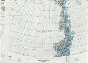 Map of Northeastern Greenland. |
History
This peninsula was reported by English sea explorer Henry Hudson during his 1607 and 1608 voyage on the Muscovy Company 80-ton whaler Hopewell of Hull. It was the first definite record of land in this remote area of Greenland.[4] Hudson described the place as:
...a “mayne high Land”, a “good Land, and worth the seeing”[5]
The name is one of the oldest known geographical names in Northeastern Greenland. It appeared on an early 17th-century Dutch map by Jodocus Hondius as Holde with hope.[3]
References
- ↑ The World’s biggest relay ramp: Hold With Hope, NE Greenland Journal of Structural Geology, Volume 22, Issue 7, 15 July 2000, Pages 843–850
- ↑ "Hold with Hope". Mapcarta. Retrieved 24 June 2016.
- 1 2 "Catalogue of place names in northern East Greenland" (PDF). Geological Survey of Denmark. Retrieved 18 June 2016.
- ↑ Wordie, J.M. (1927) The Cambridge Expedition to East Greenland in 1926. Geographical Journal 70 (3): 225-265
- ↑ Purchas, S. 1906: Hakluytus Posthumus or Purchas His Pilgrimes. Glasgow: James MacLehose & Sons. pp. 297–298
External links
- Petrogenesis of late stage magmatism at Hold with Hope, East Greenland
- Tertiary volcanism in northern E Greenland: Gauss Halvø and Hold with Hope