Hokota, Ibaraki
| Hokota 鉾田市 | |||
|---|---|---|---|
| City | |||
|
Hokota city hall | |||
| |||
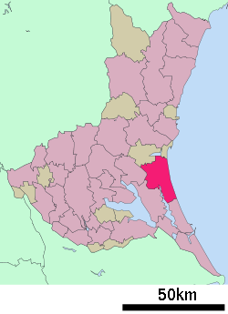 Location of Hokota in Ibaraki Prefecture | |||
 Hokota
| |||
| Coordinates: 36°9′31.2″N 140°30′59.1″E / 36.158667°N 140.516417°ECoordinates: 36°9′31.2″N 140°30′59.1″E / 36.158667°N 140.516417°E | |||
| Country | Japan | ||
| Region | Kantō | ||
| Prefecture | Ibaraki Prefecture | ||
| Area | |||
| • Total | 207.61 km2 (80.16 sq mi) | ||
| Population (September 2015) | |||
| • Total | 47,396 | ||
| • Density | 228/km2 (590/sq mi) | ||
| Time zone | Japan Standard Time (UTC+9) | ||
| - Tree | Sakura | ||
| - Flower | Sunflower | ||
| - Bird | Japanese bush warbler | ||
| Phone number | 0291-33-2111 | ||
| Address | 1444-1 Hokota, Hokota-shi, Ibaraki-ken 311-1592 | ||
| Website | Official website | ||


Hokota (鉾田市 Hokota-shi) is a city located in Ibaraki Prefecture, in the northern Kantō region of Japan. As of September 2015, the city had an estimated population of 47,396 and a population density of 228 persons per km². Its total area was 207.61 square kilometres (80.16 sq mi).
Geography
Hokota is located in central Ibaraki Prefecture, bordered by the Pacific Ocean to the east. It is approximately 90 kilometers northeast of Tokyo.
Surrounding municipalities
History
The town of Hokota was created with the establishment of the municipalities system on April 1, 1889. The city of Hokota was established on October 11, 2005, from the merger of the former town of Hokota, and the villages of Asahi and Taiyō (all from Kashima District).
Economy
The economy of Hokota is primarily agricultural, with melons as a major cash crop.
Education
- Hokota has 20 elementary schools, four middle schools and three high schools.
Transportation
Railway
- Kashima Rinkai Railway – Ōarai Kashima Line
- Hinuma - Kashima-Asahi - Tokushuku - Shin-Hokota - Kitaurakohan - Taiyō
Highway
Local attractions
- Otake Beach
- Kashima Littoral Park
Notable people from Hokota
- Tetsuya Asano, soccer player
External links
![]() Media related to Hokota, Ibaraki at Wikimedia Commons
Media related to Hokota, Ibaraki at Wikimedia Commons
- Official website (Japanese)
| Special cities | ||
|---|---|---|
| Cities | ||
| Higashiibaraki District | ||
| Inashiki District | ||
| Kitasōma District | ||
| Kuji District | ||
| Naka District | ||
| Sashima District | ||
| Yūki District | ||