Hochkönig Road
| Highway B164 | |
|---|---|
| Landstraße B164 | |
| Route information | |
| Length: | 75 km (47 mi) |
| Location | |
| States: | Salzburg, Tyrol |
| Highway system | |
| |
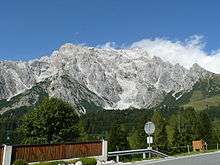
The Hochkönig Road (German: Hochkönig Straße or, in Tyrol, Hochkönigstraße),[1] – the B 164 – is a state road (Landesstraße) in Austria. It has a length of 75 kilometres (47 mi). Beginning in Bischofshofen in the Salzach valley, it runs initially between the Hochkönig and Dienten Mountains along the Dienten Saddle (1,342 m (AA)) and on into the valley of the Saalach to Saalfelden am Steinernen Meer. On the far side of the Saalach the road runs into the Leoganger Tal between the Leoganger Steinberge and the Loferer Steinberge to the north and the Kitzbühel Alps to the south via Leogang up to the Grießen Pass (975 m (AA)), and via Fieberbrunn downhill again into the valley of the Kitzbühler Ache to St. Johann in Tirol. On the last section the road runs parallel to the Salzburg-Tyrol Railway.
History


Since 1948 three sections of the present-day Hochkönig Road in the state of Salzburg have been classified as Class II state highways ( Landesstraßen):[2]
- The 9.6 km-long (6.0 mi) Mühlbach Road (Mühlbacher Straße) between Bischofshofen and Mühlbach
- The 5.7 km-long (3.5 mi) Alm Road (Almer Straße) between Alm and Saalfelden
- The 7.1 km-long (4.4 mi) long Leogang Road (Leoganger Straße) between Saalfelden and Leogang
With effect from 1 July 1962 the last two roads were extended:[3]
- The Alm Road was lengthened by 8.2 km (5.1 mi) as far as Hinterthal.
- The Leogang Road was lengthened by 11.0 km (6.8 mi) as far as the Tyrolean state border at the Grießen Pass.
The middle section between Mühlbach and Hinterthal wurde was declared a Konkurrenzstraße (literally "competitive road") by the state act of 11 April 1962. In Austrian legal language Konkurrenz means joint financing of a project by various institutions, of which each takes on a legally defined percentage of the maintenance costs. In this case the shares were:
- the State of Salzburg 65.00%
- the municipality of Alm 8.00%
- the municipality of Bischofshofen 2.25%
- the municipality of Dienten am Hochkönig 8.00%
- the municipality of Mühlbach am Hochkönig 8.00%
- the municipality of Saalfelden 3.75%
- the Austrian State Forests 5.00 %[4]
The Hochkönig Road has been part of the network of federal highways (Bundestrassen) in Austria since 1 Jan 1973.[5]
Traffic restrictions
The following restrictions apply to the Hochkönig Road: no entry on the B 164 Hochkönigstraße from km 56.251 (Hochfilzen municipality) to km 75.76 (St. Johann in Tirol) in both directions for lorries over 7.5 tonnes (7.4 long tons; 8.3 short tons) maximum permitted weight, excluding recovery and breakdown vehicles, military vehicles and lorries that load or unload, start or finish their journeys in the following municipalities: St. Johann in Tirol and Fieberbrunn in Tyrol, Hochfilzen and Leogang in the state of Salzburg.
Route / Junctions
| Salzburg, Sankt Johann im Pongau District | ||||
|---|---|---|---|---|
| Pinzgauer Straße B 311 | ||||
| Salzach | ||||
| Salzburg-Tyrol Railway | ||||
| Salzachtal Straße B 159 | ||||
| Mühlbach am Hochkönig | ||||
| Salzburg, Zell am See District | ||||
| Dienten Saddle (1,342 m (AA)) | ||||
|
| ||||
|
December to March | |||
|
| ||||
| Dienten am Hochkönig | ||||
| Urslau | ||||
| Maria Alm | ||||
| Urslau | ||||
| Urslau | ||||
| Saalfelden am Steinernen Meer B 311 | ||||
| Urslau | ||||
| Saalach | ||||
| Salzburg-Tyrol Railway | ||||
| Leogang | ||||
| Leoganger Ache | ||||
| Grießen Pass (975 m (AA)) | ||||
| Tyrol, Kitzbühel District | ||||
| Hochfilzen | ||||
| Barred to lorry traffic over 7.5 t from km 56.251 to km 75.76 | ||||
| Fieberbrunn | ||||
| Fieberbrunner Ache | ||||
| Salzburg-Tyrolean Railway | ||||
| Kitzbühler Ache | ||||
| St. Johann in Tirol B 178 | ||||
References
- ↑ Resolution by the Tyrolean Landtag of 15 May 2002, published in the Landesgesetzblatt 23/2002
- ↑ Verzeichnis der Landesstraßen II. Ordnung. LGBl. No. 42/1948.
- ↑ Law of 16 May 1962, with the individual roads taken over as state roads (Landesstraßen) and sections of several Landesstraßen left as such. LGBl. Nr. 129/1962.
- ↑ Law of 11 April 1962, with which the road running from Mühlbach am Hochkönig via Dienten am Hochkönig to Hinterthal, ,municipality of Alm, is designated as a Konkurrenzstraße. LGBl. No. 118/1962.
- ↑ Kundmachung des Bundesministers für Bauten und Technik dated 8 Feb 1977 iaw § 33 Abs. 4 of the Bundesstraßengesetzes 1971 within the state of Salzburg, BGBl. No. 112/1977.