Hjartdal
| Hjartdal kommune | |||
|---|---|---|---|
| Municipality | |||
| |||
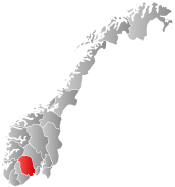
 Hjartdal within Telemark | |||
| Coordinates: 59°39′54″N 8°43′34″E / 59.66500°N 8.72611°ECoordinates: 59°39′54″N 8°43′34″E / 59.66500°N 8.72611°E | |||
| Country | Norway | ||
| County | Telemark | ||
| District | Aust-Telemark | ||
| Administrative centre | Sauland | ||
| Government | |||
| • Mayor (2015) | Bengt Halvard Odden (Ap) | ||
| Area | |||
| • Total | 792 km2 (306 sq mi) | ||
| • Land | 739 km2 (285 sq mi) | ||
| Area rank | 137 in Norway | ||
| Population (2004) | |||
| • Total | 1,633 | ||
| • Rank | 359 in Norway | ||
| • Density | 2/km2 (5/sq mi) | ||
| • Change (10 years) | -2.8 % | ||
| Demonym(s) | Hjartdøl[1] | ||
| Time zone | CET (UTC+1) | ||
| • Summer (DST) | CEST (UTC+2) | ||
| ISO 3166 code | NO-0827 | ||
| Official language form | Nynorsk | ||
| Website |
www | ||
|
| |||

Hjartdal is a municipality in Telemark county, Norway. It is part of the traditional region of Øst-Telemark. The administrative centre of the municipality is the village of Sauland.
The municipality of Hierdal was established as a municipality on 1 January 1838 (see formannskapsdistrikt). It consists of three parish'es: Hjartdal, Sauland, and Tuddal.
Up to the 1500s Hjartdal parish stretched from Rauland in the west and Kongsberg to the east. Counting from west to east, the villages Åmotsdal, Svartdal, Hjartdal, Tuddal, Sauland, Gransherad, Bolkesjø, Jondalen and Lisleherad was at one point included in the same parish. Gransherad was spun off last, around 1860. At the same time the administrative centre was moved from Hjartdal village to Sauland. Today, the Hjartdal parish and municipality consist of the three villages Hjartdal, Sauland and Tuddal.[2]
General information
Name
The Old Norse form of the name was Hjartdalr. The first element is probably a river name *Hjarta (now called the Hjartdøla river) and the last element is dalr m 'valley, dale'. The river name is derived from hjǫrtr m 'red deer'.[3]
Coat-of-arms
The coat-of-arms is from modern times. They were granted in 1989. The arms show a silver-colored red deer on a green background. They are canting arms because the name of the municipality is derived from the word for deer.
Notable residents
- Sigrid Louise Gundersen, television host from Sauland[4]
- Knut Buen, master fiddler living in Tuddal
- Sven Tore Løkslid, current county governor of Telemark
References
- ↑ "Navn på steder og personer: Innbyggjarnamn" (in Norwegian). Språkrådet. Retrieved 2015-12-01.
- ↑ Cultural Centre in Telemark
- ↑ Rygh, Oluf (1914). Norske gaardnavne: Bratsbergs amt (Dokumentasjonsprosjektet) (in Norwegian) (7 ed.). Kristiania, Norge: W. C. Fabritius & sønners bogtrikkeri. pp. 297–298.
- ↑ http://www.kjendis.no/2009/02/05/kjendis/japansk_gameshow/japan/tv_3/4707195/
External links
 Media related to Hjartdal at Wikimedia Commons
 The dictionary definition of Hjartdal at Wiktionary
- Municipal fact sheet from Statistics Norway
 Telemark travel guide from Wikivoyage
| Øvre Telemark (Telemark) |
|  | ||||||||||
|---|---|---|---|---|---|---|---|---|---|---|---|---|
| Nedre Telemark (Grenland) |
| |||||||||||