Yreka, California
| Yreka, California | |
|---|---|
| City | |
| City of Yreka | |
|
Statue at entrance to Yreka Historic District | |
 Location in Siskiyou County and the state of California | |
 Yreka, California Location in the United States | |
| Coordinates: 41°43′36″N 122°38′15″W / 41.72667°N 122.63750°WCoordinates: 41°43′36″N 122°38′15″W / 41.72667°N 122.63750°W | |
| Country |
|
| State |
|
| County |
|
| Incorporated | April 21, 1857[1] |
| Government | |
| • Type | Council–manager[2] |
| Area[3] | |
| • Total | 10.053 sq mi (26.036 km2) |
| • Land | 9.980 sq mi (25.847 km2) |
| • Water | 0.073 sq mi (0.188 km2) 0.72% |
| Elevation[4] | 2,589 ft (789 m) |
| Population (April 1, 2010)[5] | |
| • Total | 7,765 |
| • Estimate (2013)[5] | 7,605 |
| • Density | 770/sq mi (300/km2) |
| Time zone | Pacific (UTC−8) |
| • Summer (DST) | PDT (UTC−7) |
| ZIP code | 96097 |
| Area code | 530 |
| FIPS code | 06-86944 |
| GNIS feature IDs | 1652661, 2412324 |
| Website |
ci |

Yreka (/waɪˈriːkə/ wy-REE-kə) is the county seat of Siskiyou County, California, United States, located in the Shasta Valley at 2,500 feet (760 m) above sea level and covering about 10.1 sq mi (26 km2) area, of which most is land. As of the 2010 United States Census, the population was 7,765, reflecting an increase of 475 from the 7,290 counted in the 2000 Census. Yreka is home to the College of the Siskiyous, Klamath National Forest Interpretive Museum and the Siskiyou County Museum. Its gold mining heritage is commemorated by the high school team which uses a gold miner as their name and mascot.
History
In March 1851, Abraham Thompson, a mule train packer, discovered gold near Rocky Gulch while traveling along the Siskiyou Trail from southern Oregon. By April 1851, 2,000 miners had arrived in "Thompson's Dry Diggings" to test their luck, and by June 1851, a gold rush "boomtown" of tents, shanties, and a few rough cabins had sprung up. Several name changes occurred until the little city was called Yreka. The name comes from the Shasta language /wáik'a/, for which Mount Shasta is named.[6] The word means "north mountain" or "white mountain".[7][8]
Mark Twain tells a different story:
- Harte had arrived in California in the [eighteen-]fifties, twenty-three or twenty-four years old, and had wandered up into the surface diggings of the camp at Yreka, a place which had acquired its mysterious name — when in its first days it much needed a name — through an accident. There was a bakeshop with a canvas sign which had not yet been put up but had been painted and stretched to dry in such a way that the word BAKERY, all but the B, showed through and was reversed. A stranger read it wrong end first, YREKA, and supposed that that was the name of the camp. The campers were satisfied with it and adopted it.[9]
Poet Joaquin Miller described Yreka during 1853–1854 as a bustling place with "... a tide of people up and down and across other streets, as strong as if a city on the East Coast".[10] Incorporation proceedings were completed on April 21, 1857.[10]
State of Jefferson
In November 1941, Yreka was designated as the capital of the proposed State of Jefferson, a secession movement along the Oregon and California border.[11]
Lynchings
There have been two documented lynchings in the town of Yreka. The first took place on August 26, 1895, when four men – William Null, Garland Stemler, Luis Moreno, and Lawrence Johnson – awaiting trial for various charges of murder and robbery,[12] were simultaneously hanged by a lynch mob from a railroad tie suspended from two adjacent trees.[11][13]
The second lynching occurred about 40 years later on July 28, 1935. Clyde Johnson and Robert Miller Barr robbed a local business and its patrons in Castella, California.[14] The pair then stole an auto from a patron and drove north to Dunsmuir, California, where they planned to abandon the car and make a getaway by train. Soon after they abandoned the car north of Dunsmuir, the pair was stopped by California Highway Patrolman George “Molly” Malone and Dunsmuir titular Chief of Police, 38-year-old Frank R. "Jack" Daw. Johnson pulled out a Luger and wounded both men. Malone recovered, but Daw died the next day.[15] Clyde Johnson was caught a few hours later by a dragnet and was taken into custody. Barr, who was holding the $35 that they got from the robbery, panicked during the shootout and ran off into the woods, then got away on a freight train. Jack Daw was a beloved figure in Dunsmuir. His title of Chief of Police was honorary, given to him because of his cool head and experience as a World War I veteran. The night of Daw’s funeral a dozen cars from Dunsmuir, carrying approximately 50 masked men, drove north to Yreka to lynch Johnson. On August 3, 1935 at 1:30am, the vigilante mob reached the Yreka jail and lightly knocked on the door. Deputy Marin Lange, the only guard on duty, opened the door slightly and was quickly overtaken. He was driven nine miles east of Yreka where he was released, barefoot. The mob proceeded to search the jail, found Johnson, took him out in one of the cars, and hanged him from a pine tree.[16][17][18] Barr was arrested over a year later, on September 4, 1936, in Los Angeles on a burglary charge.[19] During his time on the lam, he got a part as an extra in the Nelson Eddy/Jeanette MacDonald film, Rose Marie, which was filmed near Lake Tahoe. He is credited in the film under his real name.[20]
Geography

Yreka is located at approximately 2,500 feet (760 m) above sea level in the Shasta Valley, south of the Siskiyou Mountains and north of Mount Shasta, a 14,000 ft (4,300 m) dormant volcano which towers over the valley.
According to the United States Census Bureau, the city has a total area of 10.1 sq mi (26 km2), of which 10.0 square miles (26 km2) is land and 0.1 square miles (0.26 km2) (0.72%) is water.
Natural history
The official city flower of Yreka is the Yreka phlox (Phlox hirsuta).[21]
The only known specimen of Calochortus monanthus, the single-flowered mariposa lily, was collected near Yreka along the banks of the Shasta River by botanist Edward Lee Greene, in June 1876.[22]
Nearby settlements
Nearby places include:[23]
- Montague: 6.4 miles (10.3 km) east
- Grenada: 11.5 miles (18.5 km) southeast
- Fort Jones: 17.2 miles (27.7 km) southwest
- Klamath River: 24.3 miles (39.1 km) northwest
- Hornbrook: 15.1 miles (24.3 km) north
Climate
According to the Köppen climate classification system, Yreka qualifies as having a hot-summer Mediterranean climate (Csa), but almost qualifies as having a warm-summer Mediterrean climate (Csb).
| Climate data for Yreka, California | |||||||||||||
|---|---|---|---|---|---|---|---|---|---|---|---|---|---|
| Month | Jan | Feb | Mar | Apr | May | Jun | Jul | Aug | Sep | Oct | Nov | Dec | Year |
| Record high °F (°C) | 66 (19) |
74 (23) |
81 (27) |
96 (36) |
103 (39) |
109 (43) |
112 (44) |
110 (43) |
107 (42) |
95 (35) |
87 (31) |
66 (19) |
112 (44) |
| Average high °F (°C) | 45.9 (7.7) |
51.4 (10.8) |
58.0 (14.4) |
63.8 (17.7) |
73.2 (22.9) |
81.8 (27.7) |
91.8 (33.2) |
91.2 (32.9) |
83.1 (28.4) |
70.0 (21.1) |
52.8 (11.6) |
44.7 (7.1) |
67.3 (19.6) |
| Daily mean °F (°C) | 35.4 (1.9) |
39.0 (3.9) |
44.0 (6.7) |
48.9 (9.4) |
56.7 (13.7) |
63.9 (17.7) |
71.8 (22.1) |
70.8 (21.6) |
63.5 (17.5) |
52.7 (11.5) |
40.8 (4.9) |
34.6 (1.4) |
51.8 (11) |
| Average low °F (°C) | 24.9 (−3.9) |
26.5 (−3.1) |
29.9 (−1.2) |
33.9 (1.1) |
40.1 (4.5) |
45.9 (7.7) |
51.7 (10.9) |
50.4 (10.2) |
43.8 (6.6) |
35.3 (1.8) |
28.8 (−1.8) |
24.4 (−4.2) |
36.3 (2.4) |
| Record low °F (°C) | −11 (−24) |
−11 (−24) |
0 (−18) |
17 (−8) |
20 (−7) |
26 (−3) |
34 (1) |
33 (1) |
20 (−7) |
7 (−14) |
1 (−17) |
−11 (−24) |
−11 (−24) |
| Average precipitation inches (mm) | 3.09 (78.5) |
2.07 (52.6) |
1.63 (41.4) |
1.27 (32.3) |
1.31 (33.3) |
.97 (24.6) |
.55 (14) |
.36 (9.1) |
.54 (13.7) |
1.11 (28.2) |
2.92 (74.2) |
3.97 (100.8) |
19.79 (502.7) |
| Average snowfall inches (cm) | 3.7 (9.4) |
2.6 (6.6) |
.9 (2.3) |
.2 (0.5) |
0 (0) |
0 (0) |
0 (0) |
0 (0) |
0 (0) |
.1 (0.3) |
1.3 (3.3) |
3.7 (9.4) |
12.4 (31.5) |
| Average precipitation days (≥ 0.01 in) | 13.2 | 9.7 | 10.3 | 8.7 | 7.6 | 4.6 | 3.0 | 2.5 | 2.7 | 5.3 | 11.4 | 12.7 | 91.7 |
| Average snowy days (≥ 0.1 in) | 2.0 | 1.2 | .5 | .2 | 0 | 0 | 0 | 0 | 0 | 0 | .8 | 1.8 | 6.7 |
| Source: NOAA [24] | |||||||||||||
Demographics
| Historical population | |||
|---|---|---|---|
| Census | Pop. | %± | |
| 1860 | 1,327 | — | |
| 1870 | 1,063 | −19.9% | |
| 1880 | 1,059 | −0.4% | |
| 1890 | 1,100 | 3.9% | |
| 1900 | 1,254 | 14.0% | |
| 1910 | 1,134 | −9.6% | |
| 1920 | 1,277 | 12.6% | |
| 1930 | 2,126 | 66.5% | |
| 1940 | 2,485 | 16.9% | |
| 1950 | 3,227 | 29.9% | |
| 1960 | 4,759 | 47.5% | |
| 1970 | 5,394 | 13.3% | |
| 1980 | 5,916 | 9.7% | |
| 1990 | 6,948 | 17.4% | |
| 2000 | 7,290 | 4.9% | |
| 2010 | 7,765 | 6.5% | |
| Est. 2015 | 7,597 | [25] | −2.2% |
2010
The 2010 United States Census[27] reported that Yreka had a population of 7,765. The population density was 772.5 people per square mile (298.2/km²). The racial makeup of Yreka was 6,495 (83.6%) White, 57 (0.7%) African American, 491 (6.3%) Native American, 94 (1.2%) Asian, 9 (0.1%) Pacific Islander, 168 (2.2%) from other races, and 451 (5.8%) from two or more races. Hispanic or Latino of any race were 753 persons (9.7%).
The Census reported that 7,718 people (99.4% of the population) lived in households, 33 (0.4%) lived in non-institutionalized group quarters, and 14 (0.2%) were institutionalized.
There were 3,394 households, out of which 983 (29.0%) had children under the age of 18 living in them, 1,338 (39.4%) were married couples, 471 (13.9%) had a female householder with no husband present, 160 (4.7%) had a male householder with no wife present. There were 269 (7.9%) unmarried couples, and 17 (0.5%) gay couples. 1,202 households (35.4%) were made up of individuals and 636 (18.7%) had someone living alone who was 65 years of age or older. The average household size was 2.27. There were 1,969 families (58.0% of all households); the average family size was 2.92.
The population was spread out with 1,871 people (24.1%) under the age of 18, 678 people (8.7%) aged 18 to 24, 1,603 people (20.6%) aged 25 to 44, 2,119 people (27.3%) aged 45 to 64, and 1,494 people (19.2%) who were 65 years of age or older. The median age was 41.7 years. For every 100 females there were 89.5 males. For every 100 females age 18 and over, there were 84.5 males.
There were 3,675 housing units at an average density of 365.6 per square mile (141.2/km²), of which 1,751 (51.6%) were owner-occupied, and 1,643 (48.4%) were occupied by renters. The homeowner vacancy rate was 2.4%; the rental vacancy rate was 6.7%. 3,895 people (50.2% of the population) lived in owner-occupied housing units and 3,823 people (49.2%) lived in rental housing units.
2000
As of the census[28] of 2000, there were 7,290 people, 3,114 households, and 1,880 families residing in the city. The population density was 730.8 per square mile (282.0/km2). There were 3,303 housing units at an average density of 331.1 per square mile (127.8/km2). The racial makeup of the city was 86.6% White, 0.5% African American, 6.0% Native American, 1.8% Asian, 0.1% Pacific Islander, 1.7% from other races, and 3.3% from two or more races. Hispanics or Latinos of any race were 5.4% of the population.
There were 3,114 households, out of which 29.4% had children under the age of 18 living with them, 43.8% were married couples, 13.0% had a female householder with no husband present, and 39.6% were non-families. 34.8% of all households were made up of individuals and 17.2% had someone living alone who was 65 years of age or older. The average household size was 2.27 and the average family size was 2.92.
In the city, the population was spread out, with 25.5% under the age of 18, 7.8% from 18 to 24, 23.5% from 25 to 44, 23.8% from 45 to 64, and 19.4% who were 65 years of age or older. The median age was 41 years. For every 100 females, there were 88.3 males. For every 100 females, age 18 and over, there were 83.9 males.
The median income for a household in the city was $27,398, and the median income for a family was $37,448. Males had a median income of $31,632 versus $23,986 for females. The per capita income for the city was $16,664. About 17.5% of families and 21.2% of the population were below the poverty line, including 33.6% of those under age 18 and 8.8% of those age 65 or over.
Economy
|
West Miner Street-Third Street District | |
|
West Miner Street in Yreka | |
| Built | 1854-1900 |
|---|---|
| NRHP Reference # | 72000258[30] |
| CHISL # | 901[29] |
| Significant dates | |
| Added to NRHP | December 11, 1972 |
| Designated CHISL | 1976 |


Tourists visit Yreka because it is located at the northern edge of the Shasta Cascade area of northern California. The core of the historic downtown, along West Miner Street, is listed as an historic district on the National Register of Historic Places, as well as a California Historical Landmark. Yreka is home to the Siskiyou County Museum,[32] and to a number of Gold Rush-era monuments and parks. Visitors also come to enjoy trout fishing in the nearby Klamath,[33] Sacramento[34][35] and McCloud[33][34] Rivers, or come to see and climb Mount Shasta, Castle Crags or the Trinity Alps. Visitors also ski (both alpine and cross-country), or bike or hike to the waterfalls, streams and lakes in the area, including nearby Falls of the McCloud River, Burney Falls, Mossbrae Falls, Lake Siskiyou, Castle Lake and Shasta Lake.
The town hosts Gold Rush Days every year in June.
In addition, because it is the county seat of Siskiyou County, a number of businesses related to the County courts, County Recorder, and other official county functions are located in the city. Butte Valley National Grassland s located in northern Siskiyou County, near the Oregon border but is administered from Yreka offices.[36][37]
Government
In the state legislature Yreka is in the 1st Senate District, represented by Republican Ted Gaines,[38] and the 1st Assembly District, represented by Republican Brian Dahle.[39]
Federally, Yreka is in California's 1st congressional district, represented by Republican Doug LaMalfa.[40]
Education
Yreka is home to a branch campus of the College of the Siskiyous[41] which hosts the Rural Health Science Institute[42] and Administration of Justice programs. The College is one of 10 California Community Colleges to offer on campus lodging.[43] High school buses carry students from towns that would not otherwise be able to fund a secondary education.
In Yreka, the gold-mining era is commemorated with a gold museum, as well as with a remnant of a silver mining operation in Greenhorn Park. The Yreka Union High School District sports mascot is a gold miner. School colors are red and gold. Yreka High School was the first high school in the county, founded in 1894. It currently has eleven feeder districts which serve the approximately 1,200 square miles (3,100 km2) county area.[44]
The Yreka elementary school district is composed of Evergreen Elementary as well as the Jackson Street Middle School.
Media
The city and county are served by a daily newspaper, the Siskiyou Daily News, as well as 13 FM and one AM station. Yreka Community Television Channel 4 (commonly known as YCTV 4) is a small public-educational-and-government-access cable TV run by the city of Yreka.[45]
Infrastructure
Transportation
Interstate 5 is the primary north-south route through Yreka, connecting Redding and Sacramento to the south, and the Oregon border to the north. Interstate 5 through the city follows the former path of the Siskiyou Trail, which stretched from California's Central Valley to Oregon's Willamette Valley.[46]
California State Route 3 runs east to Montague, and west to Fort Jones and Weaverville. California State Route 263 serves as a business loop of Interstate 5 through the northern part of the city.
General aviation uses the Montague Airport in Montague, 6 miles (9.7 km) to the east.
Notable people
- Jodi Ann Arias dropped out of high school in Yreka[47] and was living there in June 2008,[48] when she drove to Mesa, Arizona to see her ex-boyfriend Travis Alexander, whom she was later convicted of murdering in his home.[49] She was found guilty of first degree murder on May 8, 2013.[50]
- Erik Bennett, Major League Baseball player, was born in Yreka.[51]
- Charles Earl Bowles aka Black Bart robbed a number of stagecoaches on the trails leading to or from Yreka in the 1880s.[52]
- Leander Clark, an Iowa state legislator and Union Army officer, prospected for gold in the Yreka area, returning home to the east coast via the isthmus of Panama in 1852, $3,000 to $4,000 richer.[53]
- Edward Silsby Farrington, United States federal judge was born in Yreka.[54]
- Marco Grifantini, baseball player was born in Yreka.[55]
- William Irwin, Siskiyou representative and later, Governor of the state of California.[11]
- Ross McCloud was Siskiyou County surveyor in the middle 1850s and laid out for improvement many of the trails and road courses still in use today.[56]
- Patrick F. McManus was a sutler killed in the Yreka area while hauling mail.[57]
- Tim Meamber, American football player, was born in Yreka.[58]
- Richie Myers, baseball player, was a resident of Yreka when he died there.[59]
- John Otto was the first park custodian at Colorado National Monument, and had been a key advocate for its creation and its later inclusion in the National Park System spent his final 20 years on his mining claim near Yreka and was buried in a pauper's grave.[60]
- Eric Pianka, biologist, grew up in Yreka.[61]
- Elijah Steele, an early Northern California pioneer, state legislator, and Indian agent who tried to prevent the Modoc War, lived in Yreka when he was Superior Court Judge for Siskiyou County from 1879 to 1883.[62]
Palindromes
"Yreka Bakery" is a palindrome. The loss of the “B” in a bakery sign read from the reverse is mentioned as a possible source of the name Yreka in Mark Twain’s autobiography.[9][63] The original Yreka Bakery was founded in 1856 by baker Frederick Deng.[64] The palindrome was recognized early on: “spell Yreka Bakery backwards and you will know where to get a good loaf of bread” is quoted as an ad in the Yreka Semi-Weekly Journal May 23, 1863 and states that twelve loaves sold for $1.[64] The Yreka Bakery moved eventually to its long-time location, 322 West Miner Street, where it remained under several ownerships until it closed in 1965 on retirement of the baker "Martin", and clerk Alta Hudson. Another Yreka Bakery reopened in a different location in 1974,[64] but is no longer in business.[65] Author Martin Gardner mentioned that Yreka Bakery was in business on West Miner Street in Yreka,[66]:246 but it was pointed out by readers "the Yreka Bakery no longer existed. In 1970 the original premises were occupied by the art store Yrella Gallery, also a palindrome".[66]:251 The historic building, the Brown-Nickell-Authenrieth Building, 322–324 West Miner Street, currently houses a restaurant.[67]
See also
References
- ↑ "California Cities by Incorporation Date" (Word). California Association of Local Agency Formation Commissions. Retrieved August 25, 2014.
- ↑ "City Council". City of Yreka, CA. Retrieved February 1, 2015.
- ↑ "2010 Census U.S. Gazetteer Files – Places – California". United States Census Bureau.
- ↑ "Yreka". Geographic Names Information System. United States Geological Survey. Retrieved December 30, 2014.
- 1 2 "Yreka (city) QuickFacts". United States Census Bureau. Retrieved March 20, 2015.
- ↑ Bright, William (2004). Native American placenames of the United States. University of Oklahoma Press. p. 582. ISBN 978-0-8061-3598-4. Retrieved April 11, 2011.
- ↑ "The Boomtown That Didn't Go Bust - A History of Early Yreka". Yreka Chamber of Commerce. Retrieved June 4, 2007.
- ↑ "A short history of the cities in Siskiyou County and a directory to their current addresses and telephone numbers". Siskiyou County Library. 2013. Retrieved July 6, 2013.
- 1 2 Autobiography of Mark Twain. New York: Harper/Perennial Literary. 1990. p. 162.
- 1 2 "Siskiyou History 1850 - 1874". Siskiyou History Organization. 2013. Retrieved July 6, 2013.
- 1 2 3 Karen Cleland; Donald Y. East (May 1, 2007). Yreka. Arcadia Publishing. pp. 7–. ISBN 978-0-7385-4735-0. Retrieved August 6, 2013.
- ↑ "The corpse of Clyde Johnson. August 3, 1935. Yreka, California". Without Sanctuary lynching photos and history. Retrieved May 5, 2009.
- ↑ Kulczyk, David (October 15, 2012). "Four Lynchings in One Day – Yreka, California – August 26, 1895". Retrieved July 6, 2013.
- ↑ David Kulczyk (August 1, 2007). California Justice: Shootouts, Lynchings and Assassinations in the Golden State. Word Dancer Press. ISBN 978-1-884995-54-5. Retrieved July 16, 2013.
- ↑ Chief Frank R. Daw Dunsmuir Police Department, California Peace Officers Memorial Foundation, accessed July 16, 2013
- ↑ California Mob Lynches Police Slayer, Omaha Bee-News, August 3, 1936, pages 1-2.
- ↑ James Allen (2000). Without Sanctuary: Lynching Photography in America. Twin Palms. ISBN 978-0-944092-69-9.
- ↑ Without Sanctuary: Photographs and postcards of lynchings in America, 2000-2005 Photographic collection of James Allen and John Littlefield, images as published in Allen, James "Without Sanctuary".
- ↑ Nab suspect as slayer of police chief: Man long sought in Dunsmuir Crime in L.A. Jail, Lodi News-Sentinel, September 5, 1936, page 1, accessed July 16, 2013
- ↑ Associated Press, Hunted Bandit Busy in Movie, Spokesman-Review, Spokane Washington, September 16, 1936, page 9
- ↑ Smith, David (September 11, 2009). "Council names Yreka Phlox city flower". Siskiyou Daily News..
- ↑ Treatment from the Jepson Manual 1993, University of California Press, 1993, Regents of the University of California, accessed August 7, 2013
- ↑ "Google Maps: Directions from Yreka, California". Google, Inc. Retrieved 2014-11-28.
- ↑ "NowData - NOAA Online Weather Data". National Oceanic and Atmospheric Administration. Retrieved November 30, 2012.
- ↑ "Annual Estimates of the Resident Population for Incorporated Places: April 1, 2010 to July 1, 2015". Retrieved July 2, 2016.
- ↑ "Census of Population and Housing". Census.gov. Archived from the original on May 11, 2015. Retrieved June 4, 2015.
- ↑ "2010 Census Interactive Population Search: CA - Yreka city". U.S. Census Bureau. Retrieved July 12, 2014.
- ↑ "American FactFinder". United States Census Bureau. Archived from the original on September 11, 2013. Retrieved 2008-01-31.
- 1 2 "West Miner Street-Third Street District". Office of Historic Preservation, California State Parks. Retrieved October 14, 2012.
- ↑ National Park Service (2010-07-09). "National Register Information System". National Register of Historic Places. National Park Service.
- ↑ Yreka, Siskiyou County North Central/Northeast area, Shasta Cascade region Carnegie Libraries, 2009, accessed August 7, 2013
- ↑ Siskiyou County Museum website Archived January 18, 2008, at the Wayback Machine. accessed February 21, 2008.
- 1 2 "Fishing". Visit Siskiyou County. VisitSiskiyou.org. 2013. Retrieved July 6, 2013.
- 1 2 Ross, John (2005). Trout Unlimited's Guide to America's 100 Best Trout Streams, Updated and Revised. Guilford, CT: The Lyons Press. ISBN 1-59228-585-6.
- ↑ Brooks, Wade (2006). Fly fishing and the meaning of life. St. Paul, MN: Voyageur Press. p. 92. ISBN 0-7603-2575-8.
- ↑ "Butte Valley National Grassland" (PDF). U.S. Forest Service. Retrieved December 8, 2012.
- ↑ "Butte Valley National Grassland". Wdilernet. Retrieved December 8, 2012.
- ↑ "Senators". State of California. Retrieved March 10, 2013.
- ↑ "Members Assembly". State of California. Retrieved March 2, 2013.
- ↑ "California's 1st Congressional District - Representatives & District Map". Civic Impulse, LLC. Retrieved March 1, 2013.
- ↑ "College of the Siskiyous webpage". College of the Siskiyous. 2013. Retrieved July 6, 2013.
- ↑ "Rural Health Science Institute". College of the Siskiyous. 2013. Retrieved July 6, 2013.
- ↑ "Lodging". College of the Siskiyous. 2014. Retrieved July 6, 2013.
- ↑ Yreka Union School District
- ↑ Live Stream, Siskiyou Media Council, accessed August 7, 2013
- ↑ Richard H. Dillon (1975). Siskiyou Trail: the Hudson's Bay Company route to California. McGraw-Hill. ISBN 978-0-07-016980-7. Retrieved August 7, 2013.
- ↑ Curry, Colleen, Jodi Arias Must Overcome Her Lies If She Testifies This Week, ABC News, January 29, 2013, accessed April 8, 2013
- ↑ Lohr, David, Jodi Arias Case: Twists And Delays In Alleged Femme Fatale's Murder Trial, The Huffington Post, December 29, 2011, accessed April 8, 2013
- ↑ Curry, Colleen, Jodi Arias Borrowed Gas Cans Day Before Killing Travis Alexander, Ex-Beau Says, ABC News, January 29, 2013, accessed April 8, 2013
- ↑ Lohr, David (January 2, 2013). "Travis Alexander Murder: Trial Of Jodi Arias Opens". The Huffington Post. Retrieved January 3, 2013.
- ↑ Choy, Bill (February 7, 2013). "Erik Bennet returns home: Current Salt Lake pitching coach helps out at clinic". Siskiyou Daily. Retrieved July 20, 2013.
- ↑ George Hoeper (1995). Black Bart: Boulevardier Bandit. Quill Driver Books. ISBN 978-1-884995-05-7. Retrieved August 7, 2013.
- ↑ Transcribed by Iowa GenWeb Project (1883). History of Tama County Chapter XIII. Springfield, Illinois: Union Publishing Company. Retrieved July 15, 2010.
- ↑ "Farrington, Edward Silsby", Biographical Directory of Federal Judges, retrieved August 7, 2013
- ↑ "Marco Grifantini - BR Bullpen". Retrieved August 7, 2013.
- ↑ "http://www.siskiyous.edu/shasta/bib/B13.htm". Archived from the original on January 1, 1970. Retrieved August 7, 2013. External link in
|title=(help) - ↑ "McManus, Patrick F., House" (PDF). National Park Service Register. National Park Service. Retrieved May 13, 2012.
- ↑ Tim Meamber, Pro-Football-Reference.com, 2013, accessed July 20, 2013
- ↑ "Obituary For: Richard Myers – Girdner Funeral Chapel". Retrieved August 7, 2013.
- ↑ "John Otto - Colorado National Monument". Retrieved August 7, 2013.
- ↑ "Bazooka Injuries". Retrieved August 7, 2013.
- ↑ Wells, Harry L. (1881). "http://www.rootsweb.ancestry.com/~casiskiy/History/Biographies/esteele.htm". D. J. Stewart & Co. p. 92B & 92C. Retrieved August 7, 2013. External link in
|title=(help) - ↑ Mikkelson, Barbara; David Mikkelson (August 12, 2011). "Yreka Bakery". Snopes. Snopes.com. Retrieved August 7, 2013.
- 1 2 3 Carey, Don (April–May 1983). "Yreka Bakery". Yreka Historic Preservation Corporation, Yreka Echoes. This article was quoting a column by editor Ed Foss in the Siskiyou Daily News, February 9, 1973
- ↑ Tivoli, Brian (September 12, 2005). "http://brainyplanet.com/index.php/Yreka%20Bakery%20solution". Brainy Planet. Retrieved August 7, 2013. External link in
|title=(help) - 1 2 Martin Gardner (1979). Mathematical circus: more games, puzzles, paradoxes, & other mathematical entertainments from Scientific American; with thoughts from readers, afterthoughts from the author, and 105 drawings & diagrams. Knopf. Retrieved April 8, 2013.
- ↑ "Local restaurant owner preserves history of building". January 20, 2010. Archived from the original on July 16, 2011.
External links
- Official website
- Yreka Chamber of Commerce
- Siskiyou County Historical Society
- Siskiyou Daily News
- Images of Yreka from the Eastman’s Originals Collection, Special Collections Dept., University of California, Davis.
-
 Yreka travel guide from Wikivoyage
| Wikimedia Commons has media related to Yreka, California. |
| Mountains | 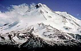 | |
|---|---|---|
| Bodies of Water | ||
| Rivers | ||
| Incorporated Cities | ||
| Counties | ||
| Parks |
| |
Municipalities and communities of Siskiyou County, California, United States | ||
|---|---|---|
| Cities | 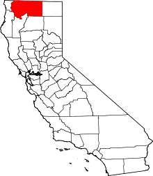 | |
| CDPs | ||
| Unincorporated communities | ||
| Indian reservation | ||
| Ghost towns | ||
| Footnotes | ‡This populated place also has portions in an adjacent county or counties | |