Hinksland
 Hinksland | |
| Geography | |
|---|---|
| Location | East Greenland |
| Coordinates | 71°43′N 28°19′W / 71.717°N 28.317°WCoordinates: 71°43′N 28°19′W / 71.717°N 28.317°W |
| Adjacent bodies of water |
Nordvestfjord Flyver Fjord |
| Length | 64 km (39.8 mi) |
| Width | 41 km (25.5 mi) |
| Highest elevation | 2,316 m (7,598 ft) |
| Highest point | Hinksland HP |
| Administration | |
|
Greenland (Denmark) | |
| Zone | Northeast Greenland National Park |
Hinksland (Danish: Hinksland) is a peninsula in eastern Greenland. It is a part of the Northeast Greenland National Park.
The peninsula is named after Arthur R. Hinks, Secretary of the Royal Geographical Society, 1915–45.
Geography
Hinksland is limited to the northwest by the Daugaard-Jensen Glacier, to the northeast by the Nordvestfjord of the Scoresby Sound and to the south by the 2 km wide Flyver Fjord. To the southwest the peninsula is attached to the mainland. The Renland peninsula lies to the southeast.[1] The highest point of the peninsula is a 700 metres (2,297 feet) high mountain located in the southern part rising above the Flyver Fjord.[2]
Geologically Hinksland is part of the Vestfjord-Hinksland gneiss and schist zone crystalline complex.[3]
Hinksland is at the southern limit of the eastern coastal area of the Northeast Greenland National Park. Constable Point (Nerlerit Inaat) is the closest airport.
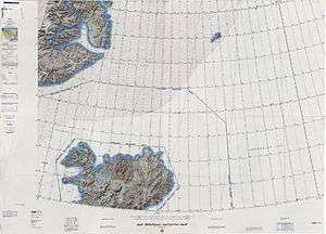 Map of NE Greenland and Iceland. |
See also
References
- ↑ "HInksland". Mapcarta. Retrieved 17 April 2016.
- ↑ Glacial outburst floods at Renland, Greenland?
- ↑ Harold Williams ed. Geology of the Appalachian—Caledonian Orogen in Canada and Greenland, p. 898
External links
- A Review of Muskox Observations from North and Northeast Greenland
- Greenland place names and spelling, by T. Higgins