Hillsdale, Michigan
| Hillsdale, Michigan | |
|---|---|
| City | |
|
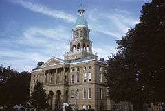
Hillsdale County Courthouse | |
| Nickname(s): The Dale | |
| Motto: It's the College | |
 Location of Hillsdale, Michigan | |
| Coordinates: 41°55′10″N 84°38′00″W / 41.91944°N 84.63333°WCoordinates: 41°55′10″N 84°38′00″W / 41.91944°N 84.63333°W | |
| Country | United States |
| State | Michigan |
| County | Hillsdale |
| Area[1] | |
| • Total | 6.19 sq mi (16.03 km2) |
| • Land | 5.92 sq mi (15.33 km2) |
| • Water | 0.27 sq mi (0.70 km2) |
| Elevation | 1,119 ft (341 m) |
| Population (2010)[2] | |
| • Total | 8,305 |
| • Estimate (2012[3]) | 8,211 |
| • Density | 1,402.9/sq mi (541.7/km2) |
| Time zone | Eastern (EST) (UTC-5) |
| • Summer (DST) | EDT (UTC-4) |
| ZIP code | 49242 |
| Area code(s) | 517 |
| FIPS code | 26-38460[4] |
| GNIS feature ID | 0628321[5] |
| Website | http://www.cityofhillsdale.org |
Hillsdale is a city in the state of Michigan. As of the 2010 census, the city population was 8,305. It is the county seat of Hillsdale County,[6] and is run as a council-manager government. The city is the home of Hillsdale College, a private liberal arts college noted for its academics and its influence in politics and education.
The city is situated mostly within Hillsdale Township, but is a municipality governed independently of the township.
Nearby communities include: Allen, Bankers, Cambria, Camden, Frontier, Jerome, Jonesville, Litchfield, Montgomery, Moscow, Mosherville, North Adams, Osseo, Pittsford, Prattville, Ransom, Reading, and Waldron.
Geography and Climate
According to the United States Census Bureau, the city has a total area of 6.19 square miles (16.03 km2), of which, 5.92 square miles (15.33 km2) is land and 0.27 square miles (0.70 km2) is water.[1]
The Saint Joe river begins in Hillsdale, near Lake Baw Beese, a major body of water in this city, around which is situated several parks and a beach.
Climate
| Climate data for Hillsdale, MI 41°55′12″N 84°37′50″W / 41.92000°N 84.63056°W, 1981–2010 normals | |||||||||||||
|---|---|---|---|---|---|---|---|---|---|---|---|---|---|
| Month | Jan | Feb | Mar | Apr | May | Jun | Jul | Aug | Sep | Oct | Nov | Dec | Year |
| Average high °F (°C) | 30.0 (−1.1) |
34.0 (1.1) |
44.0 (6.7) |
58.0 (14.4) |
69.0 (20.6) |
78.0 (25.6) |
82.0 (27.8) |
80.0 (26.7) |
73.0 (22.8) |
60.0 (15.6) |
47.0 (8.3) |
34.0 (1.1) |
57.4 (14.1) |
| Average low °F (°C) | 15.0 (−9.4) |
16.0 (−8.9) |
24.0 (−4.4) |
35.0 (1.7) |
46.0 (7.8) |
56.0 (13.3) |
59.0 (15) |
57.0 (13.9) |
49.0 (9.4) |
39.0 (3.9) |
30.0 (−1.1) |
20.0 (−6.7) |
37.2 (2.9) |
| Average rainfall inches (mm) | 2.36 (59.9) |
1.97 (50) |
2.32 (58.9) |
3.31 (84.1) |
4.13 (104.9) |
3.90 (99.1) |
3.78 (96) |
3.82 (97) |
3.78 (96) |
3.15 (80) |
3.07 (78) |
2.32 (58.9) |
37.91 (962.8) |
| Source: "U.S. Climate Data"[7] | |||||||||||||
History
In 1834 the first settler of Hillsdale, Jeremiah Arnold, erected a cabin and settled there with his wife Percy Round Arnold. In 1838 the first schoolhouse was erected. The City was established in 1839 and chartered in 1869, located in the rolling, fertile hills of South Central Michigan, bordering Indiana and Ohio.[8] Hillsdale College, founded in 1844, relocated to the city of Hillsdale in 1853. It was the first American college to prohibit in its charter any discrimination based on race, religion or sex, and became an early force for the abolition of slavery. It was also only the second college in the nation to grant four-year liberal arts degrees to women.[9] In 1885 a high school building was dedicated on what is now West Street which now is the middle school. In the late 1800s, Hillsdale was a booming railroad town, but this came to an end when the last passenger train left Hillsdale in 1956. Dozens of beautiful Victorian homes, many of which are still occupied as private residences, line its streets. In 1908 the city opened its first public library. In 1921 it opened its first hospital and in 1934 Hillsdale Municipal Airport opened.[10]
Transportation
Highways
Hillsdale has one major roadway passing through it, Michigan highway 99 (![]() M-99). It passes through both the historic downtown as well as the newer business strip. Highway 99 connects to Highway 12 just over a mile north of Hillsdale.
M-99). It passes through both the historic downtown as well as the newer business strip. Highway 99 connects to Highway 12 just over a mile north of Hillsdale.
Airports
Hillsdale Municipal Airport (KJYM) established in 1934, has a 5000' paved lighted runway with instrument approaches, hangars, tie-downs, and fuel services available.
Railroad
Although passenger trains no longer frequent the railway, the railway is still used for commercial purposes and is occasionally used by the Little River Railroad.
Demographics
| Historical population | |||
|---|---|---|---|
| Census | Pop. | %± | |
| 1850 | 1,067 | — | |
| 1860 | 2,177 | 104.0% | |
| 1870 | 3,518 | 61.6% | |
| 1880 | 3,441 | −2.2% | |
| 1890 | 3,915 | 13.8% | |
| 1900 | 4,151 | 6.0% | |
| 1910 | 5,001 | 20.5% | |
| 1920 | 5,476 | 9.5% | |
| 1930 | 5,896 | 7.7% | |
| 1940 | 6,381 | 8.2% | |
| 1950 | 7,297 | 14.4% | |
| 1960 | 7,629 | 4.5% | |
| 1970 | 7,728 | 1.3% | |
| 1980 | 7,432 | −3.8% | |
| 1990 | 8,170 | 9.9% | |
| 2000 | 8,233 | 0.8% | |
| 2010 | 8,305 | 0.9% | |
| Est. 2015 | 8,163 | [11] | −1.7% |
2010 census
As of the census[2] of 2010, there were 8,305 people, 2,970 households, and 1,686 families residing in the city. The population density was 1,402.9 inhabitants per square mile (541.7/km2). There were 3,383 housing units at an average density of 571.5 per square mile (220.7/km2). The racial makeup of the city was 95.8% White, 0.7% African American, 0.4% Native American, 0.7% Asian, 0.3% from other races, and 2.0% from two or more races. Hispanic or Latino of any race were 2.3% of the population.
There were 2,970 households of which 31.0% had children under the age of 18 living with them, 37.7% were married couples living together, 14.3% had a female householder with no husband present, 4.7% had a male householder with no wife present, and 43.2% were non-families. 36.4% of all households were made up of individuals and 14.6% had someone living alone who was 65 years of age or older. The average household size was 2.35 and the average family size was 3.03.
The median age in the city was 30.2 years. 22.1% of residents were under the age of 18; 21.9% were between the ages of 18 and 24; 21.9% were from 25 to 44; 20.5% were from 45 to 64; and 13.6% were 65 years of age or older. The gender makeup of the city was 47.0% male and 53.0% female.
2000 census
As of the census[4] of 2000, there were 8,233 people, 3,067 households, and 1,781 families residing in the city. The population density was 1,548.2 per square mile (597.5/km²). There were 3,274 housing units at an average density of 615.7 per square mile (237.6/km²). The racial makeup of the city was 96.53% White, 0.60% African American, 0.50% Native American, 0.83% Asian, 0.01% Pacific Islander, 0.49% from other races, and 1.06% from two or more races. Hispanic or Latino of any race were 1.53% of the population.
There were 3,067 households out of which 30.2% had children under the age of 18 living with them, 41.5% were married couples living together, 12.6% had a female householder with no husband present, and 41.9% were non-families. 34.6% of all households were made up of individuals and 13.6% had someone living alone who was 65 years of age or older. The average household size was 2.33 and the average family size was 3.01.
In the city the population was spread out with 22.5% under the age of 18, 21.3% from 18 to 24, 24.7% from 25 to 44, 17.4% from 45 to 64, and 14.1% who were 65 years of age or older. The median age was 30 years. For every 100 females there were 87.6 males. For every 100 females age 18 and over, there were 83.7 males.
The median income for a household in the city was $34,695, and the median income for a family was $42,649. Males had a median income of $32,573 versus $22,707 for females. The per capita income for the city was $16,062. About 5.5% of families and 10.3% of the population were below the poverty line, including 10.1% of those under age 18 and 15.7% of those age 65 or over.
Points of interest
- Hillsdale College
- Hillsdale Academy
- Hillsdale High School
- Slayton Arboretum
- Hillsdale Municipal Airport
- Michindoh Conference Center
Media
- WPCJ 91.1 FM
- WCSR 92.1 FM / 1340 AM
- WRFH 101.7 FM
- Hillsdale Daily News – newspaper
- The Collegian- student paper for Hillsdale College
There are no television stations broadcasting from within the county; Hillsdale County gets its television signals from the Lansing-Jackson, Toledo-Port Clinton-Lake Erie Islands, Kalamazoo-Battle Creek-Grand Rapids, and Detroit-Windsor SMSAs.
Notable people
- Baw Beese, Potawatomi chief
- Will Carleton, reporter, American poet
- William W. Cook, legal scholar and benefactor of the University of Michigan Law School
- Dick Estell, host and producer of The Radio Reader
- Tonya Kay, actress/dancer/performance artist
- Henry Churchill King, theologian, president of Oberlin College (1902–1927)
- John Corbett O'Meara United States District Court judge
- Jason Robards, Sr., actor
- Michael Sessions, youngest mayor elected
- Penny Neer, collegiate and Olympic athlete
- Sile Doty, thief, robber and burglar
- Lee Bartlett, three-time Olympian
- Charles Doolittle, Civil War General
- Henry Waldron
- McKenna Thayer, University of Michigan Marching Band Drum Major 2016
Climate
This climatic region is typified by large seasonal temperature differences, with warm to hot (and often humid) summers and cold (sometimes severely cold) winters. According to the Köppen Climate Classification system, Hillsdale has a humid continental climate, abbreviated "Dfb" on climate maps.[13]
References
- 1 2 "US Gazetteer files 2010". United States Census Bureau. Archived from the original on January 24, 2012. Retrieved 2012-11-25.
- 1 2 "American FactFinder". United States Census Bureau. Retrieved 2012-11-25.
- ↑ "Population Estimates". United States Census Bureau. Archived from the original on June 17, 2013. Retrieved 2013-06-03.
- 1 2 "American FactFinder". United States Census Bureau. Retrieved 2008-01-31.
- ↑ "US Board on Geographic Names". United States Geological Survey. 2007-10-25. Retrieved 2008-01-31.
- ↑ "Find a County". National Association of Counties. Archived from the original on May 31, 2011. Retrieved 2011-06-07.
- ↑ "Climate Hillsdale - Michigan". usclimatedata.com. Retrieved March 23, 2016.
- ↑ "The City of Hillsdale, Michigan". cityofhillsdale.org.
- ↑ "About/History – Hillsdale College". hillsdale.edu.
- ↑ City of Hillsdale history
- ↑ "Annual Estimates of the Resident Population for Incorporated Places: April 1, 2010 to July 1, 2015". Retrieved July 2, 2016.
- ↑ "Census of Population and Housing". Census.gov. Archived from the original on May 11, 2015. Retrieved June 4, 2015.
- ↑ "Hillsdale, Michigan Köppen Climate Classification (Weatherbase)". Weatherbase.
External links
| Wikimedia Commons has media related to Hillsdale, Michigan. |
Municipalities and communities of Hillsdale County, Michigan, United States | ||
|---|---|---|
| Cities | 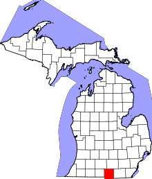 | |
| Villages | ||
| Townships | ||