Highland Township, Greene County, Indiana
| Highland Township | |
|---|---|
| Township | |
|
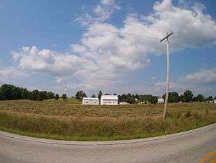
Countryside in Highland Township | |
 Location in Greene County | |
| Coordinates: 39°07′17″N 86°53′13″W / 39.12139°N 86.88694°WCoordinates: 39°07′17″N 86°53′13″W / 39.12139°N 86.88694°W | |
| Country | United States |
| State | Indiana |
| County | Greene |
| Government | |
| • Type | Indiana township |
| Area | |
| • Total | 32.69 sq mi (84.7 km2) |
| • Land | 32.47 sq mi (84.1 km2) |
| • Water | 0.22 sq mi (0.6 km2) 0.67% |
| Elevation | 545 ft (166 m) |
| Population (2010) | |
| • Total | 718 |
| • Density | 22.1/sq mi (8.5/km2) |
| GNIS feature ID | 0453411 |
Highland Township is one of fifteen townships in Greene County, Indiana, USA. As of the 2010 census, its population was 718.[1]
| Historical population | |||
|---|---|---|---|
| Census | Pop. | %± | |
| 2000 | 655 | — | |
| 2010 | 718 | 9.6% | |
| Source: US Census Bureau | |||
Geography
According to the 2010 census, the township has a total area of 32.69 square miles (84.7 km2), of which 32.47 square miles (84.1 km2) (or 99.33%) is land and 0.22 square miles (0.57 km2) (or 0.67%) is water.[1] The streams of Camp Creek, Clark Creek, Dead Horse Branch, Goose Creek, Jim Creek and Kelly Branch run through this township.
Unincorporated towns
(This list is based on USGS data and may include former settlements.)
Adjacent townships
- Franklin Township, Owen County (north)
- Beech Creek Township (east)
- Richland Township (south)
- Fairplay Township (southwest)
- Jefferson Township (west)
Cemeteries
The township contains nine cemeteries: Bucher, Calvertville, Goodwin, Kelley, Owens, Snyder, Stalcup, Wall and Walnut Grove.
Major highways
References
- "Highland Township, Greene County, Indiana". Geographic Names Information System. United States Geological Survey. Retrieved 2009-09-24.
- United States Census Bureau cartographic boundary files
- 1 2 "Population, Housing Units, Area, and Density: 2010 - County -- County Subdivision and Place -- 2010 Census Summary File 1". United States Census. Retrieved 2013-05-10.
External links
Municipalities and communities of Greene County, Indiana, United States | ||
|---|---|---|
| Cities | ||
| Towns | ||
| Townships | ||
| CDPs | ||
| Other unincorporated communities |
| |
| Footnotes | ‡This populated place also has portions in an adjacent county or counties | |
This article is issued from Wikipedia - version of the 7/4/2016. The text is available under the Creative Commons Attribution/Share Alike but additional terms may apply for the media files.