Higher Kinnerton
| Higher Kinnerton | |
 Main Road |
|
 Higher Kinnerton |
|
| Population | 1,697 (2011)[1] |
|---|---|
| OS grid reference | SJ328613 |
| Principal area | Flintshire |
| Ceremonial county | Flintshire |
| Country | Wales |
| Sovereign state | United Kingdom |
| Post town | CHESTER |
| Postcode district | CH4 |
| Dialling code | 01244 |
| Police | North Wales |
| Fire | North Wales |
| Ambulance | Welsh |
| EU Parliament | Wales |
| UK Parliament | Alyn and Deeside |
| Welsh Assembly | Alyn and Deeside |
|
|
Coordinates: 53°08′43″N 3°00′18″W / 53.14515°N 3.00513°W
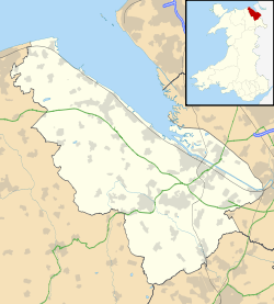
Higher Kinnerton is a residential village within rural Flintshire, Wales. The area is an electoral ward for Flintshire County Council close to the English Border. Its sister village, Lower Kinnerton is on the other side of the border in Cheshire, England.
Education
The village has a primary school, Ysgol Derwen School. The local secondary school is Castell Alun High School, located in Hope.
Amenities
The village has a post office, a shop, and two public houses, The Swan and The Royal Oak. The parish church is All Saints, which is actually in the parish of Dodleston, England. There is a scout group called 1st Kinnerton Scouts. There is also a Village Hall which hosts various community clubs & events. There is a primary school 5-11 Ysgol Derwen. The nearest 11-18 schools are Castell Alun in Hope & Hawarden High School in Hawarden.
The village has a progressive community council which supports village activities. The village was awarded Best Kept Village status in 2012 and again in 2014.
See also
References
- ↑ "Community/Ward population 2011". Retrieved 26 May 2015.
External links
| Wikimedia Commons has media related to Higher Kinnerton. |