High Wood, Dunmow
| Site of Special Scientific Interest | |
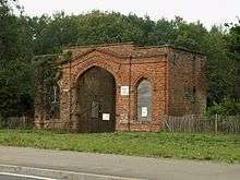 The ruined gatehouse to High Wood | |
| Area of Search | Essex |
|---|---|
| Grid reference | TL 603220 |
| Interest | Biological |
| Area | 41.5 hectares |
| Notification | 1986 |
| Location map | Magic Map |
High Wood, Dunmow is a 41.5 hectare biological Site of Special Scientific Interest in Great Dunmow in Essex. The local planning authority is Uttlesford District Council.[1][2]
The site on boulder clay and loess has areas of wet ash and maple woodland, and others of pedunculate oak and hornbeam. Some areas are ancient woodland. There is a diverse layer of ground flora, such as dog's mercury and primrose, while damp woodland rides provide additional habitat for birds and invertebrates.[1]
The site is private land with no public access.
References
- 1 2 "High Wood, Dunmow citation" (PDF). Sites of Special Scientific Interest. Natural England. Retrieved 2 August 2016.
- ↑ "Map of High Wood, Dunmow". Sites of Special Scientific Interest. Natural England. Retrieved 2 August 2016.
Coordinates: 51°52′23″N 0°19′37″E / 51.873°N 0.327°E
This article is issued from Wikipedia - version of the 8/2/2016. The text is available under the Creative Commons Attribution/Share Alike but additional terms may apply for the media files.