Hi Vista, California
| Hi Vista, California | |
|---|---|
| Unincorporated community | |
 Hi Vista, California | |
| Coordinates: 34°44′06″N 117°46′38″W / 34.73500°N 117.77722°WCoordinates: 34°44′06″N 117°46′38″W / 34.73500°N 117.77722°W | |
| Country |
|
| State |
|
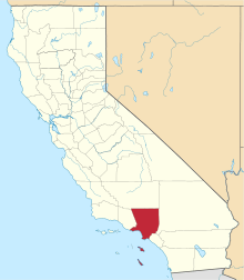
| County | Los Angeles |
| Elevation | 933 m (3,061 ft) |
| Time zone | Pacific (PST) (UTC-8) |
| • Summer (DST) | PDT (UTC-7) |
| Area code(s) | 661 |
| GNIS feature ID | 1660742[1] |
Hi Vista is an unincorporated community in northeastern Los Angeles County, California, United States. Unlike most of the Los Angeles area, Hi Vista is a quite rural and mostly undeveloped community with a total population of 1,046 people, as of July 01, 2015. Hi Vista is sometimes confused with being Lancaster because both communities use the same zip code of 93535.
Geography
Hi Vista is located in the Antelope Valley, in the southwestern part of the Mojave Desert. This area is referred to as the "High Desert"due to its altitude. The community is surrounded by Edwards Air Force Base, 22 miles to the north in Kern County, Adelanto, 31 miles to the east in San Bernardino County, Lake Los Angeles, 11 miles to the south, and Lancaster, 21 miles to the west.
Parks and recreation

Hi Vista is home to Saddleback Butte State Park, Butte Valley Wildflower Sanctuary, Phacelia Wildlife Sanctuary, and the "Kill Bill" church.
Education
Local students now attend Eastside High School in Lancaster, instead of Littlerock, which was over 30 miles away.