Herzliya Airport
| Herzliya airport שדה התעופה הרצליה مطار هرتسيليا | |||||||||||
|---|---|---|---|---|---|---|---|---|---|---|---|
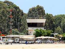 Herzliya airport tower | |||||||||||
| IATA: HRZ – ICAO: LLHZ | |||||||||||
| Summary | |||||||||||
| Airport type | Public | ||||||||||
| Operator | Israeli Airports Authority | ||||||||||
| Location | Herzliya | ||||||||||
| Elevation AMSL | 121 ft / 37 m | ||||||||||
| Coordinates | 32°10′49.03″N 34°50′02.34″E / 32.1802861°N 34.8339833°ECoordinates: 32°10′49.03″N 34°50′02.34″E / 32.1802861°N 34.8339833°E | ||||||||||
| Runways | |||||||||||
| |||||||||||
Herzliya Airport (Hebrew: שְׂדֵה הַתְּעוּפָה הֶרְצְלִיָּה, Arabic: مطار هرتسيليا) (IATA: HRZ, ICAO: LLHZ) is an airport located in the city of Herzliya in central Israel. The airport is mainly used by flight schools and for general aviation. It has no terminal.
Herzilya was used by the Israeli Air Force's 101 "First Fighter" Squadron as a temporary base from June to October 1948.
In early 2008, a new safety system was installed at the airfield.[1] Plans by the Israel Airports Authority and civil aviation managers to expand the airfield southward by 100 dunams (10 hectares) were rejected. Conversely, former Herzliya Mayor Yael German advocated for a complete shut-down of the airport, arguing that its use endangers the local residents. She proposed the land be redeveloped to accommodate the city's growing demand for residential space.[2] The airport was slated to be closed down in April 2015, but was given a six-month extension. It was reported that Haifa Airport was proposed to replace Herzliya Airport, and Herzliya was thus designated a temporary landing strip until a conclusive government decision is made.[3]

In December 2015, it was announced that the airport would make way for new residential and industrial space.[4]
References
- ↑ http://www.iaa.gov.il/Rashat/en-US/Rashot/Messages/SpokesMan/Spokesman_En_160308.htm
- ↑ http://fr.jpost.com/servlet/Satellite?cid=1235898313690&pagename=JPost%2FJPArticle%2FPrinter
- ↑ http://www.themarker.com/consumer/tourism/1.1844643
- ↑ http://www.globes.co.il/en/article-herzliya-airport-to-make-way-for-residential-development-1001085466
External links
| Airports |
| ||||||||||
|---|---|---|---|---|---|---|---|---|---|---|---|
| Border terminals |
| ||||||||||
| Defunct or former properties | |||||||||||