Herringfleet
| Herringfleet | |
 Herringfleet St. Margaret |
|
 Herringfleet |
|
| Shire county | Suffolk |
|---|---|
| Region | East |
| Country | England |
| Sovereign state | United Kingdom |
| Post town | Lowestoft |
| Postcode district | NR32 |
| EU Parliament | East of England |
Coordinates: 52°31′01″N 1°39′00″E / 52.517°N 1.65°E
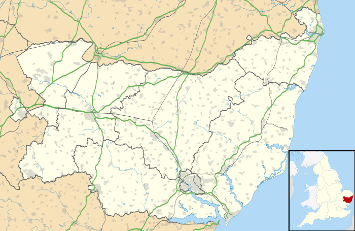
Herringfleet is a small village on the River Waveney, between Somerleyton and St. Olaves in Suffolk, England within The Broads National Park. The population of the village is included in the civil parish of Somerleyton, Ashby and Herringfleet.
Herringfleet was occupied by the Roman Empire, and archaeologists have made a number of finds, including a Roman bronze 'patera', a 'soup ladle' vessel with the maker's name 'Quattenus' on the handle, and a Roman nether mill-stone of trachyte, originally imported from Saxony or Koblenz on the Rhine.
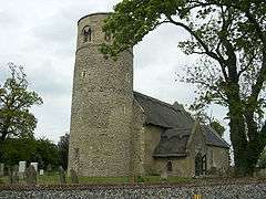
In the Middle Ages, Herringfleet was governed by the St Olaves Priory. Herringfleet is known for its Norman church, built in several parts over the past millennia. Its round tower is indicative of many East Anglian churches dating from the period. The church includes a nave and chancel. The whole edifice is of Norman architecture, though considerable alterations have been made. The tower retains most of its original features, and has in the upper story wide windows of two lights, which are triangular-headed.[1]
Herringfleet Mill is a timber smock drainpipe windpump in full working order. There is also evidence of a Saxon manor house on the site of the present-day Manor Farm.
References
- ↑ England (1855). The ecclesiastical and architectural topography of England. Bedfordshire (Berkshire, Buckinghamshire, Cambridgeshire, Huntingdonshire, Oxfordshire, Suffolk). (Public domain ed.). pp. 122–. Retrieved 3 December 2011.
External links
| Wikimedia Commons has media related to Herringfleet. |