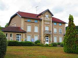
Herbeuville
| Herbeuville | |
|---|---|
 | |
 Herbeuville | |
|
Location within Grand Est region  Herbeuville | |
| Coordinates: 49°02′47″N 5°38′15″E / 49.0464°N 5.6375°ECoordinates: 49°02′47″N 5°38′15″E / 49.0464°N 5.6375°E | |
| Country | France |
| Region | Grand Est |
| Department | Meuse |
| Arrondissement | Arrondissement of Verdun |
| Canton | Canton of Fresnes-en-Woëvre |
| Intercommunality | Communauté de communes du Canton de Fresnes en Woëvre |
| Government | |
| • Mayor (2008–2014) | Jean-Claude Faou |
| Area1 | 6.71 km2 (2.59 sq mi) |
| Population (1999)2 | 148 |
| • Density | 22/km2 (57/sq mi) |
| Time zone | CET (UTC+1) |
| • Summer (DST) | CEST (UTC+2) |
| INSEE/Postal code | 55243 / 55210 |
| Elevation |
221–392 m (725–1,286 ft) (avg. 318 m or 1,043 ft) |
|
1 French Land Register data, which excludes lakes, ponds, glaciers > 1 km² (0.386 sq mi or 247 acres) and river estuaries. 2 Population without double counting: residents of multiple communes (e.g., students and military personnel) only counted once. | |
Herbeuville is a commune in the Meuse department in Grand Est in north-eastern France.
See also
| Wikimedia Commons has media related to Herbeuville. |
This article is issued from Wikipedia - version of the 11/6/2016. The text is available under the Creative Commons Attribution/Share Alike but additional terms may apply for the media files.