Hempfield Township, Mercer County, Pennsylvania
| Hempfield Township, Mercer County, Pennsylvania | |
|---|---|
| Township | |
 Location of Hempfield Township in Mercer County | |
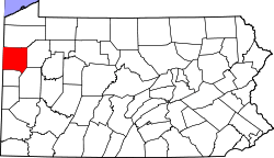 Location of Mercer County in Pennsylvania | |
| Country | United States |
| State | Pennsylvania |
| County | Mercer County |
| Area | |
| • Total | 14.2 sq mi (37 km2) |
| • Land | 14.1 sq mi (37 km2) |
| • Water | 0.1 sq mi (0.3 km2) |
| Population (2000) | |
| • Total | 4,004 |
| • Density | 280/sq mi (110/km2) |
| Time zone | EST (UTC-4) |
| • Summer (DST) | EDT (UTC-5) |
| Area code(s) | 724 |
Hempfield Township is a township in Mercer County, Pennsylvania, United States. The population was 4,004 at the 2000 census.
History
The Quaker Bridge was listed on the National Register of Historic Places in 1988.[1]
Geography
According to the United States Census Bureau, the township has a total area of 14.2 square miles (37 km2), of which, 14.1 square miles (37 km2) of it is land and 0.04 square miles (0.10 km2) of it (0.28%) is water.
Demographics
As of the census[2] of 2000, there were 4,004 people, 1,590 households, and 1,160 families residing in the township. The population density was 283.0 people per square mile (109.3/km2). There were 1,646 housing units at an average density of 116.3/sq mi (44.9/km2). The racial makeup of the township was 98.70% White, 0.27% African American, 0.07% Native American, 0.50% Asian, 0.02% from other races, and 0.42% from two or more races. Hispanic or Latino of any race were 0.37% of the population.
There were 1,590 households, out of which 27.9% had children under the age of 18 living with them, 64.2% were married couples living together, 6.0% had a female householder with no husband present, and 27.0% were non-families. 24.3% of all households were made up of individuals, and 14.4% had someone living alone who was 65 years of age or older. The average household size was 2.41 and the average family size was 2.85.
In the township the population was spread out, with 21.5% under the age of 18, 5.1% from 18 to 24, 22.3% from 25 to 44, 26.0% from 45 to 64, and 25.1% who were 65 years of age or older. The median age was 46 years. For every 100 females there were 92.3 males. For every 100 females age 18 and over, there were 87.1 males.
The median income for a household in the township was $38,396, and the median income for a family was $47,008. Males had a median income of $35,183 versus $21,615 for females. The per capita income for the township was $20,169. About 4.6% of families and 7.8% of the population were below the poverty line, including 8.7% of those under age 18 and 7.5% of those age 65 or over.
References
- ↑ National Park Service (2010-07-09). "National Register Information System". National Register of Historic Places. National Park Service.
- ↑ "American FactFinder". United States Census Bureau. Retrieved 2008-01-31.
Coordinates: 41°25′00″N 80°22′35″W / 41.41667°N 80.37639°W