Helen, West Virginia
| Helen, West Virginia | |
|---|---|
| Census-designated place (CDP) | |
 Helen, West Virginia | |
| Coordinates: 37°38′5″N 81°18′50″W / 37.63472°N 81.31389°WCoordinates: 37°38′5″N 81°18′50″W / 37.63472°N 81.31389°W | |
| Country | United States |
| State | West Virginia |
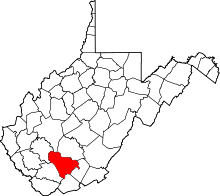
| County | Raleigh |
| Area[1] | |
| • Total | 0.238 sq mi (0.62 km2) |
| • Land | 0.238 sq mi (0.62 km2) |
| • Water | 0 sq mi (0 km2) |
| Elevation | 1,630.9 ft (497.1 m) |
| Population (2010)[2] | |
| • Total | 219 |
| • Density | 920/sq mi (360/km2) |
| Time zone | Eastern (EST) (UTC-5) |
| • Summer (DST) | CDT (UTC-4) |
| ZIP codes | 25853 |
Helen is a census-designated place (CDP) in Raleigh County, West Virginia, United States. As of the 2010 census, its population was 219.[2] West Virginia Route 16, Winding Gulf and railroad tracks run right through the community.[3]
The Helen mine and coal camp was opened in the 1910s by the East Gulf Coal Company. Many years later, the mine was operated by the Koppers Coal company, which then became the Eastern Gas & Fuel - Coal Division, and even later Eastern Associated Coal Company. Eastern Associated operated the Helen mine into the 1980s.
Today, Helen remains a small, unincorporated area in southern West Virginia. There is a Protestant church there.
References
- ↑ "US Gazetteer files: 2010, 2000, and 1990". United States Census Bureau. 2011-02-12. Retrieved 2011-04-23.
- 1 2 "American FactFinder". United States Census Bureau. Retrieved 2011-05-14.
- ↑ Raleigh County, West Virginia General Highway Map (PDF) (Map). West Virginia Department of Transportation. 2011. p. 3. Retrieved December 12, 2011.
This article is issued from Wikipedia - version of the 9/5/2016. The text is available under the Creative Commons Attribution/Share Alike but additional terms may apply for the media files.