Heřmaň (České Budějovice District)
| Heřmaň | |
| Village | |
| Country | Czech Republic |
|---|---|
| Region | South Bohemian |
| District | České Budějovice |
| Commune | České Budějovice |
| Municipality | Heřmaň |
| Elevation | 472 m (1,549 ft) |
| Coordinates | CZ 48°54′34″N 14°30′18″E / 48.90944°N 14.50500°ECoordinates: CZ 48°54′34″N 14°30′18″E / 48.90944°N 14.50500°E |
| Area | 2.17 km2 (0.84 sq mi) |
| Population | 157 (2006) |
| Density | 72/km2 (186/sq mi) |
| Founded | 1787 |
| Mayor | Ing. Václav Pexa |
| Timezone | CET (UTC+1) |
| - summer (DST) | CEST (UTC+2) |
| Postal code | 370 07 |
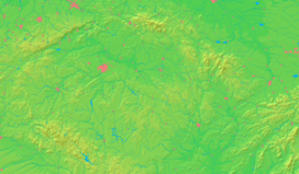  Location in the Czech Republic | |
| Wikimedia Commons: Heřmaň (České Budějovice District) | |
| Statistics: | |
| Website: www.obec-herman.cz | |
Heřmaň (Czech pronunciation: [ˈɦɛr̝maɲ]) German: Hermansdorf) is a small village in the South Bohemian Region of the Czech Republic. It has cca 157 inhabitants.
Historie
The first written mention about settlement in this point is from 1400, the village was established in 1787.
More...: Czech Wikipedia Site
External links
| Wikimedia Commons has media related to Heřmaň (České Budějovice District). |
- Municipal website (in Czech)
This article is issued from Wikipedia - version of the 4/4/2016. The text is available under the Creative Commons Attribution/Share Alike but additional terms may apply for the media files.