Haypoint, Minnesota
| Haypoint, Minnesota | |
|---|---|
| Unincorporated community | |
 Haypoint, Minnesota  Haypoint, Minnesota Location of the community of Haypoint | |
| Coordinates: 46°53′59″N 93°36′50″W / 46.89972°N 93.61389°WCoordinates: 46°53′59″N 93°36′50″W / 46.89972°N 93.61389°W | |
| Country | United States |
| State | Minnesota |
| County | Aitkin |
| Township | Macville Township |
| Elevation | 1,270 ft (390 m) |
| Time zone | Central (CST) (UTC-6) |
| • Summer (DST) | CDT (UTC-5) |
| ZIP code | 55748 |
| Area code(s) | 218 |
| GNIS feature ID | 654747[1] |
Haypoint is an unincorporated community in Macville Township, Aitkin County, Minnesota, United States, within the Hill River State Forest. The community is located along U.S. Highway 169 near the junction with Aitkin County Road 7, 610th Street. Nearby places include Hill City, Swatara, and Waukenabo. The Willow River, a tributary of the Mississippi River, flows through the community. The Moose River is also nearby.
References
Municipalities and communities of Aitkin County, Minnesota, United States | ||
|---|---|---|
| Cities | 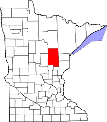 | |
| Townships |
| |
| Unorganized territories | ||
| Unincorporated communities | ||
| Indian reservations | ||
| Footnotes | ‡This populated place also has portions in an adjacent county or counties | |
This article is issued from Wikipedia - version of the 7/28/2016. The text is available under the Creative Commons Attribution/Share Alike but additional terms may apply for the media files.