Hayatabad

Phase 3 Chowk, Hayatabad.
Bagh e Naran Chowk
Hayatabad is a modern suburb on the south-western fringe of Peshawar, the capital of the Khyber Pakhtunkhwa, Pakistan. It was named after Hayat Sherpao, former Governor of Khyber Pakhtunkhwa and a notable leader of Pakistan Peoples Party. It is close to the Khyber Agency[1] which leads to Khyber Pass, a prominent route through the Hindu Kush mountains to Landi Kotal, the highest point of the pass, and the Afghan border.
Geographical features
Hayatabad developed as a residential area in Peshawar in the late 1970s. Primarily known to be used for residential purposed, but it is also been used by various industries comprising "industrial estate". It has been divided into seven phases while each phase consists of sectors. The town can be accessed via three routes from Jamrud Road and one from the Ring road. A fifth route has also been there but it was sealed for the security reasons arising from War on Terror, due to its boundary with the tribal area. Hayatabad has been divided into 7 phases. Each phase is several divided into sectors.

View of CECOS University from F5 Park
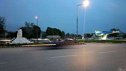
Phase 3 Chowk Hayatabad

Zarghuni Mosque

Phase 6, Hayatabad

Bagh e Naran

Under construction Food Street, Hayatabad

View of Shalman park and St. Francis High School
People and culture
The communities of Hayatabad form a diverse spectrum ranging from locals settled for generations to expatriates on temporary assignments belonging to different ethnicities and cultural backgrounds. Owing to its proximity to Peshawar and the adjoined Industrial Estate, Pashtuns, Urdu Speakers, Persian and Hindko speakers as well as Afghan refugees are the main residents of Hayatabad.
Facilities
Peshawar Development Authority (PDA) is responsible for maintenance and development of the township. There are several different schools, colleges, a national University, public and private hospitals, private clinics, public parks, shopping malls, and offices to facilitate the residents.
Markets
- Zahid Market Phase 2
- Shumali Market Phase 1
- Basharat Market Phase 3
- Bakht Khan Market Phase 3
- Yusafzai Market Phase 3
- Super Market Phase 1
- Bilal Market Phase 1
- Khattak Market Phase 3
- Lala Zar Market Phase 1
- Shama Market Phase 1
- Abasin Market Phase 3
- Hamza Market Phase 3
- Afridi Market Phase 4
- People Market Phase 5
- Abdali Market Phase 4
- Tariq Market Phase 2
- Shalmaan Market Phase 2
- Shershah Market Phase 6
- Nawab Market Phase 6
- Bangash Market Phase 6
- Tatara Market Phase 5
- Arafat market Phase
- Turangzai market
- A.NAbi market
- Behram market Phase 7
- Roheela Market Phase 3
- Ibrahim market Phase 6
- Sher Khan Market Phase 7
- Malak Saad Market Phase 1
Important buildings
- Forward Model School (Phase 2)
- Pak International Medical College (phase 5)
- Peshawar Institute of Medical Sciences
- Allied Bank (Phase 7)
- Deans Heights (Phase 2)
- Qurtaba University (Phase 3)
- Shaukat Khanum Memorial Cancer Hospital & Research Centre (Phase 5)
- Rehman Medical Institute (Phase 5)
- North West General Hospital (Phase 5)
- Forward Public School
- Haji Camp (Phase 7)
- FAST National University, Peshawar Campus (Industrial Estate)
- IQRA National University (Phase 1)
- Peshawar Model Degree College (Hayatabad Branch)
- Peshawar Development Authority (Phase 5)
- Wadud Sons Store (Phase 5)
- Hayatabad Medical Complex (Phase 4)
- Community Center
- National Bank of Pakistan (Phase 5)
- Institute of Computer and Management Sciences (Phase 7)
- Zaid Bin Harsa Mosque
- Zarghooni Mosque (Phase 2)
- Hayatabad Sports Complex (Phase 1)
- Qurtuba public school and college (Phase 3)
- Frontier Children's Academy (Phase 4)
- Khyber Girls Medical College (Phase 5)
- CECOS University (Phase 6)
- Saint Francis High School (Phase 6)
- NADRA Office (Phase 5)
- Rehman Medical College (Phase 5)
- Institute of Physical Medicine and Rehabilitation (IPM&R)
- Khyber Medical University (Phase 5)
- Institute of Public Health and Social Sciences (IPH&SS)
- PIA Office (Phase 5)
- North West General Hospital (Phase 5)
- Hayatabad Model School (Phase 4)
- Horizon Model School
- FIA Building
- NAB Office(Phase 5)
- Passport Office (Phase 5)
- Beaconhouse School System Frontier Campus (Phase 6)
Paraplegic Centre Phase 4
Parks
- Complex Park (phase 4)
- Shaliman Park (Phase 6)
- Baagh-e-Naraan (Phase 1)
- Tataara Park (Phase 4)
- Khyber Park (Phase 1)
- Ghani Bagh (Phase 2)
- Bangash market park (Phase 6)
- Yousafzai park (Phase 3)
- Bahram Park (Phase 7)
References
External links
Coordinates: 33°59′10″N 71°27′25″E / 33.98611°N 71.45694°E / 33.98611; 71.45694
|
|---|
|
| Phase 1 | | Sector D |
- Bilal Market
- Super Market
|
|---|
| | Sector E |
- Lala Zar Market
- Hamza Market
- Shah-Mali Market
|
|---|
|
|---|
|
| Phase 2 | |
|---|
|
| Phase 3 | |
|---|
|
| Phase 4 | |
|---|
|
| Phase 5 | |
|---|
|
| Phase 6 | |
|---|
|
| Phase 7 | |
|---|
|
| Parks |
- Taataara Park
- Baagh-e-Naaran
- Shalman Park
- Khyber Park
- Ghani Park
|
|
|---|
|
|