Haugland, Lurøy
| Haugland | |
|---|---|
| Village | |
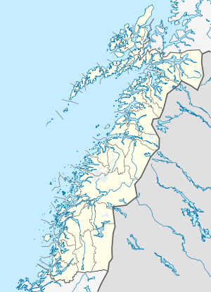 Haugland  Haugland Location in Nordland | |
| Coordinates: 66°23′05″N 13°06′24″E / 66.38472°N 13.10667°ECoordinates: 66°23′05″N 13°06′24″E / 66.38472°N 13.10667°E | |
| Country | Norway |
| Region | Northern Norway |
| County | Nordland |
| District | Helgeland |
| Municipality | Lurøy |
| Elevation[1] | 16 m (52 ft) |
| Time zone | CET (UTC+01:00) |
| • Summer (DST) | CEST (UTC+02:00) |
| Post Code | 8730 Bratland |
Haugland is a village in the municipality of Lurøy in Nordland county, Norway. The village is located on the mainland coast, along the Aldersundet strait between the mainland and Aldra island. Norwegian County Road 17 passes through the village. Aldersund Church is located in Haugland, and it serves the eastern part of the municipality.
References
- ↑ "Haugland" (in Norwegian). yr.no. Retrieved 2012-01-26.
This article is issued from Wikipedia - version of the 7/31/2016. The text is available under the Creative Commons Attribution/Share Alike but additional terms may apply for the media files.