Hatley, Mississippi
| Hatley, Mississippi | |
|---|---|
| Town | |
 Location of Hatley, Mississippi | |
 Hatley, Mississippi Location in the United States | |
| Coordinates: 33°58′47″N 88°25′34″W / 33.97972°N 88.42611°WCoordinates: 33°58′47″N 88°25′34″W / 33.97972°N 88.42611°W | |
| Country | United States |
| State | Mississippi |
| County | Monroe |
| Area | |
| • Total | 1.3 sq mi (3.5 km2) |
| • Land | 1.3 sq mi (3.5 km2) |
| • Water | 0.0 sq mi (0.0 km2) |
| Elevation | 351 ft (107 m) |
| Population (2010)[1] | |
| • Total | 482 |
| • Density | 370/sq mi (140/km2) |
| Time zone | Central (CST) (UTC-6) |
| • Summer (DST) | CDT (UTC-5) |
| ZIP code | 38821 |
| Area code(s) | 662 |
| FIPS code | 28-30980 |
| GNIS feature ID | 0671011 |
Hatley is a town in Monroe County, Mississippi. The population was 482 at the 2010 census.
Geography
Hatley is located at 33°58′36″N 88°25′14″W / 33.97667°N 88.42056°W east of Amory. According to the United States Geological Survey, a variant name is Tubbs Cross Roads.
When Hatley became a town it was on land owned by the Tubb family and named Tubb's Crossroads. Several years later a group of Seventh Day Adventist migrated into the area, took control of town government in subsequent elections and renamed it Hatley in honor of a minister in the church they left when they moved to the Hatley area.
According to the United States Census Bureau, the town has a total area of 1.3 square miles (3.4 km2), all land.
Demographics
| Historical population | |||
|---|---|---|---|
| Census | Pop. | %± | |
| 1970 | 385 | — | |
| 1980 | 497 | 29.1% | |
| 1990 | 529 | 6.4% | |
| 2000 | 476 | −10.0% | |
| 2010 | 482 | 1.3% | |
| Est. 2015 | 467 | [2] | −3.1% |
As of the 2010 United States Census, there were 482 people residing in the town. 99.4% were White, 0.2% Native American, 0.2% Pacific Islander and 0.2% of two or more races.
As of the census[4] of 2000, there were 476 people, 188 households, and 144 families residing in the town. The population density was 354.4 people per square mile (137.2/km²). There were 202 housing units at an average density of 150.4 per square mile (58.2/km²). The racial makeup of the town was 98.53% White, 1.26% African American and 0.21% Native American.
There were 188 households out of which 34.0% had children under the age of 18 living with them, 64.4% were married couples living together, 9.6% had a female householder with no husband present, and 23.4% were non-families. 22.3% of all households were made up of individuals and 9.6% had someone living alone who was 65 years of age or older. The average household size was 2.53 and the average family size was 2.98.
In the town the population was spread out with 24.4% under the age of 18, 7.6% from 18 to 24, 27.3% from 25 to 44, 25.4% from 45 to 64, and 15.3% who were 65 years of age or older. The median age was 40 years. For every 100 females there were 93.5 males. For every 100 females age 18 and over, there were 91.5 males.
The median income for a household in the town was $44,167, and the median income for a family was $51,667. Males had a median income of $32,813 versus $26,875 for females. The per capita income for the town was $17,726. About 8.7% of families and 10.8% of the population were below the poverty line, including 12.2% of those under age 18 and 14.3% of those age 65 or over.
Education
The Town of Hatley is served by the Monroe County School District.
References
- ↑ "2010 City Population and Housing Occupancy Status". U.S. Census Bureau. Retrieved May 14, 2012.
- ↑ "Annual Estimates of the Resident Population for Incorporated Places: April 1, 2010 to July 1, 2015". Retrieved July 2, 2016.
- ↑ "Census of Population and Housing". Census.gov. Retrieved June 4, 2015.
- ↑ "American FactFinder". United States Census Bureau. Retrieved 2008-01-31.
- "Hatley". Geographic Names Information System. United States Geological Survey. Retrieved 2006-04-17.
Municipalities and communities of Monroe County, Mississippi, United States | ||
|---|---|---|
| Cities | 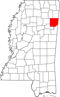 | |
| Towns | ||
| Village | ||
| CDPs | ||
| Other unincorporated communities | ||
| Ghost towns | ||
| Footnotes | ‡This town also has portions in adjacent county or counties | |