Hat Island, Washington
| Hat Island, Washington | |
|---|---|
| CDP | |
|
Hat Island seen from the Mukilteo Lighthouse | |
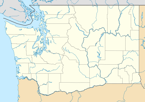 Hat Island, Washington Location of Hat Island, Washington. | |
| Coordinates: 48°0′48″N 122°19′14″W / 48.01333°N 122.32056°WCoordinates: 48°0′48″N 122°19′14″W / 48.01333°N 122.32056°W | |
| Country | United States |
| State | Washington |
| County | Snohomish |
| Area | |
| • Total | 0.692 sq mi (1.79 km2) |
| • Land | 0.688 sq mi (1.78 km2) |
| • Water | 0.004 sq mi (0.01 km2) |
| Population (2010) | |
| • Total | 41 |
| • Density | 59.6/sq mi (23.0/km2) |
| Time zone | Pacific (PST) (UTC-8) |
| • Summer (DST) | PDT (UTC-7) |
| GNIS feature ID | 2584980[1] |

Hat Island is a census-designated place (CDP) in Snohomish County, Washington, United States. The population was 41 at the 2010 census. The CDP occupies an island in Possession Sound called Hat Island, also known as Gedney Island.
There is currently one walk-on ferry named the Hat Express which transports walk-on passengers to and from the island. The maximum capacity of the ferry is 88 passengers. It runs a limited schedule on Thursdays, Friday evenings, and weekends between the Everett Yacht Club on the west end of 13th Street in Everett, and the Hat Island Marina.[2]
Geography
Hat Island is located at 48°0′48″N 122°19′14″W / 48.01333°N 122.32056°W (48.013340, -122.320562).[3]
According to the United States Census Bureau, the CDP has a total area of 0.692 square miles (1.79 km²), of which, 0.688 square miles (1.78 km²) of it is land and 0.004 square miles (0.01 km²) of it (0.58%) is water.
References
- ↑ "US Board on Geographic Names". United States Geological Survey. 2007-10-25. Retrieved 2008-01-31.
- ↑ "Ferry Info". Hat Island Community Association. Retrieved 8 March 2013.
- ↑ "US Gazetteer files: 2010, 2000, and 1990". United States Census Bureau. 2011-02-12. Retrieved 2011-04-23.
External links
- Hat Island community site the site contains a very complete history of the island
Municipalities and communities of Snohomish County, Washington, United States | ||
|---|---|---|
| Cities |  | |
| Towns | ||
| CDPs |
| |
| Other unincorporated communities | ||
| Ghost town | ||
| Indian reservation | ||
| Footnotes | ‡This populated place also has portions in an adjacent county or counties | |