Hat Creek, California
| Hat Creek | |
|---|---|
| census designated place | |
 Hat Creek Position in California. | |
| Coordinates: 40°47′23″N 121°28′28″W / 40.78972°N 121.47444°WCoordinates: 40°47′23″N 121°28′28″W / 40.78972°N 121.47444°W | |
| Country |
|
| State |
|
| County | Shasta |
| Area[1] | |
| • Total | 50.184 sq mi (129.975 km2) |
| • Land | 50.013 sq mi (129.533 km2) |
| • Water | 0.171 sq mi (0.443 km2) 0.34% |
| Elevation[2] | 3,422 ft (1,043 m) |
| Population (2010) | |
| • Total | 309 |
| • Density | 6.2/sq mi (2.4/km2) |
| Time zone | Pacific (PST) (UTC-8) |
| • Summer (DST) | PDT (UTC-7) |
| ZIP Code | 96040 |
| Area code(s) | 530 |
| GNIS feature ID | 2583033 |
| U.S. Geological Survey Geographic Names Information System: Hat Creek, California | |
Hat Creek is a census designated place (CDP) in Shasta County, California.[2] Hat Creek is situated at an elevation of 3,422 feet (1,043 m).[2] The 2010 United States census reported Hat Creek's population was 309.
Hat Creek is located 26 miles (42 km) north of Lassen Park, 13 miles (21 km) southeast of Burney (9 miles (14 km) south of the junction of hwy 89 and 299), and 15 miles (24 km) south of Burney Falls. Its zip code is 96040. Wired telephone numbers are from the Burney central office and follow the pattern 530-335-xxxx. Hat Creek is home to the Hat Creek Radio Observatory, run by SRI International.
The town's main economies are tourism, fishing, camping, and lodging. It's still a travel hot spot in Shasta County, although it's about 70 miles (110 km) east of Redding, California and about the same to Susanville, California.
Geography
According to the United States Census Bureau, the CDP covers an area of 50.2 square miles (130.0 km²), 99.66% of it land and 0.34% of it water.
Climate
Hat Creek has a warm-summer Mediterranean climate (Csb) according to the Köppen climate classification system.
| Climate data for Hat Creek (1921-2012) | |||||||||||||
|---|---|---|---|---|---|---|---|---|---|---|---|---|---|
| Month | Jan | Feb | Mar | Apr | May | Jun | Jul | Aug | Sep | Oct | Nov | Dec | Year |
| Record high °F (°C) | 70 (21) |
79 (26) |
83 (28) |
94 (34) |
101 (38) |
106 (41) |
113 (45) |
110 (43) |
107 (42) |
100 (38) |
88 (31) |
68 (20) |
113 (45) |
| Average high °F (°C) | 47 (8) |
52.3 (11.3) |
58 (14) |
65.4 (18.6) |
74.7 (23.7) |
82.7 (28.2) |
92 (33) |
91 (33) |
84.4 (29.1) |
72.2 (22.3) |
56.1 (13.4) |
47.1 (8.4) |
68.6 (20.3) |
| Average low °F (°C) | 21.9 (−5.6) |
24.8 (−4) |
28.4 (−2) |
32.3 (0.2) |
38.3 (3.5) |
43.5 (6.4) |
46.6 (8.1) |
43.9 (6.6) |
38.4 (3.6) |
32 (0) |
27.1 (−2.7) |
22.9 (−5.1) |
33.4 (0.8) |
| Record low °F (°C) | −17 (−27) |
−8 (−22) |
6 (−14) |
10 (−12) |
18 (−8) |
27 (−3) |
27 (−3) |
27 (−3) |
22 (−6) |
10 (−12) |
7 (−14) |
−20 (−29) |
−20 (−29) |
| Average precipitation inches (mm) | 2.75 (69.9) |
2.74 (69.6) |
2.16 (54.9) |
1.41 (35.8) |
1.26 (32) |
0.78 (19.8) |
0.19 (4.8) |
0.24 (6.1) |
0.55 (14) |
1.24 (31.5) |
2.15 (54.6) |
2.79 (70.9) |
18.27 (464.1) |
| Average snowfall inches (cm) | 7.9 (20.1) |
4.6 (11.7) |
3.1 (7.9) |
1.2 (3) |
0.2 (0.5) |
0 (0) |
0 (0) |
0 (0) |
0 (0) |
0.1 (0.3) |
1.5 (3.8) |
6 (15) |
24.5 (62.2) |
| Average precipitation days | 11 | 11 | 11 | 8 | 7 | 5 | 1 | 2 | 3 | 5 | 9 | 11 | 84 |
| Source: WRCC[3] | |||||||||||||
Demographics
The 2010 United States Census[4] reported that Hat Creek had a population of 309. The population density was 6.2 people per square mile (2.4/km²). The racial makeup of Hat Creek was 239 (77.3%) White, 4 (1.3%) African American, 45 (14.6%) Native American, 2 (0.6%) Asian, 4 (1.3%) Pacific Islander, 9 (2.9%) from other races, and 6 (1.9%) from two or more races. Hispanic or Latino of any race were 20 persons (6.5%).
The Census reported that 301 people (97.4% of the population) lived in households, 8 (2.6%) lived in non-institutionalized group quarters, and 0 (0%) were institutionalized.
There were 133 households, out of which 31 (23.3%) had children under the age of 18 living in them, 75 (56.4%) were opposite-sex married couples living together, 11 (8.3%) had a female householder with no husband present, 3 (2.3%) had a male householder with no wife present. There were 6 (4.5%) unmarried opposite-sex partnerships, and 1 (0.8%) same-sex married couples or partnerships. 38 households (28.6%) were made up of individuals and 17 (12.8%) had someone living alone who was 65 years of age or older. The average household size was 2.26. There were 89 families (66.9% of all households); the average family size was 2.79.
The population was spread out with 59 people (19.1%) under the age of 18, 21 people (6.8%) aged 18 to 24, 55 people (17.8%) aged 25 to 44, 110 people (35.6%) aged 45 to 64, and 64 people (20.7%) who were 65 years of age or older. The median age was 51.9 years. For every 100 females there were 96.8 males. For every 100 females age 18 and over, there were 96.9 males.
There were 194 housing units at an average density of 3.9 per square mile (1.5/km²), of which 93 (69.9%) were owner-occupied, and 40 (30.1%) were occupied by renters. The homeowner vacancy rate was 3.1%; the rental vacancy rate was 6.8%. 199 people (64.4% of the population) lived in owner-occupied housing units and 102 people (33.0%) lived in rental housing units.
Politics
In the state legislature Hat Creek is in the 1st Senate District, represented by Republican Ted Gaines,[5] and the 1st Assembly District, represented by Republican Brian Dahle.[6]
Federally, Hat Creek is in California's 1st congressional district, represented by Republican Doug LaMalfa.[7]
References
- ↑ U.S. Census
- 1 2 3 U.S. Geological Survey Geographic Names Information System: Hat Creek, California
- ↑ "HAT CREEK, CA (043824)". Western Regional Climate Center. Retrieved November 29, 2015.
- ↑ "2010 Census Interactive Population Search: CA - Hat Creek CDP". U.S. Census Bureau. Retrieved July 12, 2014.
- ↑ "Senators". State of California. Retrieved March 10, 2013.
- ↑ "Members Assembly". State of California. Retrieved March 2, 2013.
- ↑ "California's 1st Congressional District - Representatives & District Map". Civic Impulse, LLC. Retrieved March 1, 2013.
Municipalities and communities of Shasta County, California, United States | ||
|---|---|---|
| Cities | 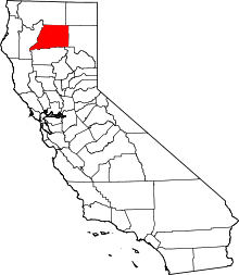 | |
| CDPs | ||
| Unincorporated communities |
| |
| Indian reservations | ||
| Ghost town |
| |