Harvey Cedars, New Jersey
| Harvey Cedars, New Jersey | |
|---|---|
| Borough | |
| Borough of Harvey Cedars | |
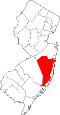
 Map of Harvey Cedars in Ocean County. Inset: Location of Ocean County highlighted in the State of New Jersey. | |
 Census Bureau map of Harvey Cedars, New Jersey | |
| Coordinates: 39°41′58″N 74°08′29″W / 39.699578°N 74.141511°WCoordinates: 39°41′58″N 74°08′29″W / 39.699578°N 74.141511°W[1][2] | |
| Country |
|
| state |
|
| County | Ocean |
| Incorporated | November 20, 1894 |
| Government[3] | |
| • Type | Walsh Act |
| • Body | Board of Commissioners |
| • Mayor | Jonathan S. Oldham (term ends December 31, 2019)[4] |
| • Clerk | Daina Dale[5] |
| Area[1] | |
| • Total | 1.185 sq mi (3.070 km2) |
| • Land | 0.557 sq mi (1.444 km2) |
| • Water | 0.628 sq mi (1.626 km2) 52.97% |
| Area rank |
486th of 566 in state 21st of 33 in county[1] |
| Elevation[6] | 3 ft (0.9 m) |
| Population (2010 Census)[7][8][9][10] | |
| • Total | 337 |
| • Estimate (2015)[11] | 341 |
| • Rank |
559th of 566 in state 32nd of 33 in county[12] |
| • Density | 604.6/sq mi (233.4/km2) |
| • Density rank |
427th of 566 in state 24th of 33 in county[12] |
| Time zone | Eastern (EST) (UTC-5) |
| • Summer (DST) | Eastern (EDT) (UTC-4) |
| ZIP code | 08008[13][14] |
| Area code(s) | 609 exchanges: 207, 361, 492, 494[15] |
| FIPS code | 3402930390[1][16][17] |
| GNIS feature ID | 0885246[1][18] |
| Website |
www |
Harvey Cedars is a borough in Ocean County, New Jersey, United States. As of the 2010 United States Census, the borough's population was 337,[7][8][9][10] reflecting a decline of 22 (-6.1%) from the 359 counted in the 2000 Census, which had in turn declined by 3 (-0.8%) from the 362 counted in the 1990 Census.[19] The borough borders the Atlantic Ocean on Long Beach Island.
Harvey Cedars was incorporated as a borough by an act of the New Jersey Legislature on December 15, 1894, from portions of Union Township (now Barnegat Township), based on the results of a referendum held on November 20, 1894.[20]
The majority of the housing units in the borough are seasonal houses used primarily in the summer by owners who live elsewhere, bringing the summer population to 12,000.[21] The borough's quiet character and bay and ocean access make housing very expensive, with bay or oceanfront houses priced at $2 million or more. Despite the borough's small size, its property was assessed at over $1.2 billion in 2014.[22]
History
Before Long Beach Island was developed, its northern area, from the Barnegat Inlet to the Great Swamp (now Surf City), was covered with Atlantic white cedar (chamaecyparis thyoides). Early inhabitants of the area harvested salt hay (spartina patens) and seaweed to make a living.
The earliest reference to the area was a deed from 1751 that called the place "Harvest Quarters".[23] The name "Harvey Cedars" may be a portmanteau derived from the combination of "harvest" housing used by these farmers and the "cedars" that grew in the area.[24]
Geography
According to the United States Census Bureau, the borough had a total area of 1.185 square miles (3.070 km2), including 0.557 square miles (1.444 km2) of land and 0.628 square miles (1.626 km2) of water (52.97%).[1][2]
Unincorporated communities, localities and place names located partially or completely within the borough include High Point.[25]
The borough borders the Ocean County municipalities of Barnegat Township, Long Beach Township and Stafford Township.[26]
Demographics
| Historical population | |||
|---|---|---|---|
| Census | Pop. | %± | |
| 1900 | 39 | — | |
| 1910 | 33 | −15.4% | |
| 1920 | 65 | 97.0% | |
| 1930 | 53 | −18.5% | |
| 1940 | 74 | 39.6% | |
| 1950 | 106 | 43.2% | |
| 1960 | 134 | 26.4% | |
| 1970 | 314 | 134.3% | |
| 1980 | 363 | 15.6% | |
| 1990 | 362 | −0.3% | |
| 2000 | 359 | −0.8% | |
| 2010 | 337 | −6.1% | |
| Est. 2015 | 341 | [11][27] | 1.2% |
| Population sources: 1900-2000[28] 1900-1920[29] 1900-1910[30] 1910-1930[31] 1930-1990[32] 2000[33][34] 2010[7][8][9][10] | |||
Census 2010
At the 2010 United States Census, there were 337 people, 169 households, and 110 families residing in the borough. The population density was 604.6 per square mile (233.4/km2). There were 1,214 housing units at an average density of 2,178.0 per square mile (840.9/km2). The racial makeup of the borough was 99.11% (334) White, 0.59% (2) Black or African American, 0.00% (0) Native American, 0.30% (1) Asian, 0.00% (0) Pacific Islander, 0.00% (0) from other races, and 0.00% (0) from two or more races. Hispanics or Latinos of any race were 0.89% (3) of the population.[8]
There were 169 households, of which 13.6% had children under the age of 18 living with them, 59.8% were married couples living together, 5.3% had a female householder with no husband present, and 34.9% were non-families. 32.0% of all households were made up of individuals, and 18.3% had someone living alone who was 65 years of age or older. The average household size was 1.99 and the average family size was 2.47.[8]
In the borough, 11.6% of the population were under the age of 18, 4.5% from 18 to 24, 10.1% from 25 to 44, 32.0% from 45 to 64, and 41.8% who were 65 years of age or older. The median age was 61.6 years. For every 100 females there were 97.1 males. For every 100 females age 18 and over, there were 97.4 males.[8]
The Census Bureau's 2006-2010 American Community Survey showed that (in 2010 inflation-adjusted dollars) median household income was $106,875 (with a margin of error of +/- $15,693) and the median family income was $112,656 (+/- $8,889). Males had a median income of $85,625 (+/- $32,732) versus $51,875 (+/- $42,840) for females. The per capita income for the borough was $74,525 (+/- $13,683). About 3.0% of families and 4.2% of the population were below the poverty line, including 0.0% of those under age 18 and 6.2% of those age 65 or over.[35]
Census 2000
As of the 2000 United States Census[16] there were 359 people, 167 households, and 112 families residing in the borough. The population density was 657.1 people per square mile (252.0/km2). There were 1,205 housing units at an average density of 2,205.6 per square mile (845.9/km2). The racial makeup of the borough was 96.94% White, 0.56% African American, 0.28% Native American, 0.28% Asian, 1.95% from other races. Hispanic or Latino of any race were 3.62% of the population.[33][34]
There were 167 households out of which 16.8% had children under the age of 18 living with them, 61.7% were married couples living together, 4.2% had a female householder with no husband present, and 32.9% were non-families. 29.3% of all households were made up of individuals and 15.6% had someone living alone who was 65 years of age or older. The average household size was 2.15 and the average family size was 2.61.[33][34]
In the borough the population was spread out with 14.5% under the age of 18, 4.2% from 18 to 24, 22.0% from 25 to 44, 29.0% from 45 to 64, and 30.4% who were 65 years of age or older. The median age was 54 years. For every 100 females there were 102.8 males. For every 100 females age 18 and over, there were 106.0 males.[33][34]
The median income for a household in the borough was $61,875, and the median income for a family was $69,722. Males had a median income of $71,042 versus $32,361 for females. The per capita income for the borough was $36,757. About 2.6% of families and 5.1% of the population were below the poverty line, including 5.1% of those under age 18 and 2.9% of those age 65 or over.[33][34]
Government
Local government
The Borough of Harvey Cedars has operated under the Walsh Act Commission form of New Jersey municipal government since 1923.[36][37] The governing body is a three-member Board of Commissioners whose members are elected at-large on a nonpartisan basis to serve conncurrent four-year terms of office in elections held as part of the November general election.[3] Each commissioner acts as department head. The Mayor and Deputy Mayor are elected by the Board from among its members. The mayor has no veto power.
As of 2016, members of the Harvey Cedars Board of Commissioners are Mayor Jonathan S. Oldham (Commissioner of Public Works, Parks and Public Property), Deputy mayor Judith E. Gerkens (Commissioner of Revenue and Finance) and Michael E. Garofalo (Commissioner of Public Affairs and Public Safety), all of whom are serving concurrent four-year terms of office that expire on December 31, 2019.[38][39][40][41][42]
Federal, state and county representation
Harvey Cedars is located in the 2nd Congressional District[43] and is part of New Jersey's 9th state legislative district.[9][44][45] Prior to the 2010 Census, Harvey Cedars had been part of the 3rd Congressional District, a change made by the New Jersey Redistricting Commission that took effect in January 2013, based on the results of the November 2012 general elections.[46]
New Jersey's Second Congressional District is represented by Frank LoBiondo (R, Ventnor City).[47] New Jersey is represented in the United States Senate by Cory Booker (D, Newark, term ends 2021)[48] and Bob Menendez (D, Paramus, 2019).[49][50]
For the 2016–2017 session (Senate, General Assembly), the 9th Legislative District of the New Jersey Legislature is represented in the State Senate by Christopher J. Connors (R, Lacey Township) and in the General Assembly by DiAnne Gove (R, Long Beach Township) and Brian E. Rumpf (R, Little Egg Harbor Township).[51] The Governor of New Jersey is Chris Christie (R, Mendham Township).[52] The Lieutenant Governor of New Jersey is Kim Guadagno (R, Monmouth Beach).[53]
Ocean County is governed by a Board of Chosen Freeholders consisting of five members, elected on an at-large basis in partisan elections and serving staggered three-year terms of office, with either one or two seats coming up for election each year as part of the November general election.[54] At an annual reorganization held in the beginning of January, the board chooses a Director and a Deputy Director from among its members. As of 2015, Ocean County's Freeholders (with party affiliation, term-end year, residence and department directorship listed in parentheses) are Freeholder Director John C. Bartlett, Jr. (R, term ends December 31, 2015, Pine Beach; Finance, Parks and Recreation),[55] Freeholder Deputy Director Gerry P. Little (R, 2015, Surf City; Human Services),[56] John P. Kelly (R, 2016, Eagleswood Township; Law and Public Safety),[57] James F. Lacey (R, 2016, Brick Township; Transportation)[58] and Joseph H. Vicari (R, 2017, Toms River; Senior Services and County Operations).[59][60][61] Constitutional officers elected on a countywide basis are County Clerk Scott M. Colabella (R, 2015, Barnegat Light),[62][63] Sheriff Michael Mastronardy (R, 2016; Toms River)[64] and Surrogate Jeffrey Moran (R, 2018, Beachwood).[65][66]
Politics
As of March 23, 2011, there were a total of 375 registered voters in Harvey Cedars, of which 86 (22.9%) were registered as Democrats, 157 (41.9%) were registered as Republicans and 132 (35.2%) were registered as Unaffiliated. There were no voters registered to other parties.[67] Among the borough's 2010 Census population, 111.3% (vs. 63.2% in Ocean County) were registered to vote, including 125.8% of those ages 18 and over (vs. 82.6% countywide).[67][68]
In the 2012 presidential election, Republican Mitt Romney received 58.7% of the vote (152 cast), ahead of Democrat Barack Obama with 40.5% (105 votes), and other candidates with 0.8% (2 votes), among the 262 ballots cast by the borough's 412 registered voters (3 ballots were spoiled), for a turnout of 63.6%.[69][70] In the 2008 presidential election, Republican John McCain received 54.5% of the vote (145 cast), ahead of Democrat Barack Obama with 42.5% (113 votes) and other candidates with 1.1% (3 votes), among the 266 ballots cast by the borough's 384 registered voters, for a turnout of 69.3%.[71] In the 2004 presidential election, Republican George W. Bush received 60.1% of the vote (181 ballots cast), outpolling Democrat John Kerry with 39.5% (119 votes) and other candidates with 0.3% (1 votes), among the 301 ballots cast by the borough's 388 registered voters, for a turnout percentage of 77.6.[72]
In the 2013 gubernatorial election, Republican Chris Christie received 73.6% of the vote (159 cast), ahead of Democrat Barbara Buono with 25.0% (54 votes), and other candidates with 1.4% (3 votes), among the 221 ballots cast by the borough's 423 registered voters (5 ballots were spoiled), for a turnout of 52.2%.[73][74] In the 2009 gubernatorial election, Republican Chris Christie received 56.8% of the vote (126 ballots cast), ahead of Democrat Jon Corzine with 35.1% (78 votes), Independent Chris Daggett with 5.9% (13 votes) and other candidates with 0.5% (1 votes), among the 222 ballots cast by the borough's 355 registered voters, yielding a 62.5% turnout.[75]
Education
For Kindergarten through sixth grade, public school students attend the Long Beach Island Consolidated School District, which also serves students from Barnegat Light, Long Beach Township, Ship Bottom and Surf City.[3][76] As of the 2011-12 school year, the district's two schools had an enrollment of 238 students and 26.9 classroom teachers (on an FTE basis), for a student–teacher ratio of 8.85:1.[77] Schools in the district (with 2011-12 enrollment data from the National Center for Education Statistics[78]) are Ethel Jacobsen School[79] in Surf City with 138 students in grades Kindergarten – 2 and Long Beach Island Grade School[80] in Ship Bottom with 100 students in grades 3 – 6.[81]
Students in public school for seventh through twelfth grades attend the Southern Regional School District, which serves the five municipalities in the Long Beach Island Consolidated School District, along with students from Beach Haven and Stafford Township, as well as students from Ocean Township (including its Waretown section) who attend as part of a sending/receiving relationship.[3][82] Schools in the district (with 2013-14 enrollment data from the National Center for Education Statistics[83]) are Southern Regional Middle School[84] (grades 7 and 8; 992 students) and Southern Regional High School[85] (grades 9 – 12; 2,071 students).[86] Both schools are in the Manahawkin section of Stafford Township.
Transportation
Roads and highways
As of May 2010, the borough had a total of 9.82 miles (15.80 km) of roadways, of which 7.59 miles (12.21 km) were maintained by the municipality and 2.23 miles (3.59 km) by Ocean County.[87]
Public transportation
Ocean County Ride provides bus service on the OC9 LBI North route between Barnegat Light and Manahawkin / Stafford Township.[88]
The LBI Shuttle operates along Long Beach Boulevard, providing free service every 5 to 20 minutes from 10:00 AM to 10:00 PM. It serves the Long Beach Island municipalities / communities of Barnegat Light, Loveladies, Harvey Cedars, North Beach, Surf City, Ship Bottom, Long Beach Township, Beach Haven and Holgate.[89]
Noted residents
People who were born in, residents of, or otherwise closely associated with Harvey Cedars include:
- Wendy Mae Chambers (born 1953), composer.[90]
- Paul L. Gill (1894-1938), watercolor painter and teacher.[91]
- Sue May Gill (1887-1989), artist and member of the Philadelphia Ten.[91]
- Leon Kelly (1901-1982), artist best known for his contributions to Surrealism.[92]
- Nathan Gregory Silvermaster (1898-1964), economist with the United States War Production Board during World War II, who was the head of a large Communist spy ring in the U.S. government.[93]
References
- 1 2 3 4 5 6 2010 Census Gazetteer Files: New Jersey County Subdivisions, United States Census Bureau. Accessed May 21, 2015.
- 1 2 US Gazetteer files: 2010, 2000, and 1990, United States Census Bureau. Accessed September 4, 2014.
- 1 2 3 4 2012 New Jersey Legislative District Data Book, Rutgers University Edward J. Bloustein School of Planning and Public Policy, March 2013, p. 49.
- ↑ 2016 New Jersey Mayors Directory, New Jersey Department of Community Affairs. Accessed June 14, 2016. As of date accessed, Oldham is listed as mayor with a term-end date incorrectly shown as April 30, 2019.
- ↑ Municipal Clerk, Borough of Harvey Cedars. Accessed July 26, 2016.
- ↑ U.S. Geological Survey Geographic Names Information System: Borough of Harvey Cedars, Geographic Names Information System. Accessed March 5, 2013.
- 1 2 3 "N.J.'s population shifting to coast, south". USA Today. 2011. Retrieved February 27, 2011.
- 1 2 3 4 5 6 DP-1 - Profile of General Population and Housing Characteristics: 2010 for Harvey Cedars borough, Ocean County, New Jersey, United States Census Bureau. Accessed December 25, 2012.
- 1 2 3 4 Municipalities Grouped by 2011-2020 Legislative Districts, New Jersey Department of State, p. 5. Accessed January 6, 2013.
- 1 2 3 Profile of General Demographic Characteristics: 2010 for Harvey Cedars borough, New Jersey Department of Labor and Workforce Development. Accessed December 25, 2012.
- 1 2 PEPANNRES - Annual Estimates of the Resident Population: April 1, 2010 to July 1, 2015 - 2015 Population Estimates for New Jersey municipalities, United States Census Bureau. Accessed May 22, 2016.
- 1 2 GCT-PH1 Population, Housing Units, Area, and Density: 2010 - State -- County Subdivision from the 2010 Census Summary File 1 for New Jersey, United States Census Bureau. Accessed December 25, 2012.
- ↑ Look Up a ZIP Code for Harvey Cedars, NJ, United States Postal Service. Accessed December 25, 2012.
- ↑ Zip Codes, State of New Jersey. Accessed September 24, 2013.
- ↑ Area Code Lookup - NPA NXX for Harvey Cedars, NJ, Area-Codes.com. Accessed September 24, 2013.
- 1 2 American FactFinder, United States Census Bureau. Accessed September 4, 2014.
- ↑ A Cure for the Common Codes: New Jersey, Missouri Census Data Center. Accessed October 28, 2012.
- ↑ US Board on Geographic Names, United States Geological Survey. Accessed September 4, 2014.
- ↑ Table 7. Population for the Counties and Municipalities in New Jersey: 1990, 2000 and 2010, New Jersey Department of Labor and Workforce Development, February 2011. Accessed December 25, 2012.
- ↑ Snyder, John P. The Story of New Jersey's Civil Boundaries: 1606-1968, Bureau of Geology and Topography; Trenton, New Jersey; 1969. p. 202. Accessed October 26, 2012.
- ↑ Home Page, Harvey Cedars Police Department. Accessed February 18, 2015. "Harvey Cedars has a winter population of approximately 400 people. In the summer the population grows to approximately 12,000."
- ↑ 2014 Abstract Of Ratables, Ocean County Board of Taxation. Accessed February 18, 2015.
- ↑ Buchholz, Margaret Thomas. The History of Harvey Cedars, Borough of Harvey Cedars. Accessed August 31, 2015. "But from a 1751 deed we now know that our Harvey is as ephemeral as Harvey the Rabbit. In the deed, the locality was designated as 'a hammock and clump of cedars called Harvest Quarters.' And if you say 'harvest cedars' often and fast enough, harvest will be clipped to harves -- and it's only a brief skip of the mouth to Harvey."
- ↑ Harvey Cedars History, LBI.net. Accessed January 2, 2011.
- ↑ Locality Search, State of New Jersey. Accessed May 21, 2015.
- ↑ Areas touching Harvey Cedars, MapIt. Accessed August 9, 2015.
- ↑ Census Estimates for New Jersey April 1, 2010 to July 1, 2015, United States Census Bureau. Accessed May 22, 2016.
- ↑ Barnett, Bob. Population Data for Ocean County Municipalities, 1850 - 2000, WestJersey.org, January 6, 2011. Accessed December 25, 2012.
- ↑ Compendium of censuses 1726-1905: together with the tabulated returns of 1905, New Jersey Department of State, 1906. Accessed September 23, 2013.
- ↑ Thirteenth Census of the United States, 1910: Population by Counties and Minor Civil Divisions, 1910, 1900, 1890, United States Census Bureau, p. 338. Accessed December 25, 2012.
- ↑ Fifteenth Census of the United States : 1930 - Population Volume I, United States Census Bureau, p. 718. Accessed December 25, 2012.
- ↑ Table 6. New Jersey Resident Population by Municipality: 1930 - 1990, New Jersey Department of Labor and Workforce Development. Accessed June 28, 2015.
- 1 2 3 4 5 Census 2000 Profiles of Demographic / Social / Economic / Housing Characteristics for Harvey Cedars borough, New Jersey, United States Census Bureau. Accessed December 25, 2012.
- 1 2 3 4 5 DP-1: Profile of General Demographic Characteristics: 2000 - Census 2000 Summary File 1 (SF 1) 100-Percent Data for Harvey Cedars borough, Ocean County, New Jersey, United States Census Bureau. Accessed December 25, 2012.
- ↑ DP03: Selected Economic Characteristics from the 2006-2010 American Community Survey 5-Year Estimates for Harvey Cedars borough, Ocean County, New Jersey, United States Census Bureau. Accessed December 25, 2012.
- ↑ "The Commission Form of Municipal Government", p. 53. Accessed June 3, 2015.
- ↑ "Forms of Municipal Government in New Jersey", p. 8. Rutgers University Center for Government Studies. Accessed June 3, 2015.
- ↑ Government, Borough of Harvey Cedars. Accessed July 26, 2016.
- ↑ 2016 Municipal Data Sheet, Borough of Harvey Cedars. Accessed July 26, 2016.
- ↑ 2016 Ocean County & Municipal Elected Officials, Ocean County, New Jersey Clerk, updated February 22, 2016. Accessed July 26, 2016.
- ↑ Borough of Harvey Cedars, Ocean County, New Jersey. Accessed July 26, 2016.
- ↑ 2015 General Election Official Results November 3, 2015, Ocean County, New Jersey Clerk, updated November 10, 2015. Accessed July 26, 2016.
- ↑ Plan Components Report, New Jersey Redistricting Commission, December 23, 2011. Accessed January 6, 2013.
- ↑ 2016 New Jersey Citizen's Guide to Government, p. 58, New Jersey League of Women Voters. Accessed July 20, 2016.
- ↑ Districts by Number for 2011-2020, New Jersey Legislature. Accessed January 6, 2013.
- ↑ 2011 New Jersey Citizen's Guide to Government, p. 58, New Jersey League of Women Voters. Accessed May 22, 2015.
- ↑ Directory of Representatives: New Jersey, United States House of Representatives. Accessed January 5, 2012.
- ↑ About Cory Booker, United States Senate. Accessed January 26, 2015. "He now owns a home and lives in Newark's Central Ward community."
- ↑ Biography of Bob Menendez, United States Senate, January 26, 2015. "He currently lives in Paramus and has two children, Alicia and Robert."
- ↑ Senators of the 114th Congress from New Jersey. United States Senate. Accessed January 26, 2015. "Booker, Cory A. - (D - NJ) Class II; Menendez, Robert - (D - NJ) Class I"
- ↑ Legislative Roster 2016-2017 Session, New Jersey Legislature. Accessed January 17, 2016.
- ↑ "About the Governor". State of New Jersey. Retrieved 2010-01-21.
- ↑ "About the Lieutenant Governor". State of New Jersey. Retrieved 2010-01-21.
- ↑ Freeholder History, Ocean County, New Jersey. Accessed January 25, 2015.
- ↑ Freeholder Director John C. Bartlett Jr., Ocean County, New Jersey. Accessed January 25, 2015.
- ↑ Freeholder Deputy Director Gerry P. Little, Ocean County, New Jersey. Accessed January 25, 2015.
- ↑ Freeholder John P. Kelly, Ocean County, New Jersey. Accessed January 25, 2015.
- ↑ Freeholder James F. Lacey, Ocean County, New Jersey. Accessed January 25, 2015.
- ↑ Freeholder Joseph H. Vicari, Ocean County, New Jersey. Accessed January 25, 2015.
- ↑ Board of Chosen Freeholders, Ocean County, New Jersey. Accessed January 25, 2015.
- ↑ County Directory, Ocean County, New Jersey. Accessed January 25, 2015.
- ↑ County Clerk, Ocean County, New Jersey. Accessed January 25, 2015.
- ↑ Biography of Scott M. Colabella, Office of the County Clerk. Accessed January 25, 2015.
- ↑ Sheriff Michael Mastronardy, Ocean County Sheriff's Office. Accessed January 25, 2015.
- ↑ County Surrogate Jeffrey W. Moran, Ocean County, New Jersey. Accessed January 25, 2015.
- ↑ 2015 Elected Officials of Ocean County, Ocean County, New Jersey. Accessed January 25, 2015.
- 1 2 Voter Registration Summary - Ocean, New Jersey Department of State Division of Elections, March 23, 2011. Accessed December 25, 2012.
- ↑ GCT-P7: Selected Age Groups: 2010 - State -- County Subdivision; 2010 Census Summary File 1 for New Jersey, United States Census Bureau. Accessed December 25, 2012.
- ↑ "Presidential General Election Results - November 6, 2012 - Ocean County" (PDF). New Jersey Department of Elections. March 15, 2013. Retrieved December 24, 2014.
- ↑ "Number of Registered Voters and Ballots Cast - November 6, 2012 - General Election Results - Ocean County" (PDF). New Jersey Department of Elections. March 15, 2013. Retrieved December 24, 2014.
- ↑ 2008 Presidential General Election Results: Ocean County, New Jersey Department of State Division of Elections, December 23, 2008. Accessed December 25, 2012.
- ↑ 2004 Presidential Election: Ocean County, New Jersey Department of State Division of Elections, December 13, 2004. Accessed December 25, 2012.
- ↑ "Governor - Ocean County" (PDF). New Jersey Department of Elections. January 29, 2014. Retrieved December 24, 2014.
- ↑ "Number of Registered Voters and Ballots Cast - November 5, 2013 - General Election Results - Ocean County" (PDF). New Jersey Department of Elections. January 29, 2014. Retrieved December 24, 2014.
- ↑ 2009 Governor: Ocean County, New Jersey Department of State Division of Elections, December 31, 2009. Accessed December 25, 2012.
- ↑ LAN Associates. Study of School Consolidation Long Beach Island, New Jersey, Long Beach Island Consolidated School District, January 21, 2011. Accessed September 25, 2013. "The Long Beach Island Consolidated School District serves the needs of the citizens of Long Beach Island including the communities of Barnegat Light Borough, Long Beach Township, Harvey Cedars Borough, Surf City Borough, and Ship Bottom Borough. The remaining community of Beach Haven at the south end of the island currently has its own school. The Long Beach Island Consolidated Schools serve children from the age of pre-school through sixth grade after which the students attend Southern Regional High School in Manahawkin."
- ↑ District information for Long Beach Island Consolidated School District, National Center for Education Statistics. Accessed September 9, 2014.
- ↑ School Data for the Long Beach Island School District, National Center for Education Statistics. Accessed September 9, 2014.
- ↑ Ethel Jacobsen School, Long Beach Island Consolidated School District. Accessed September 9, 2014.
- ↑ Long Beach Island Grade School, Long Beach Island Consolidated School District. Accessed September 9, 2014.
- ↑ New Jersey School Directory for the Long Beach Island Consolidated School District, New Jersey Department of Education. Accessed September 9, 2014.
- ↑ Southern Regional High School 2015 Report Card Narrative, New Jersey Department of Education. Accessed June 2, 2016. "Located in Manahawkin, the Southern Regional School District draws from the constituent districts of Long Beach Township, Beach Haven, Surf City, Ship Bottom, Barnegat Light, Harvey Cedars and Stafford Township, as well as the tuition sending district of Ocean Township (Waretown).
- ↑ School Data for the Southern Regional School District, National Center for Education Statistics. Accessed June 2, 2016.
- ↑ Southern Regional Middle School, Southern Regional School District. Accessed June 2, 2016.
- ↑ Southern Regional High School, Southern Regional School District. Accessed June 2, 2016.
- ↑ New Jersey School Directory for the Southern Regional School District, New Jersey Department of Education. Accessed June 2, 2016.
- ↑ Ocean County Mileage by Municipality and Jurisdiction, New Jersey Department of Transportation, May 2010. Accessed July 18, 2014.
- ↑ Ocean Ride OC9 Schedule, Ocean County, New Jersey. Accessed August 9, 2015.
- ↑ LBI Shuttle, Borough of Barnegat Light. Accessed August 9, 2015.
- ↑ Lassonde, Victoria. "Wendy Mae Chambers Stages Performance for 64 Toy Pianos", TheSandPaper.net, June 20, 2012. Accessed April 29, 2015. "Wendy Mae Chambers of Harvey Cedars is a composer with a particular interest in multiples – large-scale performances by many musicians playing the same instrument."
- 1 2 Sue May Gailey Wescott Gill-Artist (1887-1989), Wes Loder. Accessed April 29, 2015. "GG and Paul bought their own little cottage in Harvey Cedars just one house from the beach and from the mid-Twenties on spent much of their non-traveling time in the summers there."
- ↑ Boyle, Pete. "Wade Lane", Philadelphia Art News, January 17, 1938, Vol. 1 No. 6. Accessed April 29, 2015. "The apple of Lane's eye, however, is his brand new beach house at Harvey Cedars, New Jersey. Done in the modern manner, it faces Barnegat Bay and is an ideal spot for a person with a hankering for the sea. He races down there every week-end and goes native with a bang."
- ↑ Staff. "A Cast of Characters", Time (magazine), November 23, 1953. Accessed April 29, 2015. "With William Ullmann as his business partner and housemate, Silvermaster now lives at Harvey Cedars, New Jersey, where he is a building contractor."
External links
- Harvey Cedars website
- Harvey Cedars Taxpayers Association
- Long Beach Island School District
- Long Beach Island School District's 2014–15 School Report Card from the New Jersey Department of Education
- School Data for the Long Beach Island School District, National Center for Education Statistics
- Southern Regional School District
| Preceded by Loveladies |
Beaches of New Jersey | Succeeded by North Beach |