Harrow Weald
| Harrow Weald | |
 Harrow Weald |
|
| Population | 11,376 (2011 Census. Ward)[1] |
|---|---|
| OS grid reference | TQ151907 |
| London borough | Harrow |
| Ceremonial county | Greater London |
| Region | London |
| Country | England |
| Sovereign state | United Kingdom |
| Post town | HARROW |
| Postcode district | HA3 |
| Dialling code | 020 |
| Police | Metropolitan |
| Fire | London |
| Ambulance | London |
| EU Parliament | London |
| London Assembly | Brent and Harrow |
Coordinates: 51°36′14″N 0°20′20″W / 51.604°N 0.339°W
Harrow Weald is an area in northwest London, England. It includes a suburban development and forms part of the London Borough of Harrow.
Locale, geography and history
The word Weald is Old English in origin, meaning woodland. It was recorded as waldis in 1303 and welde in 1382, but the name Harrow Weald is not recorded until 1553. It was then part of the great Forest of Middlesex.[2]
Harrow Weald is near Bushey Heath, Stanmore, Wealdstone, Headstone and Hatch End. It is in the HA postcode area.
The south of the area is a suburban development with houses, schools, small shops, supermarkets and pubs (notably the Weald Stone Inn, formerly the Red Lion). The area expanded around the First World War[3] and continued to grow fast: the population grew from 1,517 in 1901 to 10,923 in 1931.[4]
The Harrow Weald campus of Harrow College (previously a grammar school, then a 16+ college) and Harrow Weald Cemetery are at the northern edge of the built up area. All Saints churchyard and its extension adjoin this cemetery and their most famous interment is of Leefe Robinson, a pilot who was awarded the Victoria Cross.
Ancient woodland on high ground fills most of the northern part of Harrow Weald on the border of Greater London (formerly Middlesex) with Hertfordshire. The area is one of the highest in Greater London; the highest point in Middlesex is near the woods at 502 feet (153 m). The eastern part of the woods merges into those of Stanmore and encompasses Bentley Priory. The priory's grounds are now Bentley Priory Nature Reserve, a biological Site of Special Scientific Interest. Along the southern edge of the high ground runs the road Old Redding and a car park here gives spectacular views over much of London. The western part of the woodland forms Harrow Weald Common, which adjoins Harrow Weald SSSI, a geological Site of Special Scientific Interest. Other smaller woods surround the Grim's Dyke Hotel, the former country house of W. S. Gilbert.[5] Gilbert and Sullivan's comic operas are frequently performed here. The house is named after the nearby earthwork Grim's Ditch, a 3-mile long ancient monument that runs from Harrow Weald to Pinner Green. The monument remains largely mysterious but is known to have been named in the Saxon era.[6] The ditch hints at a long history of habitation in the area and many artefacts have been found on the common to support this.
The Seven Balls public house in Kenton Lane is Grade II listed.[7]
Demography
The 2011 census showed that in the Harrow Weald ward, 53% of the population was white (41% British, 6% Other, 5% Irish). The largest non-white group was Indian at 19%.[8]
Transport
Buses
The following London Bus routes operate through the area:[9]
| Route | Start | End | Operator |
| 140 | Harrow Weald | Heathrow Airport | Metroline |
| 182 | Harrow Weald Oxhey Lane | Brent Cross | Metroline |
| 258 | Watford Junction | South Harrow | Arriva Shires & Essex |
| 340 | Harrow | Edgware | Arriva Shires & Essex |
| 640 | South Harrow | Harrow Weald Clamp Hill | Metroline |
| H12 | South Harrow | Stanmore | Metroline |
| H18/H19 Circular | Harrow H18: anticlockwise | Harrow H19: clockwise | Arriva Shires & Essex |
| N18 | Harrow Weald | Trafalgar Square | Metroline |
Local councillors
As of May 2010, the local councillors for Harrow Weald are:
Councillor Ramji Chauhan, Councillor Tony Ferrari and Councillor Stephen Greek
References
- ↑ "Harrow Ward population 2011". Neighbourhood Statistics. Office for National Statistics. Retrieved 24 October 2016.
- ↑ London Borough of Harrow, Management Plan: Old Redding Complex, p. 2, 2010
- ↑ British History - Harrow Development
- ↑ Vision of Britain - Harrow Weald Parish History
- ↑ The Grims Dyke Hotel
- ↑ Grim's Ditch
- ↑ "Seven Balls public house". National Heritage List for England. English Heritage. Retrieved 11 May 2014.
- ↑ http://www.ukcensusdata.com/harrow-weald-e05000290
- ↑ http://www.tfl.gov.uk/gettingaround/maps/buses/pdf/harrow-weald.pdf
| Districts | 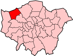 | |
|---|---|---|
| Attractions | ||
| Parks and open spaces |
| |
| Constituencies | ||
| Tube and rail stations | ||
| Other topics | ||