Harrington, Delaware
| City of Harrington | |
| City | |
| Country | United States |
|---|---|
| State | Delaware |
| County | Kent |
| Elevation | 56 ft (17.1 m) |
| Coordinates | 38°55′28″N 75°34′29″W / 38.92444°N 75.57472°WCoordinates: 38°55′28″N 75°34′29″W / 38.92444°N 75.57472°W |
| Area | 2.0 sq mi (5.2 km2) |
| - land | 2.0 sq mi (5 km2) |
| - water | 0.04 sq mi (0 km2) |
| Population | 3,562 (2010) |
| Density | 1,587.1/sq mi (613/km2) |
| Timezone | EST (UTC-5) |
| - summer (DST) | EDT (UTC-4) |
| ZIP code | 19952 |
| Area code | 302 |
 Location in Kent County and the state of Delaware.
| |
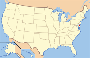 Location of Delaware in the United States
| |
Harrington is a city in Kent County, Delaware, United States. It is part of the Dover, Delaware Metropolitan Statistical Area. Harrington hosts the annual Delaware State Fair each July. The population was 3,562 at the 2010 census.[1]
History
Harrington was named for Hon. Samuel M. Harrington, a former chancellor of the state.[2]
Geography
Harrington is located at 38°55′28″N 75°34′29″W / 38.92444°N 75.57472°W (38.924446, -75.574720).[3]
According to the United States Census Bureau, the city has a total area of 2.0 square miles (5.2 km2), of which, 2.0 square miles (5.2 km2) of it is land and 0.04 square miles (0.10 km2) of it (1.48%) is water.
Demographics
| Historical population | |||
|---|---|---|---|
| Census | Pop. | %± | |
| 1880 | 745 | — | |
| 1900 | 1,242 | — | |
| 1910 | 1,500 | 20.8% | |
| 1920 | 1,617 | 7.8% | |
| 1930 | 1,812 | 12.1% | |
| 1940 | 2,113 | 16.6% | |
| 1950 | 2,241 | 6.1% | |
| 1960 | 2,495 | 11.3% | |
| 1970 | 2,407 | −3.5% | |
| 1980 | 2,405 | −0.1% | |
| 1990 | 2,311 | −3.9% | |
| 2000 | 3,174 | 37.3% | |
| 2010 | 3,562 | 12.2% | |
| Est. 2015 | 3,691 | [4] | 3.6% |
As of the census[6] of 2000, there were 3,174 people, 1,223 households, and 825 families residing in the city. The population density was 1,587.1 people per square mile (612.7/km²). There were 1,328 housing units at an average density of 664.0 per square mile (256.4/km²). The racial makeup of the city was 75.17% White, 21.64% African American, 0.25% Native American, 0.44% Asian, 0.09% Pacific Islander, 0.72% from other races, and 1.67% from two or more races. Hispanic or Latino of any race were 2.52% of the population.
There were 1,223 households out of which 37.1% had children under the age of 18 living with them, 43.9% were married couples living together, 18.7% had a female householder with no husband present, and 32.5% were non-families. 27.5% of all households were made up of individuals and 13.0% had someone living alone who was 65 years of age or older. The average household size was 2.60 and the average family size was 3.13.
In the city the population was spread out with 31.3% under the age of 18, 9.0% from 18 to 24, 27.7% from 25 to 44, 18.4% from 45 to 64, and 13.5% who were 65 years of age or older. The median age was 32 years. For every 100 females there were 84.6 males. For every 100 females age 18 and over, there were 81.8 males.
The median income for a household in the city was $30,945, and the median income for a family was $36,815. Males had a median income of $32,064 versus $20,801 for females. The per capita income for the city was $15,049. About 12.1% of families and 16.5% of the population were below the poverty line, including 26.7% of those under age 18 and 13.3% of those age 65 or over.
Places of attraction
Harrington is home to Harrington Raceway & Casino, which is located at the Delaware State Fairgrounds. The town post office contains a wax tempera mural, Men Hoeing, painted in 1941 by Eve Salisbury. Federally commissioned murals were produced from 1934 to 1943 in the United States through the Section of Painting and Sculpture, later called the Section of Fine Arts, of the Treasury Department. [7] .
External links
| Wikimedia Commons has media related to Harrington, Delaware. |
References
- ↑ http://www.stateplanning.delaware.gov/census_data_center/
- ↑ Gannett, Henry (1905). The Origin of Certain Place Names in the United States. Govt. Print. Off. p. 150.
- ↑ "US Gazetteer files: 2010, 2000, and 1990". United States Census Bureau. 2011-02-12. Retrieved 2011-04-23.
- ↑ "Annual Estimates of the Resident Population for Incorporated Places: April 1, 2010 to July 1, 2015". Retrieved July 2, 2016.
- ↑ "Census of Population and Housing". Census.gov. Retrieved June 4, 2015.
- ↑ "American FactFinder". United States Census Bureau. Retrieved 2008-01-31.
- ↑ Arnesen, Eric (2007). Encyclopedia of U.S. Labor and Working-Class History. 1. New York: Routledge. p. 1540. ISBN 9780415968263.
Municipalities and communities of Kent County, Delaware, United States | ||
|---|---|---|
| Cities | ||
| Towns | ||
| CDPs | ||
| Unincorporated communities |
| |
| Hundreds | ||
| Footnotes | ‡This populated place also has portions in an adjacent county or counties | |
Dover (capital) | ||
| Topics |
|  |
| Society |
| |
| Cities | ||
| Towns |
| |
| Counties | ||