Harnaut
| Harnaut हरनौत | |
|---|---|
| city | |
|
Sunset view of city | |
 Harnaut  Harnaut Location of Harnaut in Bihar | |
| Coordinates: 25°22′10″N 85°31′55″E / 25.36944°N 85.53194°ECoordinates: 25°22′10″N 85°31′55″E / 25.36944°N 85.53194°E | |
| Country |
|
| State | Bihar |
| Region | Magadha |
| District | Nalanda |
| Division | Patna |
| Government | |
| • MLA | Harinarayan Singh |
| • DM | Dr. Thiyagarajan SM, IAS |
| Area | |
| • Total | 181.60 km2 (70.12 sq mi) |
| Elevation | 49 m (161 ft) |
| Population (2011 Census) | |
| • Total | 1,76,140 [1][2] |
| Languages | |
| • Official | Hindi, English |
| • Regional | Magadhi |
| Time zone | IST (UTC+5:30) |
| PIN | 803110 |
| Telephone code | +91-6112 |
| Vehicle registration | BR-21-XXXX |
| Sex ratio | 1.08 (1000/914) ♂/♀ |
| Literacy | 78.32% |
| Avg. summer temperature | 38 °C (100 °F) |
| Avg. winter temperature | 10–15 °C (50–59 °F) |
| Nearest city | Gaya, Rajgir, Patna |
| Lok Sabha constituency | Nalanda |
| Website | http://nalanda.bih.nic.in/ |

Harnaut is a city in Nalanda district of Bihar, India, and the entrance city of Nalanda. The Hindu, Buddhist and Jain pilgrim centres of Vaishali, Rajgir, Nalanda, Bodh Gaya, and Pawapuri are all located nearby this city. The incumbent Chief Minister of Bihar of Bihar, Nitish Kumar, is from Harnaut.
Geography

It is located at at an elevation of 49 m above MSL.[3] Harnaut is one of the most prominent block of Nalanda district. It is the gate city of Nalanda. located 55 km from Patna, the capital of Bihar state, and 23 km from the Ruins of Nalanda. It is situated on bank of River Panchanan. The land of Harnaut is very fertile. Alluvial soil is mostly deposited by several rivers of this area. There are many local rivers such as Dhoba, Panchanan, etc. Holy river Ganges passes nearby at a distance of 10 km.
Climate

Harnaut has a Humid subtropical climate under the Köppen climate classification: (Cwa) with extremely hot summers starts from early March to late June, the monsoon season starts from July to late August and chilly winter nights and foggy or sunny days from November to February. The climate is not much hot in summer. Harnaut summer's highest day temperature is in between 30 °C to 42 °C . Average temperatures of January is 13 °C, February is 19 °C, March is 25 °C, April is 30 °C, May is 32 °C .
| Harnaut | ||||||||||||||||||||||||||||||||||||||||||||||||||||||||||||
|---|---|---|---|---|---|---|---|---|---|---|---|---|---|---|---|---|---|---|---|---|---|---|---|---|---|---|---|---|---|---|---|---|---|---|---|---|---|---|---|---|---|---|---|---|---|---|---|---|---|---|---|---|---|---|---|---|---|---|---|---|
| Climate chart (explanation) | ||||||||||||||||||||||||||||||||||||||||||||||||||||||||||||
| ||||||||||||||||||||||||||||||||||||||||||||||||||||||||||||
| ||||||||||||||||||||||||||||||||||||||||||||||||||||||||||||
The table below details historical monthly averages for climate variables.
| Climate data for Harnaut, Bihar, India | |||||||||||||
|---|---|---|---|---|---|---|---|---|---|---|---|---|---|
| Month | Jan | Feb | Mar | Apr | May | Jun | Jul | Aug | Sep | Oct | Nov | Dec | Year |
| Record high °C (°F) | 26.0 (78.8) |
30.1 (86.2) |
34.4 (93.9) |
38.6 (101.5) |
40.6 (105.1) |
46.6 (115.9) |
38.2 (100.8) |
36.7 (98.1) |
33.5 (92.3) |
30.2 (86.4) |
28.1 (82.6) |
25.5 (77.9) |
46.6 (115.9) |
| Average high °C (°F) | 22 (72) |
26.1 (79) |
32.4 (90.3) |
37.4 (99.3) |
38.4 (101.1) |
36.7 (98.1) |
32.9 (91.2) |
29.5 (85.1) |
28.2 (82.8) |
26.7 (80.1) |
25.9 (78.6) |
23.6 (74.5) |
29.98 (86.01) |
| Daily mean °C (°F) | 15.2 (59.4) |
18.9 (66) |
24.4 (75.9) |
29.8 (85.6) |
31.8 (89.2) |
31.7 (89.1) |
29.5 (85.1) |
29.3 (84.7) |
28.8 (83.8) |
26.7 (80.1) |
21.9 (71.4) |
19.7 (67.5) |
25.3 (77.5) |
| Average low °C (°F) | 9.3 (48.7) |
10.6 (51.1) |
15.4 (59.7) |
21.1 (70) |
22.1 (71.8) |
25.7 (78.3) |
26.1 (79) |
21.1 (70) |
20.3 (68.5) |
18.6 (65.5) |
14.8 (58.6) |
10.1 (50.2) |
17.93 (64.28) |
| Record low °C (°F) | 2.1 (35.8) |
3.4 (38.1) |
8.2 (46.8) |
13.3 (55.9) |
15.7 (60.3) |
18.3 (64.9) |
20.1 (68.2) |
19.5 (67.1) |
17.0 (62.6) |
12.0 (53.6) |
7.7 (45.9) |
2.2 (36) |
2.1 (35.8) |
| Average precipitation mm (inches) | 15.2 (0.598) |
11.1 (0.437) |
11.4 (0.449) |
9 (0.35) |
35.6 (1.402) |
133.5 (5.256) |
302.4 (11.906) |
266.3 (10.484) |
194.7 (7.665) |
24.6 (0.969) |
8.2 (0.323) |
7.4 (0.291) |
1,019.4 (40.13) |
| Average rainfall mm (inches) | 12.2 (0.48) |
14.1 (0.555) |
09.4 (0.37) |
10.8 (0.425) |
38.1 (1.5) |
142.5 (5.61) |
381.0 (15) |
281.6 (11.087) |
229.3 (9.028) |
78.6 (3.094) |
8.7 (0.343) |
7.0 (0.276) |
1,213.3 (47.768) |
| Average rainy days | 1.3 | 1.2 | 0.7 | 1.0 | 2.7 | 6.5 | 14.9 | 12.8 | 10.2 | 3.3 | 0.6 | 0.7 | 55.9 |
| Source: Weatherbase[6] | |||||||||||||
Overview
At present this city does not have municipality, but it is under Sabnahua Panchayat. The people of this city are demanding it to be made into a subdivision. In 2016, the Government of Bihar issued a draft order converting Harnaut into a Nagar Panchayat combining nine villages - Sabnahua, Rupuspur, Poria, Cheran, Basti, Srichandpur and Dihri.[7]
The incumbent chief minister of Bihar, Mr. Nitish Kumar, has been elected many times as MLA from Harnaut legislative assembly seat. His native village Kalyan Bigha is 4 km north-west of Haranut. River Muhane passes 1 km west of the city.
The population of city is around 176140. It is divided into many parts: Harnaut Beech Bazar, NH 30A , NH 31, Harnaut station-Kalyanbigha Rd and Harnaut-Athmalgola Rd. Administrative offices are in Dakbanglow Road. Dakbanglow Road is linked to High School Harnaut, Middle School Harnaut, many tuition centres, a big playground and guest house. Beech Bazar (Central Market Rd) and Cheran Rd is the commercial area of Harnaut. This city is linked to several small roads like - Sartha Rd, Dehra Rd, Swedah Rd, Dwarka Bigha Rd, Gokulpur Rd etc. A small bus stand and a green grocery is located just beside the NH 31. There is a Carriage Repair Workshop under East Central Railway at NH 30A for POH of 50 Non-AC coaches per month.
Economy
Banks:
- Central Bank of India, Harnaut with ATM
- State Bank of India, Harnaut with ATM
- Madhya Bihar Gramin Bank,Harnaut
- Nalanda Central Co-operative Bank, Harnaut
- Union Bank of India
- Punjab National Bank with ATM
- Canara Bank with ATM
- Bank of India ATM
Harnaut is a major rural market, catering to the needs of numerous villages which produce all kinds of agrarian and other rural produces like handicrafts, etc.
Agriculture is the main source of income, with rice, wheat, pulses, fruits and vegetables being the main crop. There is also one railway coach factory located in Harnaut. Agriculture is the primary activity although tourism in nearby places like Nalanda, Rajgir and Pawapuri boosts economy of this town. This town supplies agricultural products like cauliflower, potato, mustard seed and other vegetables to neighbouring states. Although the economy is mainly based on agricultural products, garments are also manufactured in household industries. For the help of farmers, there is Krishi Vigyan Kendra, Harnaut which provides help to the people of Nalanda district.
Education
- G.D.M College
- R.P.S College
- Ganga Memorial College of Polytechnic

Colleges are under Magadha University, Patna University. Nalanda University has been also re-established in the district.
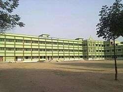
- Loyola School (Run By Catholic Church Archdiocese Patna)
- St. Paul's English School
- G.S.M public School
- Kendriya Vidyalaya, CRWCR
- D.P.S English School
- D.A.V Public School
- Swami Vivekananda High School
- Project Girls High School
- Government High School
- Anand Marg High School
- Ramrati Kamla Kanya Vidyalya
- Don Bosco Public School
- Shanti Vidya Kendra
- Saraswati Sishu Vidya Mandir
- Patliputra School
- New Cambridge High School
Culture
Festivals


Religion
The city's population is predominantly Hindu with minor Muslim and Christian population. Jains, Sikhs and Buddhists are also present because of the most important place for the Buddhism & Jainism near Rajgir, pawapuri. For Islamic religion City Mosque, for Christian Loyola Catholic Church and for Hinduism Ramjanki Temple, Mahaveer Temple and more.
Cuisine of Harnaut
- Sweets
Sweets are present in most restaurants as the popularity has increased. Many commercial stores have been established as solely desserts stores. Balushahi well prepared in Bihar State most delicious sweet specially in Harnaut. Ras malai, Rasgulla, Gulab jamun, and many more.
- Street food
Panipuri “Bhaiya, thoda spicy kam rakhna”. Bhelpuri A Zesty snack which is a meld of papadis, puffed rice, sev, onions, potatoes, tomatoes, chillies, coriander leaves and chutneys. Kachori with Jalebi, Litti (cuisine) , Samosa, Chaat, Chole bhature delicious street foods of Harnaut.
- Indo-china/Non-veg Cuisine
Kebab, Biryani,Indian Omelette, Chilli Chicken/Prawn/Fish/Mutton/Vegetables/Paneer. Garlic Egg/Chicken/Prawn/Fish/Mutton/Vegetables/Paneer. Manchurian, consisting of chicken or vegetables in a spicy sauce. It is entirely a creation of Chinese restaurants. A little resemblance to traditional Chinese cuisine. Chow mein A popular dish combining noodles, vegetables, scrambled egg, ginger and garlic, soy sauce, green chili sauce, red chili sauce and vinegar.
- veg Cuisine
Paratha, Aloo gobi, Baingan bharta, Naan, Palak paneer, Rajma, these are the special cuisine of city.
Transport and connectivity
Harnaut is well connected by roads to different cities. NH 30A connects it to Varanasi, Patna via Fatuha to Sheikhpura district, Barbigha, Barh, Deoghar etc. Harnaut thus serves as the gateway of the Nalanda district to central and southern Bihar. Similarly, NH 31 connects it to Ranchi via Hazaribagh, Barhi, Nawada, and to northeastern India from Mokama, Purnia, Kishanganj up to Guwahati.
- Distance of Harnaut from major cities:
- Harnaut-Patna(55 km)
- Harnaut-Gaya(110 km)
- Harnaut-Bhagalpur (196.9 km)
- Harnaut-Buxar (192.2 km)
- Harnaut-Ranchi (277.5 km)
- Harnaut-Dhanbad (268.6 km)
- Harnaut-Deoghar (195 km)
- Harnaut-Howrah (492.8 km)
- Harnaut-Varanasi (317.8 km)
- Harnaut-New Delhi (1100.8 km)
- Harnaut-Allahabad (426.9 km).

Harnaut railway station is the main railway station of the city, under Danapur Division of the East Central Railway zone. Harnaut is connected with the major cities in India like New Delhi, Mughalsarai, Lucknow, Asansol, Howrah by the Howrah-Delhi Main Linewith daily passenger, express and super fast trains services. Harnaut railway station lies on the Bakhtiyarpur-Gaya main line. This is firstly Bakhtiyarpur-Rajgir Line and the line is being further expanded to Natesar to connect with Gaya junction via Tilaiya junction.
See also
References
- ↑ "Cities having population 1 lakh and above, Census 2011" (PDF). Government of India. Retrieved 2013-01-23.
- ↑ "Provisional Population Totals, Census of India 2011; Urban Agglomerations/Cities having population 1 lakh and above" (PDF). Office of the Registrar General & Census Commissioner, India. Retrieved 26 March 2012.
- ↑ http://www.fallingrain.com/world/IN/34/Harnaut.html Map and weather of Harnaut
- ↑ India Meteorological Department 8 May 2015
- ↑ wetterkontor.de 8 May 2015
- ↑ "Harnaut climate variation 2000-2010". Weatherbase. Retrieved 29 March 2016.
- ↑ "Notification" (PDF). Urban Housing and Development Department, Government of Bihar. July 1, 2016.