Harbour Grace
| Harbour Grace | ||
|---|---|---|
| Town | ||
|
Harbour Grace water front ca. 1911 | ||
| ||
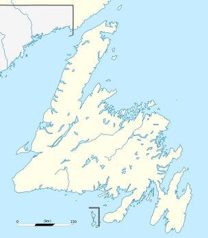 Harbour Grace Location of Harbour Grace in Newfoundland | ||
| Coordinates: 47°41′N 53°15′W / 47.683°N 53.250°W | ||
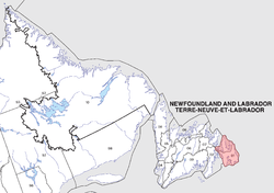
| Country |
| |
| Province |
| |
| Settled | 1610 | |
| Incorporated | July 10, 1945 | |
| Government | ||
| • Type | Harbour Grace Town Council | |
| • Mayor | Terry Barnes | |
| Area | ||
| • Total | 33.71 km2 (13.02 sq mi) | |
| Elevation | 16 m (52 ft) | |
| Population (2006)[1] | ||
| • Total | 3,074 | |
| • Density | 91.2/km2 (236/sq mi) | |
| Time zone | Newfoundland Time (UTC-3:30) | |
| • Summer (DST) | Newfoundland Daylight (UTC-2:30) | |
| Postal code span | A0A | |
| Area code(s) | 709 | |
| Highways | Route 70 | |
| Website | Harbour Grace official site | |


Harbour Grace is a town in Conception Bay on the Avalon Peninsula in the province of Newfoundland and Labrador, Canada. With roots dating back to the sixteenth century, it is one of the oldest towns in North America.[2] It is located about 45 km northwest of the provincial capital, St. John's. The town has a population of 3,074 (2006), engaged primarily in fishing and fish processing.
The alternative spelling Harbor Grace was current at one time.[3]
History
Harbour Grace was an important port and fishing centre since the earliest days of European exploration of North America and was a thriving sessional fishing community by 1550, with permanent settlement beginning in 1583 (24 years before the Jamestown, Virginia colony, often incorrectly cited as the first permanent European settlement in North America, and two years before the "lost" colony at Roanoke, North Carolina). The first year-round settler that year was Robert Tossey of Dartmouth, England.[4] The town was named after Havre de Grâce (now Le Havre), France, although it is uncertain whether the name was given by French cartographers, Francis I of France, or early settlers from the British Channel Islands and West Country who were familiar with Le Havre as a common trade destination for fishermen from the Channel Islands.
In 1610, pirate Peter Easton made Harbour Grace his headquarters, and established a fort overlooking the bay. Although it was attacked by the French the following year, the early settlement survived throughout the seventeenth century, with a permanent, year-round population numbering a few dozen, swelling to several hundred during the fishing season. In 1618, Bristol's Society of Merchant Venturers received a charter from King James I of England to establish a settlement near Harbour Grace, "Bristol's Hope", and appointed Robert Hayman as its first Proprietary Governor, a post he held for the next ten years. Back in London at the end of this period in 1628 Hayman published a work of pithy epigrams called Quodlibets which he had written in Harbour Grace — it was the first book written in the new world.[5] The Conception Bay area is referred to in the subtitle of his book not as "Conception Bay" but by its original, though now largely forgotten, name of "New Britanolia".[6]

Over the coming years, control of Harbour Grace became a point of contention between the English and the French. The town, with a population numbering about 100, was razed by the French in 1697,[7] again in 1700, and captured briefly in 1762. Nevertheless, between these attacks, the population grew by 50 percent. By 1771, the population was close to 5,800. By then, however, other colonial towns along the Atlantic coast had surpassed Harbour Grace in population and influence. The town continued to grow and peaked in population in 1921, when the census was taken at 11,458 residents.
As trans-Atlantic aviation became more popular in the 1920 and 1930s, many aviation pioneers, among them Amelia Earhart and Thor Solberg chose to make their crossing from the nearby Harbour Grace airfield due to its proximity to continental Europe. Altogether, some twenty flights left Harbour Grace from 1927 to 1936 in their attempts to cross the Atlantic.
In July 1941, the Royal Canadian Navy established a High Frequency Direction Finding wireless station on the airfield. Consisting of an Operations Building and a Direction Finding shack, the station had an uninterrupted sweep of the northern Atlantic sector and was able to provide bearings on U-boat transmissions and also intercepting enemy radio traffic.
Harbour Grace was one of the first sites that the Royal Canadian Navy was solely responsible for after war broke out. On May 21/45, the Canadian Naval Service approved the closing down and disposal of its facility at Harbour Grace. There is no evidence of the station today.
Following the war, the airstrip was left to deteriorate. In 1977, through the efforts of the Harbour Grace Historical Society, it was restored to a usable condition. In 1999, after years of being considered abandoned, the airstrip was reinstated to official international airdrome status under the designator of CHG2.
Today, Harbour Grace continues its tradition as a fishing and fish processing centre. In addition, because of its rich history and many historical buildings, a small tourist industry is emerging. The Gordon G. Pike Railway Heritage Museum and Park (c. 1881-84) was designated a Municipal Heritage Building in 2006.[8]
Demographics
|
Population trend[9]
|
Mother tongue language (2006)[9]
|
|
Race/Ethnic Groups (2006)[9]
|
History briefs
- The first English account of the capture of St. John's by the French came from Harbour Grace Island in 1708.
- The Harbour Grace Court House, constructed in 1830, is the oldest surviving public building in the province and a National Historic Site of Canada.[11]
- St. Paul's Anglican Church in Harbour Grace was built in 1835, making it the oldest stone church in Newfoundland and Labrador.[12]
- The annual Harbour Grace Regatta is the second oldest continuing sporting event in North America; it was started in 1862.
- The first railway line in Newfoundland was completed to Harbour Grace in 1884.
- Amelia Earhart took flight from Harbour Grace on May 20, 1932, to become the first woman to fly solo across the Atlantic.
- Laurence Coughlan, credited as the founder of Methodism in Newfoundland, laid the foundations of Newfoundland's first Methodist movement when he served as an Anglican priest in Harbour Grace from 1766 to 1773.
- Harbour Grace has a long and rich history in the sport of ice hockey. Newfoundland's first NHL player, Bishop's Falls native Alex Faulkner, came from the Harbour Grace-based Conception Bay Cee Bees hockey team in 1960. His brother, and former Cee Bees captain, George Faulkner was the scoring leader of the 1966 Canadian National Hockey team where they took Bronze at the World Hockey Championship in Ljubljana, Slovenia (former Yugoslavia). Other NHL players to have been part of the Cee Bees line up were Gary Simmons and Lyle Carter. The Cee Bees/Cee Bee Stars have won the senior provincial Hockey championship 8 times beginning in 1960. The Cee Bees "old timers" have won gold in Division "A" of the World Old-timer’s League on two occasions. Harbour Grace native Daniel Cleary became the first NHL player from Newfoundland and Labrador to win the Stanley Cup in 2008.
See also
References
- ↑ Population and dwelling counts
- ↑ "History of Harbour Grace". Retrieved 2010-06-29.
- ↑ The Morning Chronicle, St. John's, 1872
- ↑ History of Harbour Grace
- ↑ William Barker, ‘Hayman, Robert (bap. 1575, d. 1629)’, Oxford Dictionary of National Biography, Oxford University Press, Sept 2004; online edition, January 2008 accessed 28 December 2009
- ↑ William Barker, ‘Hayman, Robert (baptized 1575, died 1629)’, 'Quodlibets, Lately Come Over from New Britaniola, Old Newfound-land accessed 15 July 2010
- ↑ Journal of Abbe Jean Baudoin, 28 January 1697
- ↑ Gordon G. Pike Railway Heritage Museum and Park. Canadian Register of Historic Places. Retrieved 8 July 2012.
- 1 2 3
- ↑
- ↑ Harbour Grace Court House. Canadian Register of Historic Places. Retrieved 8 July 2012.
- ↑ St. Paul's Anglican Church Harbour Grace website
| Census divisions | |
|---|---|
| Cities | |
| Other communities |
|
| |
Coordinates: 47°41′N 53°15′W / 47.683°N 53.250°W