Hangu Pass
| Hangu Pass | |
|---|---|
 | |
| Coordinates | 34°38′N 110°55′E / 34.63°N 110.92°ECoordinates: 34°38′N 110°55′E / 34.63°N 110.92°E |
| Hangu Pass | |||||||||
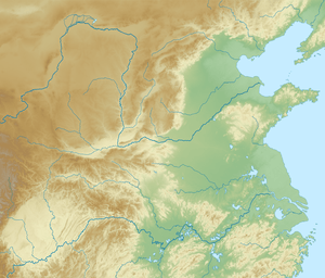
 A 1941 relief map of China. The Hangu Pass lies just below Tongguan ("Tungkwan") | |||||||||
| Traditional Chinese | 函谷關 | ||||||||
|---|---|---|---|---|---|---|---|---|---|
| Simplified Chinese | 函谷关 | ||||||||
| |||||||||
Hangu Pass or Hanguguan is a pass separating the upper Yellow River and Wei valleys—the cradle of Chinese civilization and seat of its longtime capital Xi'an—from the fertile North China Plain. It lies on the south bank of the Yellow River just east of its eastward bend out of the Ordos Loop at Tongguan in Shaanxi. It was the site of many battles during the Warring States and early imperial eras, when it was the chokepoint shielding Qin, Guanzhong, or Luoyang from outside attack. Today, the Hangu Pass forms part of the area of Lingbao in Henan.
History
Chinese legends state Lao-tze wrote his Tao Te Ching for a border guard at the Hangu Pass before leaving for the west.
The state of Qin fortified the pass in 361 BC as its eastern border, protecting access to their homeland from the armies of the other Warring States competing to succeed the Zhou. It continued to protect the Guanzhong area of the Qin and Western Han empires. Under the Eastern Han that succeeded Wang Mang's "Xin dynasty", its fortifications protected the capital Luoyang in the other direction, staving off attacks coming from the west and northwest.
After the fall of the Han and rise of the Three Kingdoms, the Hangu Pass lost most of its importance as the primary fortifications moved a little west to Tongguan.